Keith Cherkauer studies mud. It’s a dirty business that has revealed a lot about global warming.
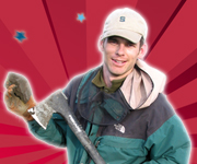
As he trudged through rural Indiana farmland earlier this spring, Cherkauer, an agricultural and biological engineer at Purdue University, paid close attention to the way his boots sank more than an inch into the mud before they reached the solidly frozen soil below. The way surface water travels under these soil conditions fascinates Cherkauer — and worries him too.

For the past decade, he has been monitoring soil temperatures and patterns of freezing and thawing in the upper midwestern region of the United States. His research, some of the most detailed of its kind ever, shows what global warming looks like — literally — on the ground in Indiana, Illinois, Minnesota, and Wisconsin. One incongruous finding: as temperatures rise, many parts of the region are experiencing more frozen soil. That’s a potentially troublesome trend for farmers in the upper Midwest.
“I want to know everything I can about the pathways water takes through the environment,” Cherkauer says. His quest to understand water has been a lifelong pursuit.
Cherkauer’s father was a geologist who studied groundwater flows into and out of the Great Lakes. Cherkauer spent virtually every summer of his youth traveling with his family around the U.S. so that his father could measure stream depths and rate of flow. As an undergraduate he flirted briefly with a career in aerospace engineering. But the burgeoning potential of remote sensing drew him back to the study of water.
Cherkauer’s research in the upper Midwest focuses primarily on winter and spring water flows. For much of the year, when the soil is warm and dry, he explains, precipitation simply percolates down into the ground. But the picture gets substantially more complex as the ground freezes and thaws in the winter and spring. Soil ice makes it hard for melting snow to penetrate the ground. When the soil finally thaws, says Cherhauer, “water sinks into the ground as though you had pulled the plug on a drain.” That’s especially true in the flat landscape of the upper Midwest.
To understand these hydrodynamics, Cherkauer takes weekly measurements of soil temperature and snow depths at an array of spots around the region. He combines this field data with remote sensing data from satellites and develops a detailed grid that tracks the movement of surface water over the course of the winter and spring. Because researchers have been collecting detailed soil temperature data from the upper Midwest since the early 1960s, Cherkauer then supplements his own measurements with this historic data. Mashing all this information together, Cherkauer has shown clearly that annual average temperatures in the region have risen and that winters are getting shorter. His potentially most significant finding, though, is a steep decline in snow cover in some areas.
Snow cover strongly affects the way water moves in the spring. A blanket of snow roughly eight inches or more in depth insulates the soil and keeps it from freezing solid. Less snow, Cherkauer explains, can often lead to more frozen soil because “a thinner snow pack means more exposure to cold winter air temperatures.” The ironic upshot is that some areas of the upper Midwest will see more frozen soil in wintertime even as overall temperatures warm.
This counterintuitive situation can cause all kinds of problems. Soil made hard by ice or frost is less absorbent. Because the region is relatively flat, non-absorptive soils means more spring runoff flowing across frozen flood plains. Not only can this lead to localized spring flooding but, even more worrisome, says Cherkauer, “an increase in freezing and thawing in the soil breaks the bonds that hold soil aggregates together,” making it more likely that topsoil will be swept away.
Cherkauer’s research is notable for its mix of simplicity and sophistication. He combines complex computer models with a old-fashioned, ground-based observational data. His work has deepened our understanding of how climate change is affecting America’s upper Midwest. But it is also helping Cherkauer and others refine our hydrologic modeling capability and build confidence in the projections of those models. This will be especially important for future research in areas such as Africa and China where, says Cherkauer, “we won’t have the luxury of long-term observational data to build upon.”
This is the fourth installment of America’s Climate Scientists: A series from the Union of Concerned Scientists. Click here to read all the climate scientist profiles.
The Union of Concerned Scientists is currently leading a campaign to elevate the voices of climate scientists and educate the public about the overwhelming scientific evidence for human-caused global warming. Learn how you can get involved at www.ucsusa.org/evidence.


