Having spent three days on the Mighty Mississip, I am beginning to see just how mighty it is. In Dubuque, we experienced a river that seemed to meander at a manageable pace. We saw a riverfront plaza with steps leading right into the water, and walked down the steps to reach out our hands to touch the water. It was idyllic and calming.
The river here in St. Louis is an entirely different beast, meeting up with several major tributaries — the Illinois, the Missouri, and the Ohio — each confluence adding interesting twists and a whole lotta volume. Looking down at the Mississippi from atop the Gateway Arch, we saw a wider, deeper, muddier, and much faster-moving river. A river carrying large bundles of debris as it churned past tree-covered islands, oil refineries, riverboat casinos, and farmland. A river that didn’t look very inviting at all.
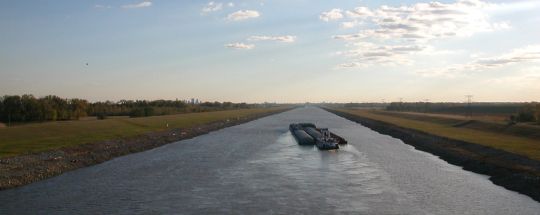
It made me realize how this river is so many things to so many people — many of them living far, far away from the actual river but getting drinking water from it or impacting its health via their local creek (pronounced "crick" in these parts). While Dubuque waters are great for puttering around in a pleasure craft, we’re told that people down in St. Louis don’t often think of the river as a place for recreation. The folks at the Great Rivers Greenway District told us that the city thinks of it as a "working river" — and seeing barges like this certainly reinforces that view.
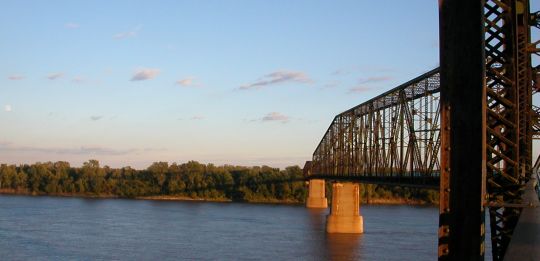
Local historian Brad Winn said that for him, the river provides beautiful scenery (especially from spots like the Old Chain of Rocks Bridge, below). He also said that for many locals, the river is an obstacle they have to get around when bridges are down and often a threat, as waters rise during heavy rains.