 Photo: Mongabay
A combination of dramatic technological advances, experience, and application of a little common sense has markedly increased scientists’ confidence in their ability to monitor forest conservation projects for their climate impact.
As The Eliasch Review [PDF], the U.K. Government’s authoritative recent report on forest-climate science and policy, put it, “Using appropriate techniques, forest emissions can be estimated with similar confidence to emissions estimates in other sectors.”
That’s very good news, as approximately 20 percent of total global warming pollution comes from deforestation, more than all the world’s cars, trucks, planes, and ships combined. As the United States and the world move towards a system in which these forests are valued for their immense carbon storage, it’s critical that we make those valuations as accurate as possible — so we can know exactly how much a particular forest conservation project (and ultimately a particular country) is actually reducing emissions.
Of course, there’s a key caveat in The Eliasch Review’s conclusion: “using appropriate techniques.” Although these appropriate techniques are available and have been applied in many projects, deploying them at the global scale needed to end deforestation will require financial and human investment.
Those investments are very affordable — the costs of monitoring forest projects are typically less than $1 per ton of carbon reduced, often much less. But they need to happen quickly, before we lose more forests. That’s why it’s so important that Congress pass climate legislation that includes strong public and private financing for tropical forest conservation (including especially the five percent tropical forest set-aside) — and supplements it with interim financing that’s able to go into place before climate legislation enters into force in 2012.
So why are emission reductions from forests so easy to monitor?
At a certain level, it’s very simple. Unlike smokestacks, tailpipes, chemical processes, or even agriculture, you don’t have to constantly monitor forests to measure how much carbon they store (or how much carbon is sent into the atmosphere when they’re burned).
You can look at a forest, use decades-old techniques to measure the amount of carbon stored in it, write the amount down, and then come back 5, 10, or 50 years later and measure how much carbon is there.
Now, although confidence in monitoring has come a long way, it doesn’t mean there isn’t any complexity. In particular, in areas where forests have been partially degraded, some sophistication is required to come up with an accurate baseline figure for deforestation, below which emissions reductions are determined. It’s been done, and done well, but it does require more effort than the classic model of just measuring degradation to a pristine forest.
But contrast forest monitoring to smokestack or tailpipe monitoring — just looking at it does nothing for you. You need to make sure that there are meters (or at least that you’ve got a very accurate recording of how much coal or gas is going in), and that no one ever “accidentally” turns off the meter or misreports quantities burned at any time. If you don’t catch misreporting in real time, it’s almost impossible to catch it ever. Of course, unlike critics of giving credit for forest conservation, I’m not suggesting that measurement challenges mean that we shouldn’t give credit for pollution reductions in the energy sector — just that the challenges in that sector should be recognized.
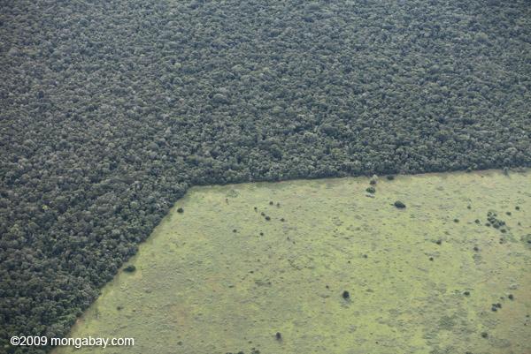
Forest monitoring has also benefited from innovation in satellite technology over the last half century. Satellites like NASA‘s MODIS, the Brazilian Space Agency and China’s CBERS, the Japanese ALOS, and French SPOT are actively and accurately monitoring the world’s forests — and new, even better satellites go up every year. There’s now even low-angle radar from Japan that can see under clouds. These “eyes in the sky” can look into your bathroom; from that perspective, measuring forest emissions looks a lot less challenging.
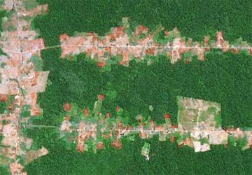 Satellite image of deforestation in the Amazon.Photo: MongabayIndeed, the last 35 years have seen the democratization of satellite technology, so that anyone can check up on what’s happening even in forests thousands of miles away. It started with the U.S. government’s Landsat satellite, which published some of the earliest high-resolution images of deforestation in the 1970s.
Now, anyone can just login to Google Earth and monitor deforestation for themselves. Google has partnered with a variety of groups in the Amazon, including indigenous tribes, to monitor deforestation — and allow individuals to protest and point out illegal and unwanted activities.
From Rhett Butler at Yale 360:
One of the first Google Earth Outreach projects involved indigenous tribes in the Amazon rain forest. Facing an onslaught of threats to their lands and culture, the tribes have embraced advanced technology as a means of protecting and better managing their homeland. The tribes — including the Surui in western Brazil and the Wayana and Trio in Suriname — are using GPS to map their lands, plot rivers, sites of spiritual significance, and their resources, including medicinal plants and rich hunting grounds. The Rainforest Foundation U.K. and the Global Canopy Program are taking a similar approach in Congo and Cameroon, respectively, helping communities map their lands to protect against illegal logging and other forms of encroachment.
In sum, it’s very difficult to hide a forest that’s been cut down. “Who are you going to believe, me or your lying eyes?” is a question anyone trying to illegitimately get credit for forest conservation will have to ask.
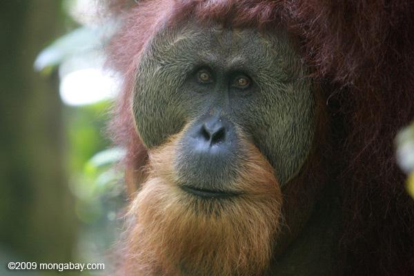 This Orangutan certainly can’t wait. Photo: MongabayKnowing the high certainty pollution reductions that forest conservation can deliver, Congress and the world can now turn their attention, with confidence, to figuring out the best incentives to actually save the forests. Because the truth is that we cannot afford any further delay. In the dozen years it’s taken for the countries of the world to start to realize that excluding tropical forests from the Kyoto Protocol was a mistake, more than 300 million acres of forest have been destroyed, putting an amount of pollution equivalent to about 10 times the United States annual pollution into the air. We can’t afford to wait another dozen years to finally agree to solutions that actually work.
For more on the reliability of forest conservation, check out “Not Your Daddy’s Offsets” and “The Tropical Global Warming Solution,” and stay tuned for a sequel to this post.