Isaac, downgraded to a tropical storm yesterday, is still winding his way slowly up the Mississippi River valley. As the storm meanders north and then east, it will bring much-needed rain to one of the areas hardest-hit by the drought. But following two days of heavy rain, the Gulf Coast isn’t yet entirely out of danger. Some 770,000 people are still without power in Louisiana as destruction trails as the storm’s shadow.
This is what the rainfall looked like in Tangipahoa Parish, Louisiana, over the past week. See if you can figure out when Isaac hit.

Data from the USGS. Click to embiggen.
Just across the Mississippi border from Tangipahoa sits a small lake. This morning, gorged with rain, it began to overtop its dam. With 90 minutes notice, 50,000 people were ordered to evacuate their homes. From NBC News:
Up to 50,000 people in Louisiana’s Tangipahoa Parish were ordered to evacuate Thursday morning when water from Tropical Storm Isaac threatened to overwhelm a dam across the state line in Mississippi. …
Located about 100 miles north of New Orleans, the parish initially said “imminent failure” of the dam was expected but later emphasized that the dam was “damaged but has not failed” and that the evacuations were “out of caution.”
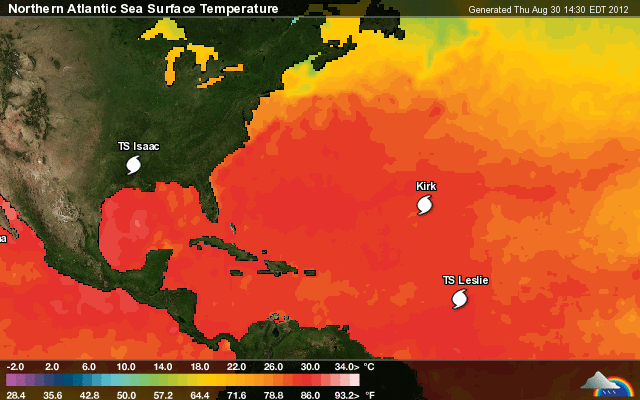
While Isaac tapers off, the hurricane season is just kicking into high gear. There are already two more storms in the North Atlantic — Hurricane Kirk and Tropical Storm Leslie.

Click to embiggen.
Kirk’s path will most likely result in it coming nowhere near the continental U.S. Leslie, on the other hand …

Click to embiggen.
As the National Weather Service notes, Leslie is “the second-earliest formation of the 12th named storm on record.” Only 1995’s Luis arrived earlier. (Wondering what happened to storm J? Come and gone.)
Leslie is still far enough out in the Atlantic that the storm’s path is a grab bag. It seems unlikely to reach the U.S., but forecasting is still an inexact science. It would certainly be interesting if it suddenly veered toward the southeast and made landfall toward the middle of next week. After all, it’s been awhile since a hurricane has interrupted a political convention.
Update: An interesting bit of data — Isaac dropped 3.36 more inches of rain on the New Orleans airport than did Katrina.