[protected-iframe id=”a6f7b71e056f76a975940a47e23a4c12-5104299-36375464″ info=”http://c.brightcove.com/services/viewer/federated_f9?isVid=1&isUI=1″ width=”480″ height=”270″]
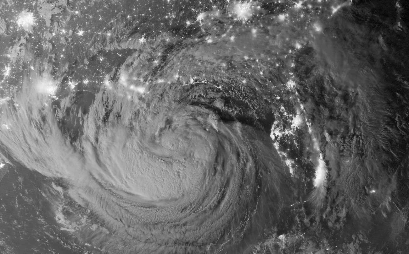
Isaac from the ISS.
Hurricane Isaac has made landfall in southern Louisiana, seven years to the day from the arrival of Hurricane Katrina in New Orleans.

Click to embiggen.
Technically, Isaac arrived last night, prompting Ann Romney to open her Republican convention speech by saying that attendees should “hope and pray that all remain safe and no life is lost and no property is lost.” But the real impact will be felt today, as the storm moves slowly in from the Gulf over New Orleans and surrounding parishes.

The live wind map clearly shows Isaac over Louisiana.
That “slowly” is the real problem. As of 7 this morning, Isaac was moving northwest at 6 mph. Though it’s only a Category 1 storm — meaning its wind speeds are much lower than Katrina’s — the slow movement will result in more rain falling over the city. Estimates put the expected amount of rain at over 20 inches in some areas.

Storm surge projection on the Gulf Coast.
Another big problem is the storm surge. The map above, from the National Oceanic and Atmospheric Administration, shows the probability of two feet or more of surge. Right now, the tide is low and rising, reaching its peak later this evening. That will be the point at which the city’s levees are in the most danger. In Plaquemines Parish, a large, sparsely populated area southeast of the city, the storm surge already topped a levee, flooding some houses in the area up to 12 feet.
New Orleans isn’t the only place at risk. Other areas along the Gulf Coast are similarly threatened. Here, storm surge in Biloxi, Miss.
http://www.newslook.com/videos/479866-raw-video-isaac-hits-low-lying-biloxi
The reason New Orleans leads the news is twofold. First, its history. Katrina was the worst natural disaster in recent memory, evoking obvious parallels any time a hurricane threatens. Second, it’s a highly populated area that’s at great risk. Lower than sea level — and sinking — the marshes that extend south and southeast from the city, areas that provide valuable protection from storm surge, are vanishing under rising seas. This combination promises to be very dangerous — and was a key consideration in how the city’s defenses were strengthened after Katrina.
Even if the levees hold — and the Army Corps of Engineers is very confident they will — Isaac’s impact is being felt. Energy and electrical systems have been hobbled. Nearly half a million people are without power in Louisiana, with a live map from the local power company showing that lines are off in most of the city. Production and refining in the Gulf has stopped, though offshore platforms didn’t see much impact. The drop in refining capacity is expected to prompt a 5-cent increase in gas prices throughout the U.S.
We’ll have updates as necessary. The threat of storm surge and flooding is expected to continue throughout the night.

Hurricane Isaac approaches the Gulf Coast last night. (Photo by NASA. Click to embiggen.)
Update: CNN’s Lizzie O’Leary notes another contributor to the vanishing marshes.
Plaquemines is basically a series of marshes, canals and levees. Oil industry ship channels whittled down the natural marsh defenses.
— Lizzie O’Leary (@lizzieohreally) August 29, 2012
Update: Given the slowness of the storm and the amount of rain, one Weather Channel reporter dubbed Isaac “about as bad as Category 1s get.”