Ian Silva
For his day job, Ian Silva drives a commuter train in Sydney, Australia. So maybe it’s not surprising that his incredibly detailed maps of imaginary cities also include fully fleshed-out public transit systems. But it’s impressive nonetheless.
Silva, who has no formal training in cartography, has invented and mapped the fictional Koana Islands, an imagined archipelago located somewhere in the Indian Ocean. He’s come up with all kinds of details about the islands — they have over 180 baseball teams, the number for emergency services is 777, the language is influenced by Swedish and English, there are 11 national parks — but the crown jewels of his Koana fantasy are the detailed street and transit maps.
Above is the full KoanaTag rail system (click to embiggen), which Wired reports has “326 local routes and nine high-speed connections.” Here’s the street map of Conneaut:
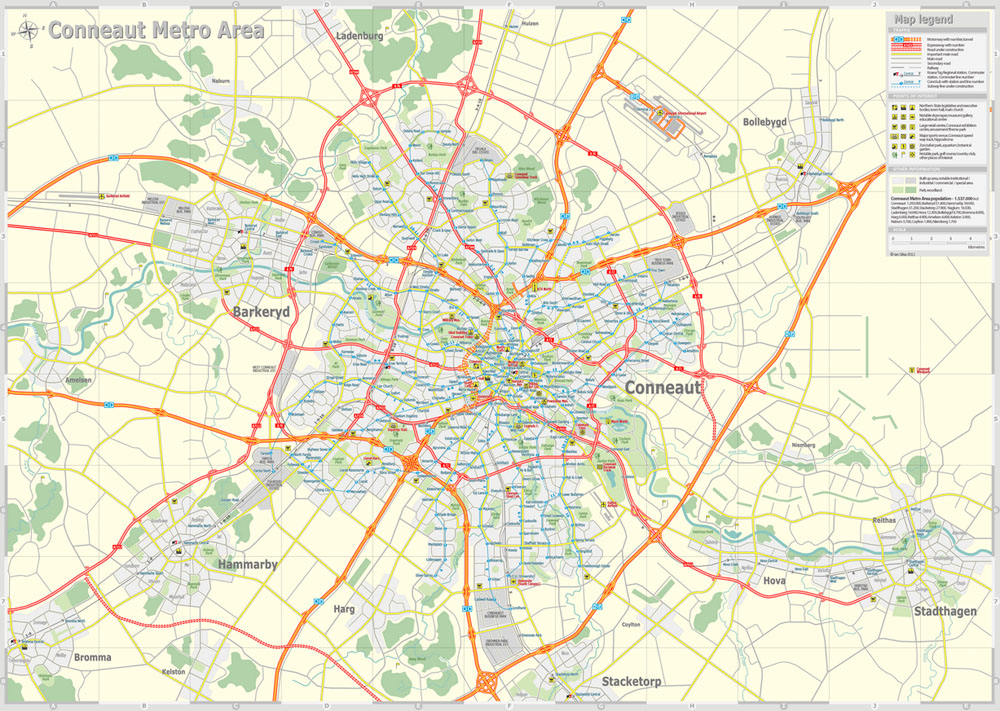
Ian Silva
And the Conneaut subway:
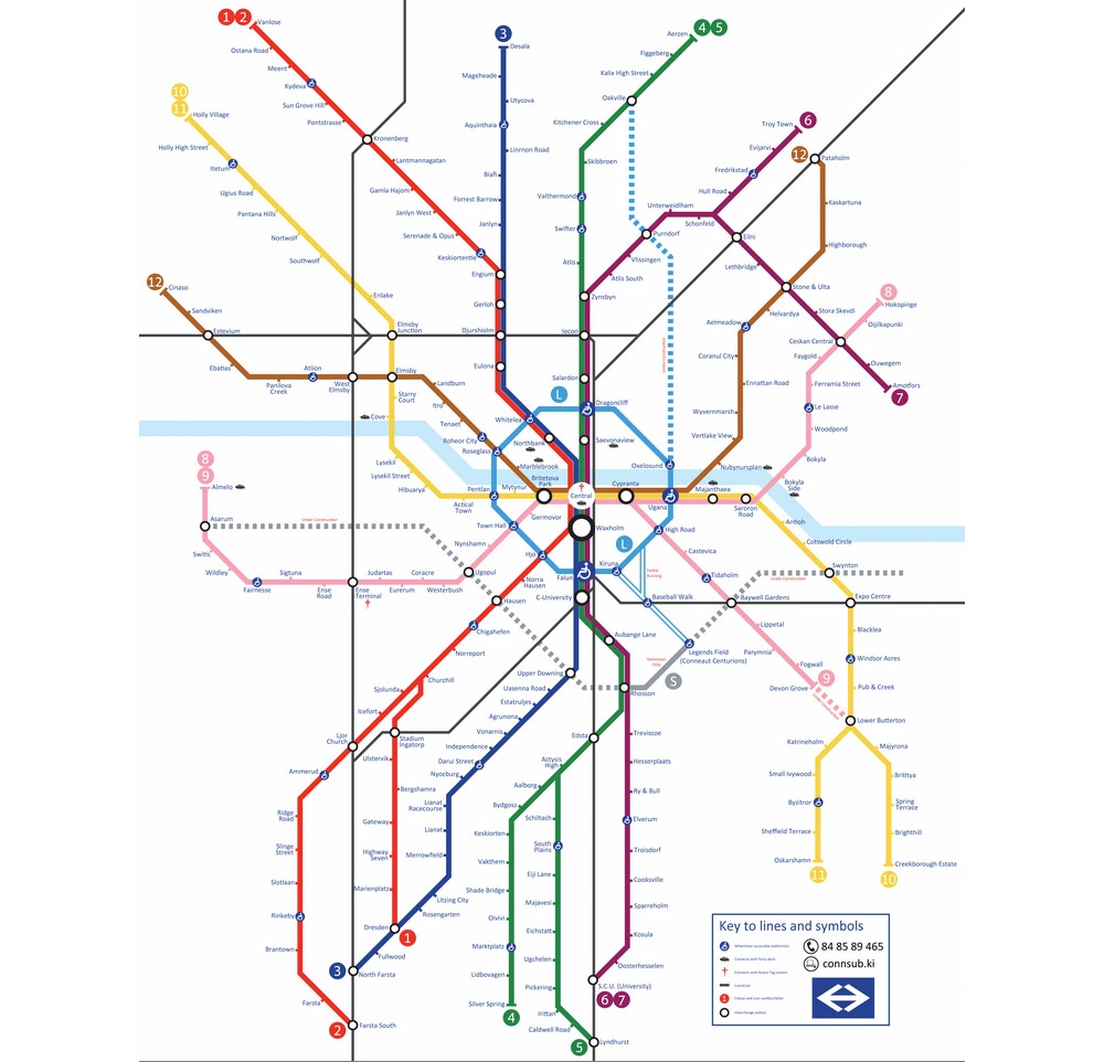
Ian Silva
Humoor:
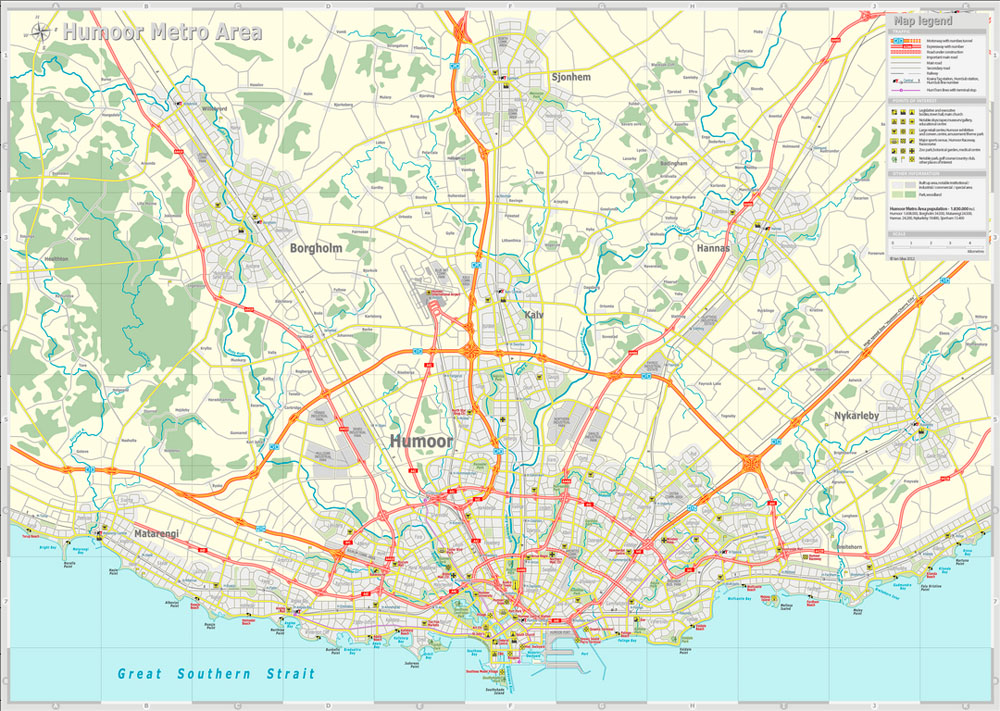
Ian Silva
And the HumoorTram, which looks like it might be an above-ground lightrail system:
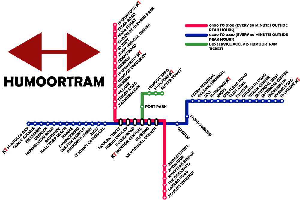
Ian Silva
Wired has more maps, each one a triumph of inventiveness and urban planning. I wish more real cities had transit plans this thorough.