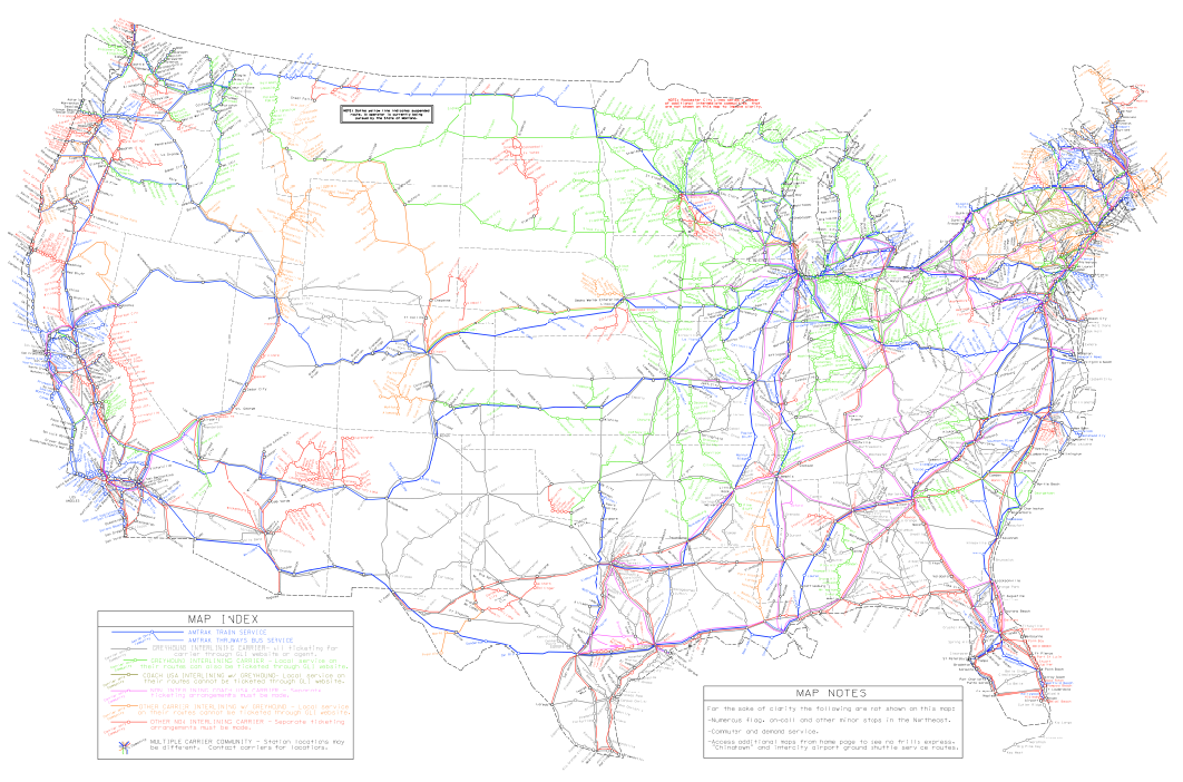
This painstaking map (click to embiggen, but you’re going to want to go to the full-size version) is a labor of love by the American Intercity Bus Riders Association, and it shows all the intercity transit routes in the U.S. In theory, you could use this map to traverse the country by rail and bus alone, never getting in a car.
Greater Greater Washington has a caveat:
It’s probably impossible for this kind of map to be 100% accurate all the time. In all likelihood there are some missing links, and missing carriers. But it’s still quite an impressive undertaking, and a useful tool to bookmark.
So, you know, keep that in mind as you light out on your trip to crisscross the United States without entering a single vehicle that holds fewer than 50 people. It might take most of your life, but it can be done, and now you know how.