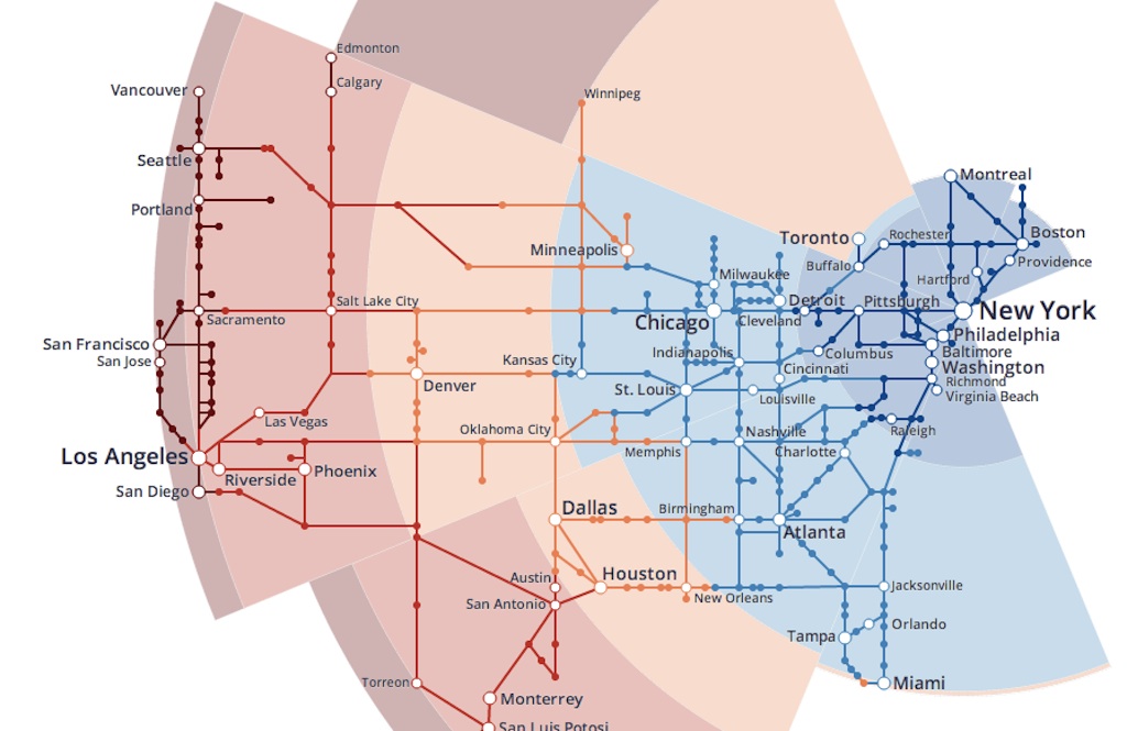
We don’t necessarily want to encourage Elon Musk’s whole “I thought up a cool idea, guys! OK bye” thing, but it is pretty fun to daydream about traveling from place to place really, really, really fast. And Popular Science is making it easy with this actually informative infographic of a hypothetical North America-wide hyperloop network. You can click on any city and find out how long, in theory, it would take you to get somewhere else on the hyperloop.
Imagine all the possibilities that would open up! Listen to harp strings and watch the screen go wavy as you picture:
- The “politico who lives in NYC” route: 31 minutes from New York to D.C.
- The “BBQ for breakfast, lunch, and dinner” route: 32 minutes from Kansas City to St. Louis; 35 from St. Louis to Memphis
- The “live in Montana and still see the ocean” route: Missoula to Seattle in 50 minutes
- The “Salt Lake City is actually pretty isolated” route: Denver, the closest big city, is still almost an hour away — but you can get to Cheyenne in under an hour!
- The “my personal family holiday pilgrimage” route: 54 minutes from New York to Cleveland, and another 30 from Cleveland to Ann Arbor
The whole thing is really nifty, actually, and you should head on over to PopSci to while the workday away, clicking around and imagining where you’d go.