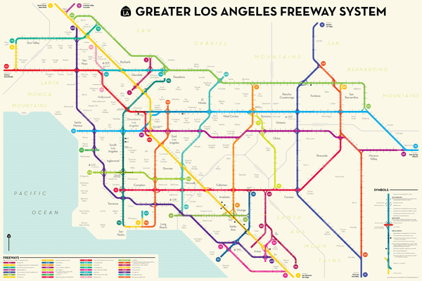

Peter Dunn says he tries to design maps “that show places a little differently — like measuring time instead of distance on the subway, or showing 50 states on a city street map.” His latest project, Atlantic Cities reports, shows the Los Angeles freeway system in the style of a subway map:
The map elegantly displays 31 freeways, 75 interchanges, and more than 850 exits on one poster.
Dunn has worked nights and weekends on the map since January, fitting it in around his full-time job as an urban planner. “If I’d known ahead of time the real size of the freeway system in L.A., I would have picked something different,” he says. “It’s a tedious hobby. It’s like knitting.”
It’s also a sort of fantasy map for transit geeks — this is what Los Angeles’ public transit might look like if the city had a healthy system of subways, or rapid-transit bus lanes, or trolleys. We know it’s not going to happen, but we can’t help but keep California dreaming about jumping on the Hollywood Red Line from Silver Lake to downtown L.A.