In 2010, the European Union launched a satellite called CryoSat-2, with data analysis to be done by scientists at University College London (UCL). It had one task: determine the extent and thickness of sea ice. Previous satellites either couldn’t gauge ice thickness or had trouble penetrating cloud cover. CryoSat-2 can do both.
“Before CryoSat, we could see summer ice coverage was dropping markedly in the Arctic,” said [UCL professor Chris] Rapley. “But we only had glimpses of what was happening to ice thickness. Obviously if it was dropping as well, the loss of summer ice was even more significant. We needed to know what was happening — and now CryoSat has given us the answer.”
It just got in under the wire.
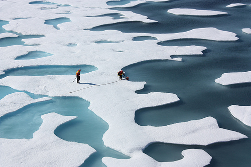
 arctic-sea-ice-ponds-flickr-nasa.jpg for post 48962")
Ponds on the surface of Arctic ice. (Photo by NASA.)
Combining data from a predecessor to CryoSat (named, lamely, ICESat) with on-the-ground measurements, scientists calculated the amount of Arctic sea ice in winter 2004 at 17,000 cubic kilometers, and in summer, at 14,000.
The new measurements from CryoSat are much lower. Last winter, the amount was gauged at 14,000 — equivalent to the summer total eight years ago. This summer, it’s at 7,000, a 50 percent reduction.

Sea ice volume in cubic kilometers.
Even worse, CryoSat indicates that the summer volume dropped 900 cubic kilometers over the last year. In the words of The Guardian:
This rate of loss is 50% higher than most scenarios outlined by polar scientists and suggests that global warming, triggered by rising greenhouse gas emissions, is beginning to have a major impact on the region. …
Using instruments on earlier satellites, scientists could see that the area covered by summer sea ice in the Arctic has been dwindling rapidly. But the new measurements indicate that this ice has been thinning dramatically at the same time. For example, in regions north of Canada and Greenland, where ice thickness regularly stayed at around five to six metres in summer a decade ago, levels have dropped to one to three metres.
As UCL’s Dr. Seymour Laxon put it:
Very soon we may experience the iconic moment when, one day in the summer, we look at satellite images and see no sea ice coverage in the Arctic, just open water.
The scientists warn that the data is preliminary analysis, though they estimate that CryoSat’s calculations are accurate to within 10 centimeters. As the years progress, we’ll be able to use CryoSat to continuously monitor the ice volume by season until, on some summer day fairly soon, CryoSat will look down and see no ice at all. At that point, it is programmed to fly off into space, probably, in a desperate search for actual intelligent life.
Update: If you’d like, here’s an animation showing the recession of surface ice over the past 30 days. It’s awesomely terrifying!


