As melting ice sheets and glaciers continue to push global sea levels higher, a California state agency recently warned that infrastructure planners along the coastline should expect up to 10 feet of sea-level rise by the end of the century.
The California Coastal Commission released a draft document designed to guide local governments as they seek to adapt to mounting water levels, which are expected to increase storm flooding, coastal erosion and the intrusion of saltwater into groundwater stores. Intended to promote the development of climate-resilient highways, bridges and water infrastructure, the updated guidance will be presented at a meeting Wednesday.
“In many cases, California’s aging infrastructure is reaching the end of its useful life and will need major maintenance, upgrades, or replacement over the coming decades,” the report states. “Proactive, collaborative, and thoughtful adaptation planning will be the key to successfully addressing the State’s coastal infrastructure needs and protecting coastal resources, now and in the future.”
Noting the importance of infrastructure in supporting the more than 70 percent of Californians who live in coastal counties, the report outlines several planning considerations, including cost estimates, potential nature-based strategies and the need to seek input from low-income and tribal communities.
The Coastal Commission voted last year to adopt a plan that calls for addressing a minimum of 3.5 feet of sea-level rise in the next 30 years. A 2009 study by the California Climate Change Center that assumed a 4.6-foot increase found that 3,500 roadway miles and nearly 30 wastewater treatment plants would be threatened or damaged by a 100-year flood event under that scenario.
The new guidance assumes that global sea levels could rise by twice as much. Acknowledging that the projected 10-foot rise represents an “extreme risk” scenario, the report states that cost estimates for adapting the state’s coastal infrastructure “are in the billions, if not trillions of dollars, over time.”
In a letter to the Coastal Commission, the California Department of Transportation wrote that the associated costs are expected to be “enormous and funding levels are currently inadequate at state and local levels.” Caltrans added that it expects adaptation costs in 2100 to be “as much as $45 billion in current dollar construction costs.”
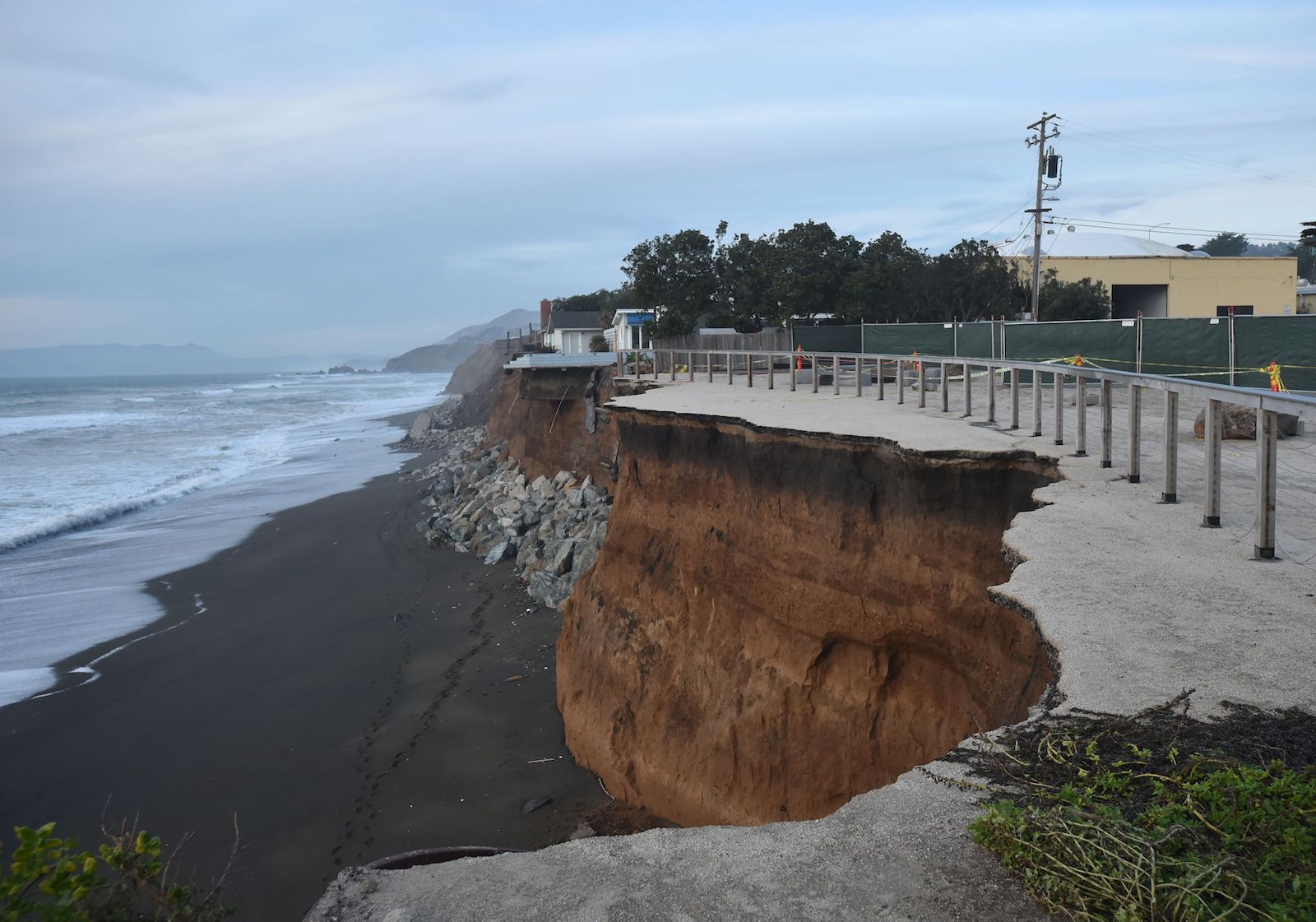
The report notes that sea-level rise not only threatens to inundate roads and highways along the coast, but that those structures “can act as barriers to the inland migration of wetlands, beaches, and other coastal resources as sea levels rise.” Sandwiching beaches and wetlands between fixed infrastructure and rising seas could result in the loss of those areas, warns the report.
Highway sections that are particularly vulnerable to coastal erosion include several segments of Highway 1, portions of Highway 101 in Humboldt and Santa Barbara counties and a section of Interstate 5 in San Diego County.
The report also emphasizes the benefits of “nature-based adaptation strategies,” as opposed to the hard, coastal armoring strategies that are often employed by local governments. Approaches such as wetland restoration, dune replenishment and stabilizing bluffs with native vegetation are intended to enhance “ecological and natural systems while reducing the impacts of coastal erosion and flooding.”