In February, the White House Council on Environmental Quality released the beta version of a screening tool meant to identify “disadvantaged” communities across the U.S. The release was part of the Biden administration’s Justice40 initiative, which aims to send at least 40 percent of the benefits of government spending on infrastructure, clean energy, and other climate-related programs to these underserved communities.
The long-awaited tool is supposed to help identify which neighborhoods should be considered disadvantaged based on whether they meet one of eight thresholds that combine environmental and socioeconomic criteria. Though the tool was developed using an open-source process meant to encourage outside input, its release has been met with controversy. Environmental justice advocates noted, for instance, that many neighborhoods of color they considered clearly disadvantaged had not been flagged by the tool. Take, for instance, the Montbello neighborhood in Denver, Colorado, which has a startling number of young residents visiting the emergency room for asthma-related issues; the flood-prone Eastwick neighborhood in Philadelphia, Pennsylvania; and the Woodlawn neighborhood on the south side of Chicago, which is close to several hazardous waste sites.
Over the last three months, the White House has collected more than 2,000 comments on the tool from environmental justice and nonprofit groups, cities, state agencies, researchers, and ordinary citizens. Their feedback includes a wide array of suggestions, ranging from specific datasets the tool should incorporate to tweaking the tool’s design to better capture communities of color facing environmental threats. The Council on Environmental Quality, or CEQ, plans to update the tool based on this feedback and release an updated version later this summer, as well as guidance to agencies about how to use it.
The most frequently submitted critique targeted the White House’s decision not to explicitly consider race as a factor to use to identify disadvantaged communities, despite voluminous research on its strong correlation with pollution burdens. The Biden administration has argued that the tool is designed in such a way that it can still prioritize communities of color, and that excluding race will help the tool survive legal challenges. (A Grist analysis found that the tool does appear to implicitly account for race in its selection of disadvantaged communities.)
Of the 2,325 comments submitted, more than 2,260 contained identical language and were generated through a League of Conservation Voters campaign urging the administration to “not ignore the critical role of race as a determining factor and explicitly use race as one of the multiple indicators for defining a disadvantaged community.”
Grist reviewed the roughly 60 remaining substantive comments and found that commenters raised many additional questions about the tool’s effectiveness and implementation. Here are some of the open questions that the White House has yet to address:
How will the tool address cumulative burdens?
The current construction of the screening tool does not consider the cumulative effects of living in communities exposed to multiple environmental threats. The tool examines whether a census tract meets one of eight environmental and socioeconomic thresholds but does not factor in how the interplay of these thresholds may combine to create challenges for a community.
Take the Montbello neighborhood in Denver. The community scores above the 80th percentile on five of the eight thresholds, including expected loss of economic value of buildings due to natural hazards, proximity to Superfund sites, toxic concentrations of wastewater discharge in nearby streams, asthma incidence, and linguistic isolation. But since the tool sets the cutoff at 90th percentile in each category, the neighborhood is not flagged as disadvantaged.
Montbello is not alone in this dilemma. An analysis by the Center for Neighborhood Technology, a nonprofit in Chicago, examined the roughly 73,000 census tracts that the tool evaluates and assessed how many of them meet the 90th percentile threshold on multiple indicators and are communities of color but aren’t flagged by the tool. The tool currently flags about 23,000 tracts as disadvantaged, and the group found that an additional 567 tracts would qualify if the tool accounted for cumulative burdens.
“It’s not just one factor that’s causing you to have needs, it’s all of these factors working together,” Bob Dean, CEO of the Center for Neighborhood Technology, told Grist. “You should have some degree of a sliding scale that’s based on the degree of environmental concern that exists in a community.”
Dean’s comments were echoed in comments submitted by the Los Angeles Department of Water and Power, the Massachusetts Department of Transportation, the Public Health Alliance of Southern California, and The Wilderness Society, among other organizations.
CEQ seems poised to redesign the tool such that it factors in cumulative burdens. When the agency kicked off the public comment period in February, it explicitly requested feedback on how it might “incorporate a cumulative impacts approach.” If the next iteration of the tool addresses cumulative burdens, it will bring the tool in line with similar screening tools developed at the state level. The screening tools developed by California, Washington, Maryland, and New York all consider cumulative impacts, albeit through different approaches.
Are these really the best metrics?
Across most of the categories of “disadvantage” that the tool analyzes, it uses three criteria — two socioeconomic, and one environmental — to determine if a community qualifies for Justice40. First, it narrows the list to low-income communities by identifying census tracts with a high concentration of households living at or below 200 percent of the federal poverty level. It then further screens out college towns, where students typically report low incomes because they don’t work full time, by identifying census tracts where at least 80 percent of the adult population are not currently enrolled in higher education. Finally, if those criteria are met, it looks at a number of environmental factors like pollution, climate impacts, and health burdens.
Apart from the fact that this method fails to recognize the cumulative burdens that some communities face, many commenters were concerned that the specific criteria and data sources themselves were inadequate.
A set of comments filed by the Environmental Policy Innovation Center pointed out that the data for the two most powerful metrics in the tool — low-income and higher education enrollment — come from a source with a high margin of error, the American Community Survey, which only samples 2 to 4 percent of people per year. “The scoring is so sensitive to that data,” they wrote, encouraging CEQ to find other data sources to complement or supplement it.
Commenters representing an initiative called The Strong, Prosperous and Resilient Communities Challenge, or SPARCC, questioned whether college neighborhoods should be automatically disqualified. SPARCC noticed one census tract in Algiers, a neighborhood in New Orleans, Louisiana, that was not designated disadvantaged because 23 percent of its residents are enrolled in college or graduate school. But the neighborhood ranked above the 90th percentile in seven out of the eight climate and environmental health categories, like expected building loss due to extreme weather and high rates of asthma, diabetes, and heart disease. It’s also surrounded by tracts that do qualify as disadvantaged. The group found similar examples in New York City, Chicago, and Atlanta.

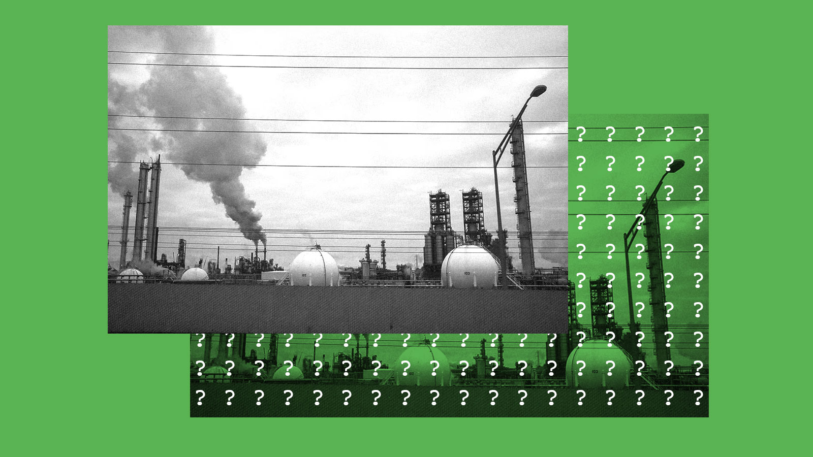
Some commenters, including the North Carolina Department of Environmental Quality, questioned the choice of data for air pollution. To measure exposure to particulate matter, tiny inhalable particles that exacerbate respiratory conditions, the tool relies on data from the EPA’s National Air Toxics Assessment, which was last updated in 2014, even though the EPA created a new Air Toxics database in 2017. It also does not account for any other types of pollution that come from industrial facilities. Multiple researchers encouraged CEQ to consider additional data from the EPA’s Toxics Release Inventory.
Another issue identified in the comments was that the data appears biased toward urban areas. Several commenters asked the CEQ to work to include data that reflect the environmental injustices that rural communities experience, like proximity to abandoned mines, heavy pesticide use, and the industrial agriculture facilities known as concentrated animal feeding operations, or CAFOs. CAFOs produce large amounts of manure with pathogens that can contaminate water systems and degrade air quality. In a support document for the screening tool, CEQ said that it considered these metrics, but did not yet have sufficient data at the census tract level to actually incorporate them into the tool.
The lack of data representative of rural areas is particularly stark in Alaska, according to comments from the Alaska Municipal League, a nonprofit that represents local governments. Disadvantaged communities there suffer from unique challenges due to climate change, like the loss of subsistence foods that many native communities rely on, and melting permafrost, that are not accounted for in the screening tool.
“When I think about what Justice40 is trying to achieve, it feels like a lot more of Alaska would fit into that than what’s currently identified,” Nils Andreassen, the group’s executive director, told Grist.
How will the tool be used?
Several commenters pointed out that it remains entirely unclear exactly how the tool will be used, whether it will interact with local tools developed by states, and how federal funds will be tracked to ensure they reach communities identified by the tool.
“A hugely important question is: How’s that money going to be used?” said Paul Mohai, an environmental justice professor at the University of Michigan. “People need to track that really closely. I would never take at face value any assertion that ‘we invested X dollars in this community that was on the list.’ What did you spend the money for? How did it help the community?”
California has used a screening tool called CalEnviroScreen to identify environmental justice communities since 2013. Washington, Maryland, and New York have also developed their own environmental health screening tools. The EPA has its own environmental justice mapping tool, too.
“The multitude of definitions of ‘disadvantaged community’ throughout states and federal agencies will lead to confusion,” noted the CEO of the Association of Metropolitan Water Agencies, an organization of managers of public water utilities. The Washington State Office of Equity also pointed out the risk of creating confusion “by having state and federal tools that point to different communities in need.”
Many commenters suggested deferring to state tools where they exist. Since the White House’s tool is limited by the availability of national datasets, state tools have more robust data with state-level and regional information, the executive director of the Public Health Alliance for Southern California, a coalition of ten local health departments, wrote. Using the federal screening tool in place of state tools will lead to “less accurate identification” about disadvantaged communities, she warned.
A spokesperson for CEQ told Grist that the agency is “considering this issue as it looks ahead to issuing guidance when the tool is updated.” The spokesperson also said that the United States Digital Service, or USDS, is working on an “Environmental Justice Scorecard” to help federal agencies and the administration track Justice40 funding. The USDS is housed within the Office of the President, employs data engineers and scientists, and helped develop the environmental justice screening tool.
The agency plans to “provide a more substantive and detailed progress update” on the Scorecard later this summer, the CEQ spokesperson said. As with the Justice40 screening tool, the agency emphasized that the scorecard will be a work in progress that “the Federal Government will build on and improve, year after year.”