Between Tropical Storm Henri, Hurricane Grace, and torrential downpours in Tennessee, it was a bad weather weekend for people living on the eastern side of North America
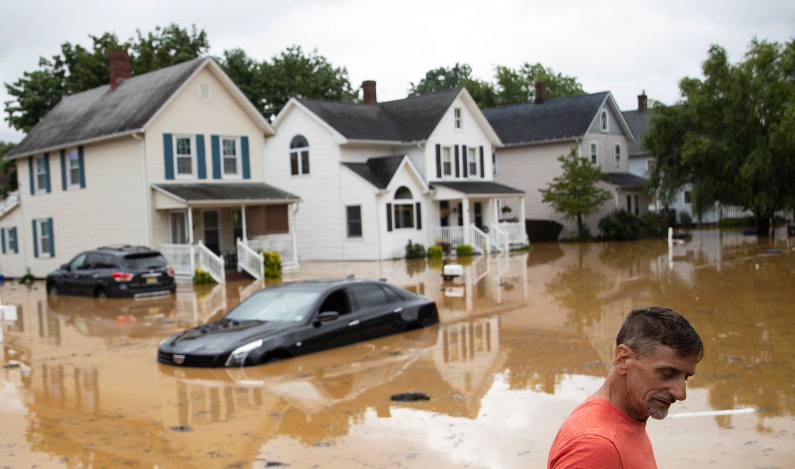
On Saturday, flash floods overwhelmed the rural town of Waverly, Tennessee, damaging bridges and in some cases sweeping entire houses off of their foundations. Seventeen inches of rainfall — a state record for the most rain in a day — caused the area’s network of rivers and creeks to burst their banks. Some residents called the surging water a “tidal wave,” with water moving so fast that it left little time for evacuation. Thousands were stranded in Waverly, and as of Monday, 21 people were reported dead and another 40 remained missing.
Farther north, Tropical Storm Henri brought heavy rains to large swaths of the mid-Atlantic and southern New England even before making landfall. On Saturday night, Central Park in New York City logged a record 1.94 inches in a single hour, and flooding was widespread over the weekend throughout coastal New York and New Jersey. One New Jersey town, Cranbury, saw more than 9 inches of rainfall from the storm, and first responders were forced to rescue many from surging floodwaters and waterlogged roads.
Meanwhile, on the Gulf coast of Mexico, Hurricane Grace also brought heavy rains and flooding — as well as 125-mile-per-hour winds — making landfall around 1 a.m. on Saturday as a Category 3 hurricane. It was one of the two strongest hurricanes to ever touch down on the Bay of Campeche. At least eight people have died from the storm, and three more have gone missing. Almost all of the reported deaths occurred in the state capital of Xalapa, where local television showed coffins from a local business floating down an inundated city street, according to Reuters. Meanwhile, the storm has caused power outages affecting more than half a million people.
Kerry Emanuel, a climate scientist at MIT, said it was difficult to pin any of the specific events on climate change. But, he said, there’s reliable evidence that global warming is driving an increase in the frequency of highly destructive tropical storms and heavy rainfall.
“These events give us an occasion to talk about how climate change affects hurricanes and floods,” Emanuel said.
In general, there’s a strong scientific consensus that rising temperatures are making storms produce more rain, since a warmer atmosphere can hold more water vapor. According to a press release from the nonprofit science initiative Climate Signals, the “copious” amount of rainfall produced in Tennessee “has the fingerprint of climate change all over it.” A 2020 study published in the Proceedings of the National Academy of Sciences, for instance, attributed an increase in one-day extreme precipitation events in North America to human-induced climate change.
There’s more climate background for the tropical cyclones that struck the Northeast and Mexico this weekend, as well. Warm waters in the Atlantic Ocean — which are strongly linked to human activity — help set the stage for hurricane formation, and scientists are currently recording temperatures there that are between 7 to 9 degrees Fahrenheit above average for this time of year. And sea-level rise is exacerbating storm surges, making hurricanes more dangerous.
“Henri’s excessive rains are certainly aligned with what our human-altered climate is doing across the globe,” concluded the meteorologist Bob Henson and the hurricane scientist Jeff Masters, writing in Yale Climate Connections.
Scientists also say that highly violent storms like Grace have become more common in the past 40 years, and may clock faster wind speeds as global temperatures rise. “Hurricanes’ speed limit is going up,” said Emanuel. “Over the next 20 years, I would expect to see new records broken around the world.”