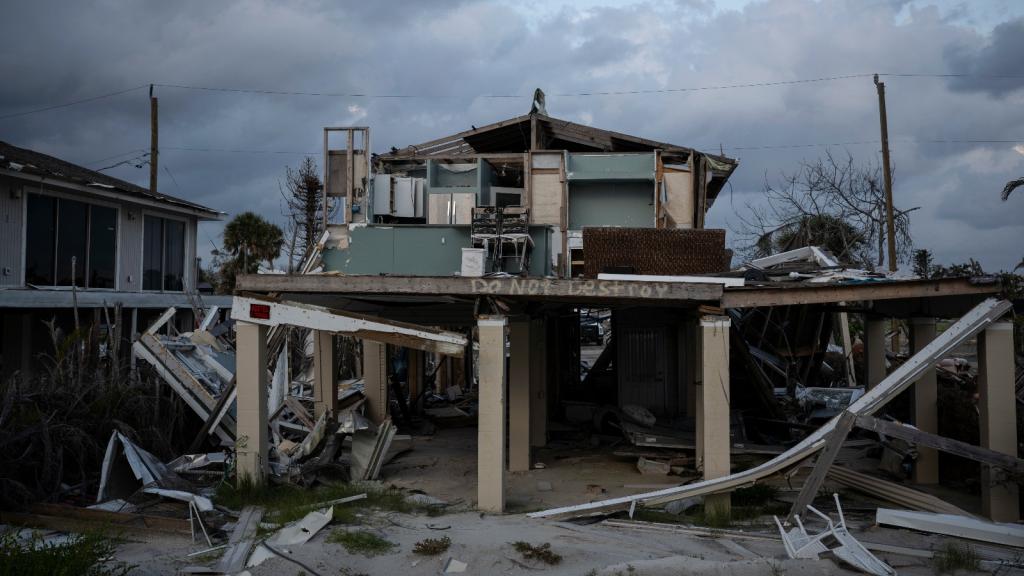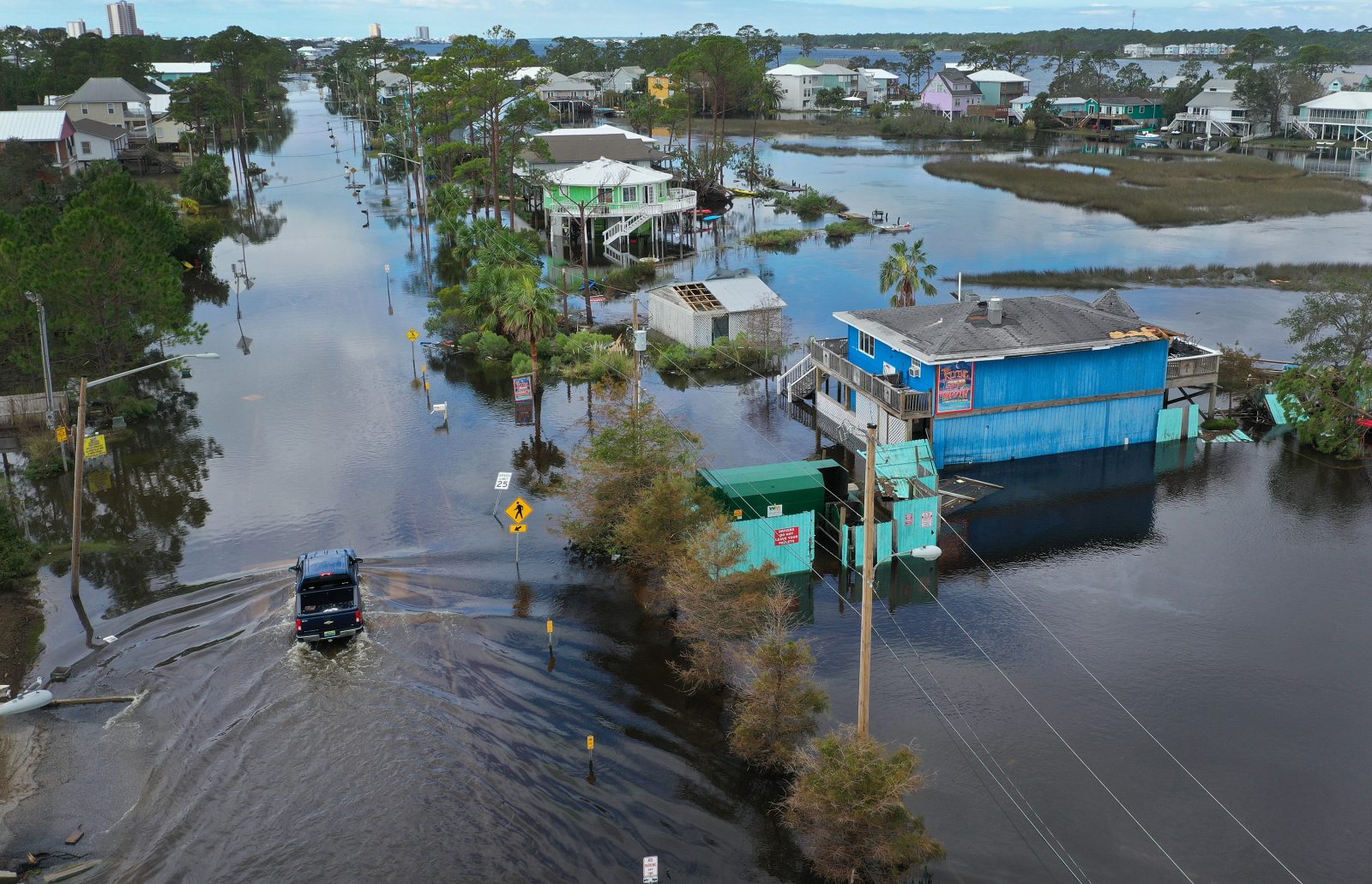
Over the past two decades, the annual cost of flood damage in the United States has quadrupled. And as global temperatures continue to rise and extreme weather events intensify, scientists estimate such damage to homes could increase another 60 percent over the next 30 years. Yet despite these alarming numbers, many homeowners in the U.S. remain unaware of the risks their properties face: More than half of states do not have, or have inadequate, flood risk disclosure laws — meaning no one has to tell homebuyers if they’re purchasing a flood prone-property.
This lack of transparency has created a false real estate market in parts of the U.S., according to new research from Stanford University and the University of North Carolina at Chapel Hill. The study, published in the journal Proceedings of the National Academies of Sciences, found there are almost 4 million single-family homes located in floodplains nationwide that collectively are overvalued by $44 billion based on their flood risk, or an average $11,526 per house.
The impact of this schema is particularly harmful for low-income families. “There is a disproportionately high share of marginalized populations that live in floodplains, because often it’s the cheapest available land,” said Miyuki Hino, lead author of the study and a professor at the University of North Carolina Chapel Hill. “If you’re a household that invested a lot of money into a home in one of these places, we would be extremely concerned about the possibility of that home’s value dropping a lot and really wiping out a lot of wealth in communities that are vulnerable to begin with.”
By not reflecting climate risk in housing values, it creates incentives for unnecessary development in hazardous areas, Hino found. It also blinds people to the financial risks of living in flood-prone neighborhoods, from riverfront towns in the Midwest to coastal Florida. Of the 10 states most at risk of severe flooding in the next 100 years, just three have flood risk disclosure laws — North Carolina, California, and Louisiana, according to data from the Natural Resources Defense Council. The latter two received passing scores for their laws, while North Carolina’s was rated as inadequate.
Floodplain maps maintained by the Federal Emergency Management Agency, or FEMA, are also woefully out of date in most parts of the country — leaving homebuyers in the dark about the risk they are acquiring.
Using publicly available flood maps and two decades of home sale data, the researchers evaluated what happened to a house’s sale price over time as flood maps were updated to include homes not previously identified in a flood zone. They saw a 2 percent decrease in the home’s price. Then, the researchers estimated what the cost of fully insuring these homes would be, and found it would actually cause the value of the house to decrease by 4.7 to 10.6 percent. If public flood maps were more thorough, the scientists said, the extent to which houses with flood risk are overvalued would likely be much greater.
The scientists argue their new research isn’t just useful for studying flooding, but can also be applied to other climate change-related disasters that affect housing, including wildfires. “We would have similar concerns with other types of hazards where the information is not really easily accessible or not forced to be disclosed to the buyer,” Hino said. ”You could get this type of overvaluation and this concern about how markets are going to fare over time as the climate changes.”