Two weeks into her first-ever research cruise, doctoral student Solveig Schilling still could not stop smiling. The trip, which was delayed by a year due to the COVID-19 pandemic, would provide her with data that will form the basis of her research over the next five years. It was also the fulfillment of a lifelong dream.
“Being on a ship and getting to do science: This is what I’ve wanted to do since I was a kid,” said Schilling, calling from on board the Tommy Munro research vessel in April.
Schilling is studying micropaleontology at the University of Texas at Austin’s Institute for Geophysics. She peers into the past through the lens of a microscope, reading tiny fossils to reconstruct the stories of ancient environments. And her current mission is to piece together the history of a lost river valley that’s buried beneath the seafloor in the Gulf of Mexico.
What she and her shipmates learn could improve predictions for how climate change will alter the Texas coast. But the research has an additional, more practical purpose. The buried valley likely contains troves of a coveted resource that could help Texas prepare for the climate-driven storms and surges to come — sand. The cruise is sponsored by the Texas General Land Office, an agency that manages state lands and wants to find new stores of sand to reinforce beaches and dunes along the coast.
“You can think of what we’re doing as a reconnaissance,” said John Goff, a senior research scientist at the university and Schilling’s advisor, the day before they set out. “We know these valleys are a ripe area for potential buried sand deposits.”
The area they are exploring is called the Trinity River Paleovalley. Today, Texas’ Trinity River empties into Galveston Bay, just east of Houston. But roughly 20,000 years ago, much of the world’s water was locked up in ice, sea levels were hundreds of feet lower, and coastlines extended miles beyond their current perimeters. During that time, Goff said, the Trinity meandered back and forth across a wide valley all the way out to the edge of the continental shelf.
Finding the bends in the former river will lead the scientists to the most likely sand deposits, since sand would have built up along the inner banks of such curves. “This sandbar deposit keeps growing and growing, and just keeps doing that for thousands of years,” said Goff. “So there’s a big pile of sand that’s left there by this process.”
Between 7,000 and 9,000 years ago, as glaciers melted, sea levels rose rapidly, burying miles of the Trinity River Valley — along with its mounds of sand — beneath the seafloor.
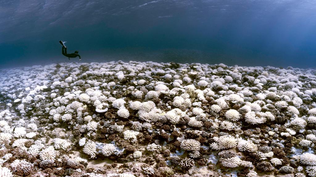
Contrary to what this journalist previously thought, the seafloor is not made of sand. Goff said that once you get into deeper water, it’s mostly mud. Wave energy along the seafloor decreases the further you get from shore, and beyond a certain point, the waves aren’t strong enough to carry sand particles, which are heavier than mud particles.
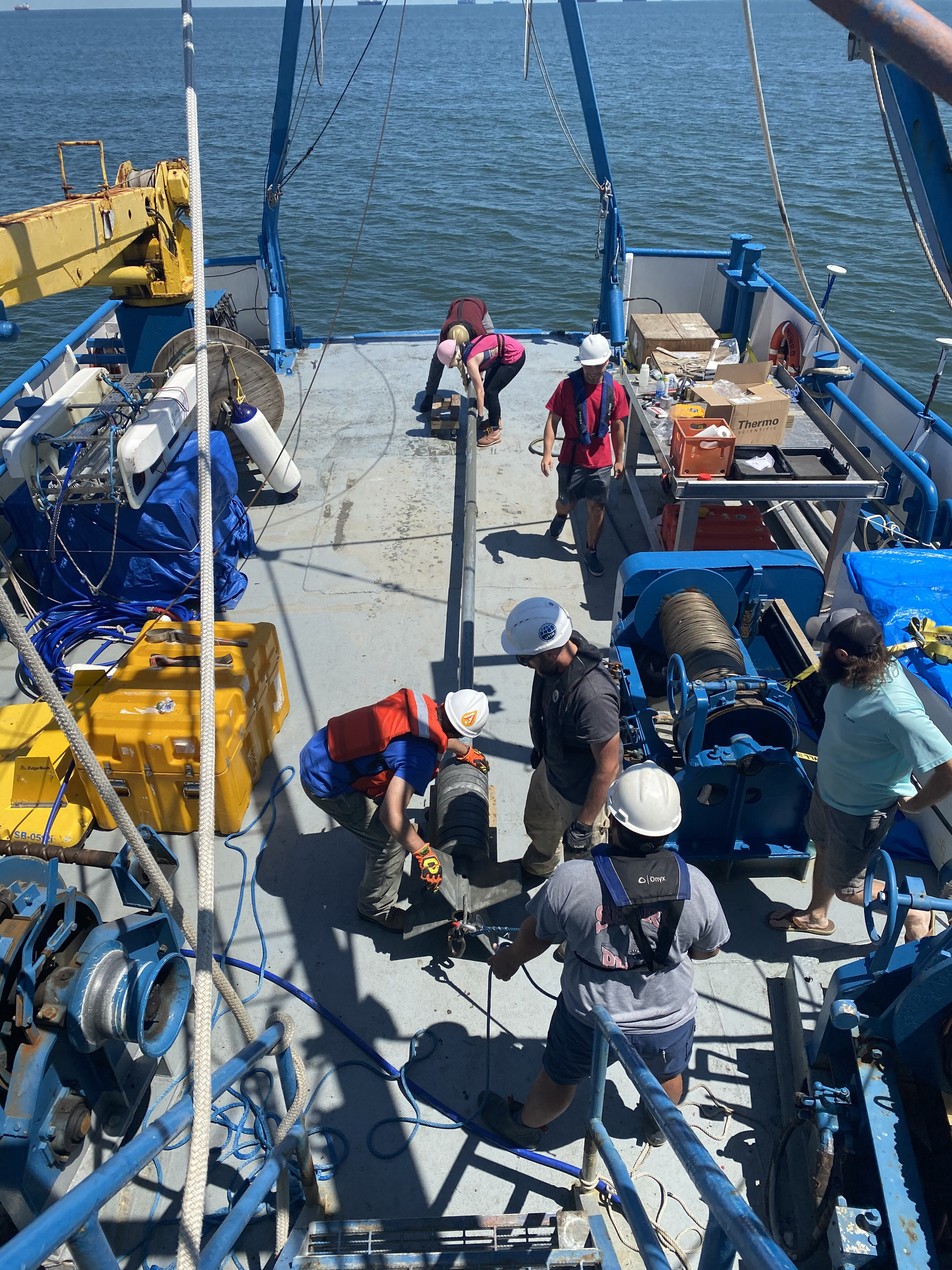
On the ship, Schilling typically wakes up around 5:30 a.m. and downs a bunch of coffee before heading into the lab. The eight scientists aboard alternate 12-hour shifts, so there’s always someone awake to monitor the equipment.
The researchers set out with a rough idea of the Trinity River’s path based on earlier mapping efforts. Now, using acoustic imaging technology that continuously X-rays the layers of sediment beneath the seafloor, they are collecting much more granular data than others have been able to in the past, enabling them to create more detailed maps of the Trinity.
After checking the data, if it’s a “coring day,” Schilling heads out to the deck and works with her fellow researchers and the ship’s crew to assemble 30-foot long cores — heavy metal straws that they lower into the seafloor using a crane to take a sample of the layers of sediment below. Later, she slices open the core to visually survey and describe what’s inside.
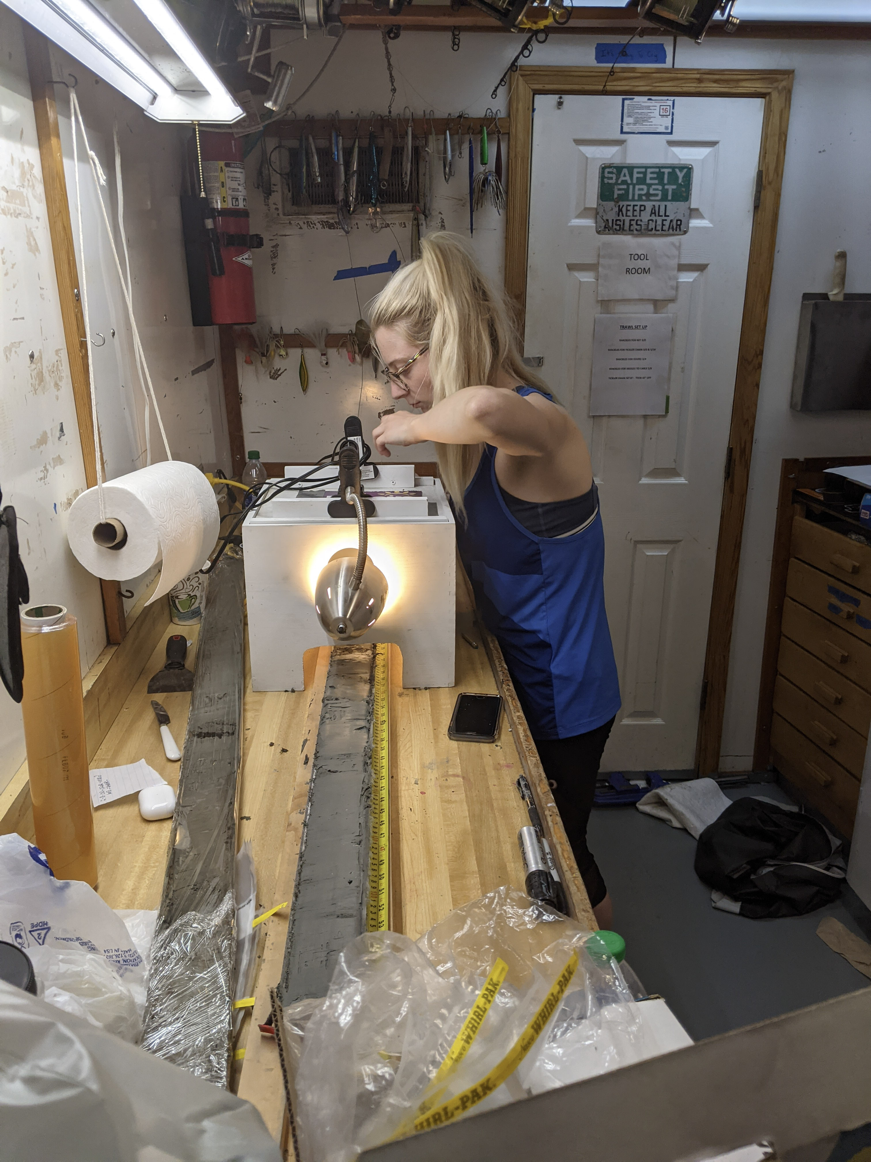
“It’s really hard right now to tell exactly what we’re seeing,” she said from the ship. They’ll learn more later once they’re back in the university lab and can analyze the grain size and the age of the material.
Ultimately, the researchers will be able to compare and verify what they see in the acoustic imaging data with what they find in the cores to understand how the ancient coast evolved in response to sea-level rise. That knowledge could help scientists and planners predict how rising seas will impact coastal landscapes and ecosystems in the coming years.
“The past is the key to the future,” said Goff. “It’s a trite thing but it’s actually quite true.”
Grain size is also a crucial metric for whether the Texas General Land Office will be able to use the sand for beach and dune nourishment projects. Goff said it’s important to choose sand that’s close in size and color to what’s already on the beach because it’s more likely to stay there longer.
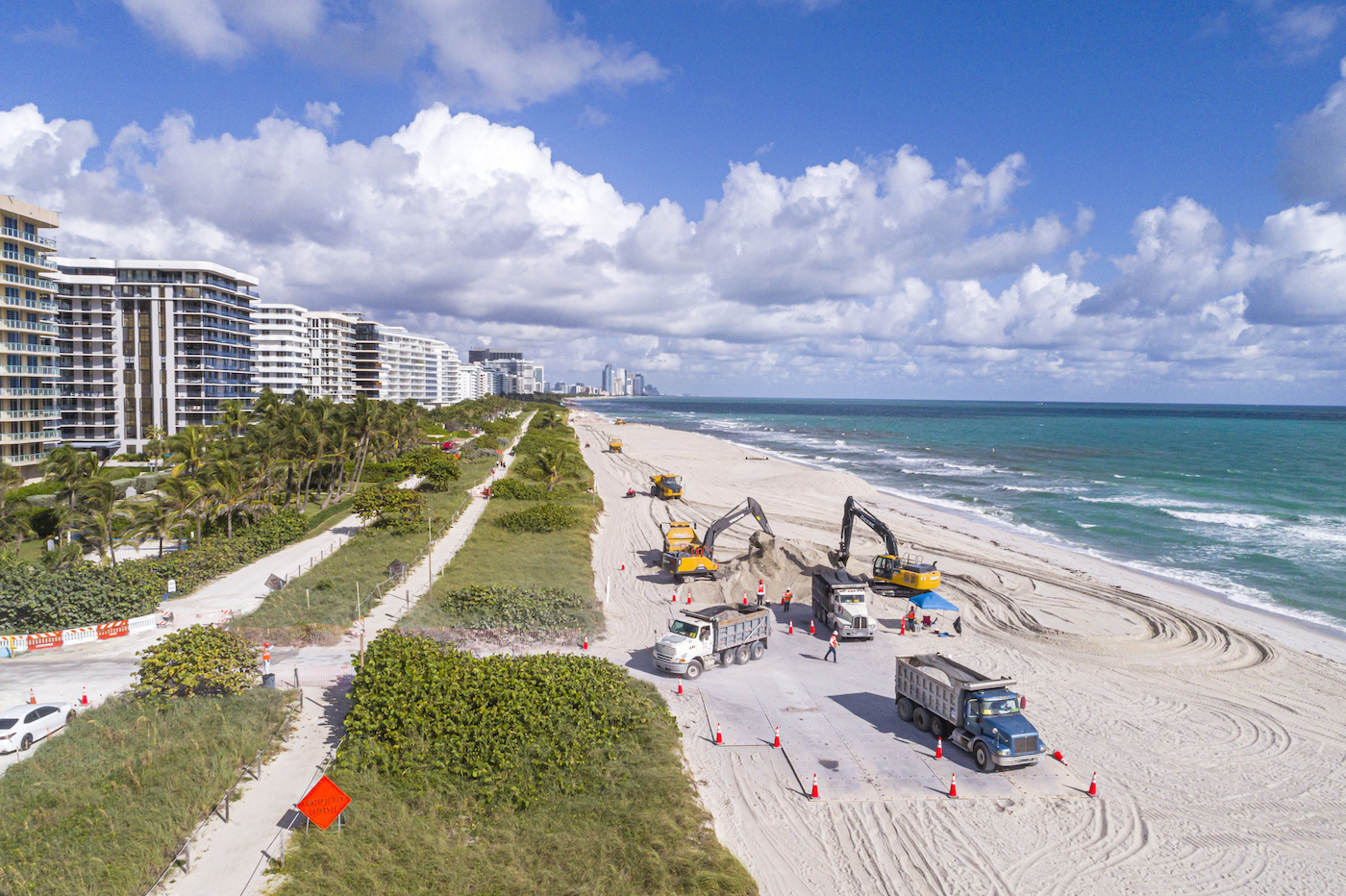
Shoring up the shoreline with sand is an incredibly common practice and not at all new. People have been dumping sand on beaches to fight coastal erosion since at least the early 20th century. In Texas alone, beaches have been replenished with sand at least 89 times since the 1950s, according to the federal government’s National Beach Nourishment Database, at a cost of at least $141 million.
What was once seen as a way to keep beaches intact for recreation has become a key tool to protect coastal environments and communities from sea-level rise and storm surge. Beach nourishment plays a central role in the Texas General Land Office’s coastal resiliency master plan, with several multi-million dollar projects in the pipeline.
In the past, the Land Office has sourced sand from inland sites near the project area, or used dredged sand from nearby navigation channels that are maintained by the U.S. Army Corps of Engineers. For one project at the McFaddin National Wildlife Refuge, sand was sourced from an offshore deposit. Kelly Brooks, a project manager at the Land Office, told Grist in an email that the agency’s sand resources have become depleted in recent years. “Additional sand resources will not only help build our beaches but can also be used to maintain them as they continue to erode,” she said.
But there is something inherently sisyphean about the practice. Beaches are dynamic environments, and it’s only a matter of time before the sand is taken back by the waves. Brooks acknowledged this in a recent statement about the research cruise.
“Spreading sand on beaches may buy us 10, maybe 15 years depending on storms,” Brooks said. That’s why the agency is also focused on restoring dunes and strengthening them with grasses, which may provide a more resilient buffer against high tides and sea-level rise.
Britt Raubenheimer, a senior scientist at the Woods Hole Oceanographic Institution, said how long the nourishment lasts can vary from a few months to several years. These projects evolve in different ways — the sand might wash down the shoreline into a thinly-spread layer, or it might get sucked into the surf zone, where it will still offer some protection by breaking up oncoming waves.
Raubenheimer said the question of whether it’s worth it depends on your criteria. Using sand for coastal protection often comes with the economic benefits of having a sandy beach that brings more tourism to the area. “For the state, it might totally balance and overcome any economic loss by doing the sand mining and replenishing the beach and dune,” she said. But other options, like marsh systems or planting mangroves, might be more durable and have environmental co-benefits. Brooks said the state’s coastal resiliency plan includes marsh and wetland enhancements.
Some studies have shown that beach nourishment projects do pay off — especially when the costs of climate change are taken into account. A 2013 analysis of potential erosion of sandy beaches around the world due to sea-level rise found that spending $65 billion to $220 billion on beach nourishment through the end of the century could reduce land loss by 8 to 14 percent and reduce forced human migration by up to 68 percent.
The idea that beach nourishment is a sustainable way to adapt to climate change, however, is contested. Authors of a 2018 study that assessed marine sand availability, potential project costs, and environmental impacts of beach nourishment in the Florida panhandle concluded that it must only be used as an interim strategy on the way to a “managed withdrawal from the coastline.”
If the Texas researchers do identify potential sand deposits, it could be a long time before they help the Texas coast. Brooks said the office will need to confirm the sand quality and do further assessments to find how much is there. Eventually they’ll need to apply for permits with the Army Corps of Engineers to take sand from the sites, involving environmental reviews of the impacts of doing so.
Dredging marine sand kills creatures living in the extracted sediment, and negatively impacts organisms that relied on the destroyed habitat. Many studies have indicated that these species can fully recover at the mine site within a few years after dredging, but that is not uniformly the case, and depends on a variety of factors like the hydrodynamics of the site and how long the dredging went on for. Noise pollution from the process can also impact marine mammals by scaring off their prey.
Brooks said it could take several years to get the right permits, and if those are approved, the Land Office will still need to find the funding to extract and utilize the sand.
“It’s a very involved process, and what we’re doing is very much the earliest stage,” said Goff.