Mike Houck has been urban naturalist for the Audubon Society of Portland since 1982 and is a cofounder of the Coalition for a Livable Future. He also sits on numerous city and regional natural resource advisory committees, and is coeditor of Wild in the City.
3:30 a.m.: Woke up, wondering what was amiss. I had been waking up abut this time for the past couple weeks because I had picked up a couple of parasitic bot flies during my month-long change of scene in rural Cost Rica. I probably picked them up at the Palo Verde biological research station in the dry forests northwest of San Jose. So, I guess out of habit, it’s time to get up.
By the way, for the biologically curious, there are some fascinating websites you can visit to find out more about the human bot fly. Having studied zoology at Iowa State and looked through microscopes at these critters 30-odd years ago, I have to admit to a morbid curiosity.
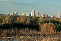
Oaks Bottom Wildlife Refuge with Portland skyline in background.
Photo: Mike Houck
Having my laptop at home comes in handy for sleepless mornings like this, so I put on some tea and decided to write my responses to Metro (Portland’s regional government, the only directly elected regional government in the U.S.). The topic for today: How can the region’s storm-water managers and sewer providers do their job with at least a modicum of respect for riparian corridors, wetlands, and streams? Past abuses are undoubtedly why chinook salmon and steelhead trout are listed by the National Marine Fisheries Service as threatened throughout the Pacific Northwest.
7:30 a.m.: Meeting with young, energetic transplant to the region at the Bijou Cafe, where virtually all of Portland’s business is conducted between the hours of 7 and 9 a.m. Are there any job prospects? I tell him his facility with Spanish might put him in good standing, given the Portland minority population is predicted to balloon to 41 percent by the year 2020, and most of them will be Hispanic. At this time, the environmental community has virtually no contact with the Hispanic community in this region. Turns out he had gotten a bot fly as well, probably from the same region in Costa Rica I had visited. Portland really is a small town.
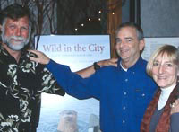
Me, with Robin and Mary Jane Cody.
8:30 a.m.: Corrections to our new book, Wild In The City. It is both expected and surprising that our 433-page book about nature in Portland must be reprinted after two months on the market. Wild In The City is the No. 1 bestseller at Annie Bloom and Lookinglass bookstores and No. 6 at Powell’s City of Books. More than 60 people contributed to this watershed-oriented natural history of the Portland metropolitan region. Even more amazing is the fact that my old high school sweetheart, Mary Jane Cody, her brother, Robin, and Bruce McCullough collaborated on the book, 41 years after we met at Estacada Union High School.
9:30 a.m.: Staff meeting. The Audubon Society of Portland has 23 staff and, though I hate the weekly ritual, it really is necessary to get together to discuss coordination of our disparate programs.
10:30 a.m. to 1 p.m.: Strategy with my colleague and friend, Ron Carley; polish my input to the regional utility input, and respond to 85 emails … a task, but far better than the 50 voicemails I used to get.
1 p.m.: A virus hits! This one swept the nation today. Ron, my tech support, is out to lunch. Having to get across town for the Metro utility meeting, I leave yellow post-its on my computer screen asking for help cleansing my computer of the virus, which sends multiple emails to my contact list.
1:30 to 4 p.m.: WRPAC (pronounced War Pack) meeting at Metro to iron out our differences. Turns out we are all amicable and agree to compromise language that ensures that local jurisdictions retain their autonomy, while securing regional assurances that the storm-water agencies will not screw up our stream corridors when they build or repair sewer lines.
4 to 5:30 p.m.: Portland Parks System Development Charge (SDC) meeting. SDCs are a way to charge developers money to provide parks for areas that are experiencing rapid development. We decide the next priorities should be neighborhood parks, trails, and natural areas.
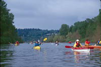
Kayakers near Ross Island.
Photo: Mike Houck.
5:45 p.m.: Met with Tommy, aide to Mayor Vera Katz, at the Lucky Labrador Brew Pub, home of Lucky Lab Stout and Portland’s favorite brewpub and environmental meeting place. Tommy and I meet to discuss the pending donation of over 100 acres of islands, the four-island Ross Island complex, to the city of Portland. This would be a major realization of the 1903 John Charles Olmsted (adopted son of Frederick Law, Sr.) master plan for a “comprehensive, interconnected” Portland park system. Ross Island Sand and Gravel, after more than 80 years of gravel extraction, has decided to move their operation and dedicate Ross, Hardtack, East, and Toe islands to the city. Ross Island, along with the adjacent 160-acre Oaks Bottom Wildlife Refuge, represents an amazing natural area system that sits literally in the heart of downtown Portland. On reflection, this is probably what got me going this morning, not bot flies.
Monday, 12 Feb 2001
PORTLAND, Ore.
Tuesday, 13 Feb 2001
PORTLAND, Ore.
My day starts with a radio interview with Barbara Bernstein. She’s putting together a program for national alternative radio on urban waterways and their social and ecological significance to cities. She produced the award-winning program, “The Malling of America,” and I look forward to talking with her about urban streams and rivers. She has an informal, conversational style that makes an interview both fun and provocative. She lives only a block south of the bluff overlooking Oaks Bottom Wildlife Refuge and tells me she saw one of the nesting pair of bald eagles fly over her house this morning.
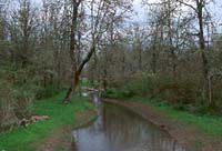
Summer Creek, part of a 200-foot-wide riparian and wetland corridor in Beaverton.
Photo: Mike Houck.
Barbara has her own program at KBOO, our local alternative radio station, and runs her own nonprofit, creating radio programs on topics that interest her. Today, we discuss why urban greenspaces in general, and streams specifically, are important to urban dwellers. Most of the interview is spent discussing the listing of the Portland harbor as a federal Superfund, and what that might portend for reclamation plans for Ross Island; musing how to reconcile the industrial use of the river with the city’s recent pledge to clean it up, create more fish and wildlife habitat, and recover salmonids; and how the protection and restoration of streams like Balch,
Stephens, and Johnson Creek fit into both the city’s River Renaissance plans and our regional government’s (Metro’s) growth management strategies.
As I leave her house, I hear a northern flicker calling repeatedly from a nearby street tree. It’s a bright, warm spring day in Portland, and after talking with Barbara for over an hour about what we are going to do, I’m energized again and want to get on with actually doing it!
Next up is an interview with Rick Roth, a Portland State University grad student doing research on an article for Metroscape. Metroscape is a publication for the Institute for Portland Metropolitan Studies. Rick’s writing an article on Sauvie Island, a farming area and state wildlife refuge just 10 miles from downtown Portland. Its upstream tip is situated at the confluence of the Willamette and Columbia Rivers.
With the increased population growth in the region, tensions have grown over recreational use on the island. Some islanders view off-island visitors as a nuisance, at best. Rick is interested in exploring various perspectives on what makes Sauvie Island special to the region. Aside from its sheer size — almost 20 miles long — it’s the only location where you can take a truly relaxed bicycle ride on bucolic country roads through rich farmland while seeing flocks of 200 to 400 sandhill cranes, brilliant white skeins of tundra and trumpeter swans, and thousands of Canada geese, snow geese, and other waterfowl, all with the silhouettes of Mt. Hood and Mt. St. Helens in the background. The island has the largest stand of Oregon white (Garry) oak (Quercus garryana) anywhere in the metropolitan region, a great place to go for white-breasted nuthatches, or just a pleasant stroll through the oak woodland.
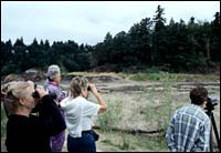
Greenspaces like Elk Rock Island offer important green relief to the city.
Photo: Mike Houck.
In other words, Sauvie Island is, in fact, unique in the region. I suggest that one key to ensuring the island does not get overused as the region continues to grow is to have a comprehensive system of greenspaces and trails spread equitably throughout the region, so that people will have plenty of places to view nature near their homes. My hunch is that if people only went to Sauvie Island for experiences unique to the island and had access to other recreational and wildlife viewing opportunities, we might be able to take some of the pressure off our treasured landscapes like Sauvie Island and Forest Park.
I spend a brief time this afternoon discussing with my partner, Ron Carley, a grant application we have to submit by Thursday. Most funding for the Urban Naturalist program comes from national and local foundations. As with other nonprofits, that means we are in a continuous cycle of writing reports and seeking new funds for the program. This time, he’s writing the grant and I am simply supplying a report of our progress over the past eight months.
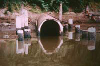
One of Portland’s biggest challenges is reducing combined sewer overflows.
Photo: Mike Houck.
Next up: Our conservation director, Sybil Ackerman, and I brief a candidate for state representative. Sybil focuses on the Tillamook Forest and changing the Forest Practices Act to protect spotted owls and marbled murrelets, both old-growth dependent species. I discuss the Willamette River and the city’s combined sewer overflows.
The day ends with a glass of wine with Bob Wilson and Martha Gannett, two key collaborators on Wild in the City: A Guide to Portland’s Natural Areas. We’re all giddy at the reception our book has received.
Wednesday, 14 Feb 2001
PORTLAND, Ore.
It’s 7:30, and I’m up on the 13th floor of the Portland Building, high above Portlandia, the trident-bearing, dice-tossing icon adorning the building’s western portico. Gathered in the Forest Park room is the dogged group that has met at the same hour several times a month, for many months. Our charge is to develop a strategy that moves the movers and shakers, as well as the regular folk, to recognize the aesthetic, social, educational, economic, and ecological values of the city’s park system. To move them to consider parks essential to a livable city. Just as important as fire, police, and schools.
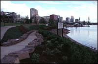
Downtown, where higher density residential development is slated, especially needs more parks and public places.
Photo: Mike Houck.
In the end, the six of us, two park bureau employees and four citizens, agree on some basic goals and strategies to ensure that park constituents, the presumed choir, well-connected Portland civic leaders, and the media “get it” — get that parks and recreational programs for youth are every bit as important as other “basic” city services.
We call ourselves the “promotions group.” We are one of several subgroups of 50 or 60 citizens and park professionals who for two years have been creating a vision for the Portland park system. Parks Vision 2020 harkens back to 1903, when John Charles Olmsted, adopted son of Frederick Law, Sr., presented both Portland and Seattle with a master plan for a “comprehensive, interconnect” urban park system. (Nothing’s changed in the intervening 98 years. Neither city had sufficient funds, so both cities agreed to chip in for Olmsted’s train fare to the West Coast.) I’ll write more on 2020 and Olmsted after tomorrow night’s unveiling of the 2020 Plan by Parks Commissioner Jim Francesconi.
At 9:30 sharp, I’m at the Koin Tower, the pyramidal green-capped Portland landmark, en route to talk with former Portland Mayor and Oregon Governor Neil Goldschmidt. We ran into one another a few months ago at a local coffee shop and struck up a conversation about a program to teach reading to Oregon’s kids. In sixth grade, I had a teacher, Mr. Ebert, who every day read to us books like Green Mansions and The Wizard of Oz. Mr. Ebert also introduced us to classical music and took us on a tour of a Portland Art Museum van Gogh exhibit. Having grown up in the outer southeast part of Portland, where many streets remain unpaved to this day and there are no parks, Ebert had a huge impact on me. I actually ran into him a couple years ago at a political fund-raiser and had the chance to tell him how much he meant to me as a teacher — a rare opportunity to thank someone who has made an impact on my life. I wanted to know more about Goldschmidt’s SMART reading program.
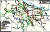
Metro regional trails and greenways.
But this morning’s not about reading. Instead, we discuss the need for open space in the central city as residential density increases. We also muse about the fate of Ross Island (see Tuesday’s diary) and marvel at the success of Metro’s Greenspace program. I give him a copy of Wild in the City, and we agree to take a day off to visit some local green spaces and perhaps link nature study with one of his reading projects.
Next, it’s Metro’s GTAC (Greenspaces Technical Advisory Committee). Thirty of the region’s park planners and a handful of park advocates, like Barbara Walker of the 40-Mile Loop Land Trust, myself, a
nd southwest Portland trail guru Don Baack, are gathered to discuss priorities for the regional trail network. Although most of the attention has focused on the 6,500 acres Metro acquired in 1995 with a $135.6 million bond measure, Metro and local park providers have also made great strides in implementing the regional trails program. For information, check out their website.
Two hours later, still at Metro, we start another committee meeting, this time for performance measures. We are attempting to establish measurable benchmarks to see if we’re succeeding in developing a compact metropolitan region, while maintaining a healthy economy and environment, as well as an outstanding quality of life.
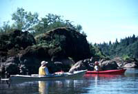
A water trail of the Willamette River, near Rock Island.
Photo: Mike Houck.
For example, for Greenspaces, one measure is to ensure that every citizen is no more than a 15-minute walk from both a park and natural area. For more information on Metro Region 2040, check their website.
Finally, I catch the tail end of a meeting of Metro’s Metropolitan Policy Advisory Committee (MPAC), a committee of the region’s elected officials, representing all 24 cities and three counties within Metro’s jurisdiction. At 7 p.m., the indefatigable Jim Zehren, Portland attorney and urban park advocate, convenes the MPAC parks subcommittee. His goal: to convince MPAC that parks are an essential element of the region’s growth management strategy, just as important as roads, utilities, and how much industrial land we might have in the 20-year land supply. Sound familiar? It should. Jim also serves on Portland Parks Vision 2020.
7:30 a.m.: Another breakfast meeting, this time with Kendra Smith of United Sewerage Agency to discuss the agency’s Watersheds 2000 project. USA is conducting detailed inventories of all the streams within their jurisdiction, which includes the Tualatin Basin inside the region’s Urban Growth Boundary (fish and wildlife habitat) program.
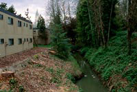
Fanno Creek, with apartments built up to the stream and trees cut.
Photo: Mike Houck.
9 to 11 a.m.: Greenstreets Technical Advisory Committee meeting at Metro, our regional government. This is one committee that I look forward to. First, because it is run by a Metro “crat” with a great sense of humor; second, because committee members are really eclectic. We have landscape architects, traffic engineers, land use policy wonks, fish and wildlife biologists, and citizen activists. The consultant team is just as eclectic. Our task is to advise Metro on the Greenstreets project.
How can we build streets that control the amount and quality of storm-water runoff? The transportation system contributes 40 percent of storm-water runoff. Perhaps the most important issue, however, is the timing and volume of water that is typically collected by gutters and drains and piped directly to the nearest water body. The result: Streams are “hosed out” by repeated deluges. During the summer, water that would have infiltrated into the groundwater is unavailable.
My hope is to create regional standards for road construction that short-circuits the collection and disposal of storm-water and treats it as a resource, rather than a “problem” to be gotten rid of. First, we’d like to mimic the natural forest with street trees that intercept water. In a forested condition, rain typically never reaches the ground. It’s intercepted or evaporated by trees. Rain that does reach the ground is taken up by the duff (or leaf layer) and evapotranspired vegetated “bioswales” along roadsides and in median areas, and the creation of landscaped areas can reduce the “effective” impervious effect of roadways.
Professor Patrick Condon, James Tayor Chair of Landscape and Livable Environments at the University of British Columbia, has developed a scheme whereby impervious or hard surfaces like parking lots, roadways, and roofs, all of which create more storm-water runoff, can be reduced, even in high density urban areas, to approximately 10 percent. Research by the Center for Watershed Protection in Maryland tells us that anything more than 10 percent impervious results in stream degradation and loss of fish and other biological integrity.

Image: Patrick Condon.
At a later meeting with Sue Marshall, executive director of the Tualatin Riverkeepers, we decide to set up an April meeting for Tualatin Basin citizens to review Metro’s Goal 5 stream-mapping project and receive an update on that program, which will help build grassroots support to ensure coordination between the two programs.
Noon: I go back to my office and work up a series of field trips we call City to the Sea, which I will colead with Sue Marshall and Sybil Ackerman. City to the Sea will feature trips from the mouth to the headwaters of the Tualatin River, over the coast range, and out to Tillamook Bay. The purpose of the field tours will be to emphasize the importance of restoring whole watersheds, not just isolated stream reaches, and of addressing negative watershed impacts from headwaters to the mouth in agricultural, forestry, and urban land use practices.
6:30 p.m.: Ron Carley and I are at the Pittock Mansion, a landmark Portland park that sits high above Portland in the Tualatin Mountains, just a few minutes from downtown. We are there for the unveiling of the discussion draft of the 2020 Vision Plan. City Commissioner Jim Francesconi leads the evening by pledging his support and giving a very gracious, and passionate, pep talk to the citizen volunteers and Portland Park Bureau staff about the need to implement the vision and pass a bond measure in 2002 to properly fund the vision:
Portland’s parks, public places, natural areas, and recreational opportunities give life and beauty to our city. These essential assets connect people to place, self, and others. Portland’s residents will treasure and care for this legacy, building on the past to provide for future generations.
Ron and I are pleased that at the top of the list is the need to protect and restore natural areas as an integral part of the park system. The 2020 principles include the following language relating to natural resources:
The city’s parks, natural areas, and recreation programs are among the essential elements that create a livable, dynamic and economically vibrant city; the City will develop multiobjective policies, planning programs, and forums that integrate and coordinate regionally significant parks, recreational facilities, trails, and natural resource protection in all major planning efforts for transportation, water quality, housing, and the Endangered Species Act; the city and region have an interconnected system of trails, parks, natural areas, streams, and rivers that are well protected and ecologically healthy; linking natural areas into larger areas provides healthier ecological systems. Linking parks with greenways, trails, and paths provides greater recreational benefit.
To see the report, contact the Portland Park Bureau.
Finally, Ron and I head back to Audubon Society of Portland, where our board meeting is in progress; we wrap things up around 9:30 and head home.
Thursday, 15 Feb 2001
PORTLAND, Ore.
Friday, 16 Feb 2001
PORTLAND, Ore.
7:45 a.m.: I meet with City Commissioner Jim Francesconi at City Hall — there’s a Marsee bakery, a homegrown alternative to Starbucks, on the first floor — to discuss last night’s 2020 Vision launching. We also talk about his proposed city resolution to require an “impact statement” for new policies to address “synergistic” effects on major city goals. There will be a late-February council hearing.
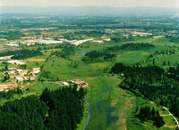
This wetland corridor between the cities of Tualatin and Sherwood is an example of the green spaces acquired by Metro.
Photo: Mike Houck.
9 a.m.: I meet with Zari Santner of Portland Parks to discuss the ongoing downtown park blocks issue, a major debate of whether and how to “renew” the downtown core around the park blocks. Recently a bevy of “outside experts” came to Portland and over 300 locals turned out to express views on low-income housing, the need for public open space, and basic urban design issues.
10:30 a.m.: Off to the Trust for Public Land to talk with Sam Hodder about urban green-space acquisitions, including the Gresham lava domes and the Willamette River riparian area near Molalla State Park. As I leave, I mention the City to the Sea field-trip series (see the Audubon Society of Portland newsletter, The Warbler.) Serendipitously, Sam is working on acquisitions in Tillamook Bay. He agrees to come along on our August sojourn to Tillamoook, for the ” … to the Sea” portion of the series. I am feeling much better about the trip now. We have something specific to focus on as a follow-up to the trip.
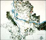
Map of greenspaces in the Portland area.
Noon: I attend the City Club lunch. Metro Executive Mike Burton speaks to Portland’s civic group about the potential impacts of Measure 7. Measure 7 was approved by a 6 percent margin in the fall election. It is a “takings” measure put on the ballot by property rights and anti-government groups. It could wreak havoc on Oregon’s land use program and does not portend well for regulations we are working to enact in the Portland region protect and restore fish and wildlife habitat.
1 p.m.: I have to run over to Kaiser Hospital for a final check on my bot fly problem (see Monday’s entry). Much of the week, including a full evening of intravenous antibiotic treatment, I have been fighting an infection in my left arm, most likely from having ruptured one of the buggers when they were excised. I bring a copy of a book my friend Bruce McCullough mailed me, Tropical Nature, to share with my Kaiser PA, David Browne. He copies the chapter, “Jerry’s Maggot,” which describes how Jerry Coyne, a tropical biologist, carried a bot fly in his head “to term.” There is a vivid description of its emergence at a Red Sox game, a must read for tales of tropical parasitism and other symbiotic adventures!
Next, it’s back to Metro. MTAC (Metro Technical Advisory Committee) has planned a two-hour session for the region’s planners, and those of us who work with them, to have an open discussion of where we have gone over the past six years with Region 2040, our regional growth management strategy. Several local planners present their views on successes and challenges, assessments of where the public is on growth issues in our region, and the next steps. It’s an amazing array of professional planners with a few citizen-activist types like myself, probably 80 or so people in the room.
In a nutshell, here’s what we’re discussing: Almost seven years ago, our region launched a growth management strategy, Region 2040, that resulted in the decision that Portland was going to grow up, not out. The basic tenets of 2040 are that we are going to hold a tight Urban Growth Boundary (UGB), both to protect rural resource lands and to contain sprawl. What we are now focusing all of our attention on is how to retain, or improve, quality of life inside the UGB while densities increase.
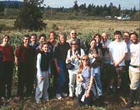
Coalition members at Urban Bounty Farm.
Photo: Mike Houck.
Virtually all of my activities this past week have, in one way or another, related to the Region 2040 planning effort. Although my work relates specifically to protecting the “urban greenfrastructure,” we are also working with 60 other nonprofit organizations to make sure green issues are integrated with affordable housing, family wage jobs, alternative transit, food security, and good urban design. Six years ago, we cofounded the Coalition for a Livable Future, along with 1000 Friends of Oregon, Urban League of Portland, Bicycle Transportation Alliance, and others. This is the most exciting work I have done in my almost 20 years at Audubon. For the first time, we have a legitimate working relationship with colleagues concerned about affordable housing and economic revitalization in low-income communities, and environmental justice.
5 p.m.: Back to Audubon to get ready for tomorrow morning’s Wild in the City field trip to Creekside Marsh.
