This story was originally published by Atlas Obscura and is reproduced here as part of the Climate Desk collaboration.
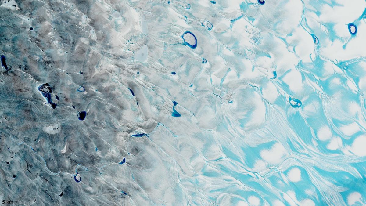
“We started hearing a noise, like breaking, or coins falling,” says Marco Tedesco, a climate scientist at Columbia University’s Lamont-Doherty Earth Observatory. He makes a loud, sustained crunching sound, recreating what he and his team heard, years earlier, while doing fieldwork on the Greenland Ice Sheet. Below the surface of the ice near where they were standing, a flood had begun. “The water below starts to move but you still have snow on top,” Tedesco says of the phenomenon. As the flowing water gains momentum, overlying snow and ice give way and reveal a meltwater stream or river.
What Tedesco describes is a small-scale seasonal melt event, one of many that occur every summer at the lower-elevation edges of the Greenland Ice Sheet, an expanse of more than 650,000 square miles that’s second only to the Antarctic Ice Sheet in size. This year, however, things were different.
Foll... Read more