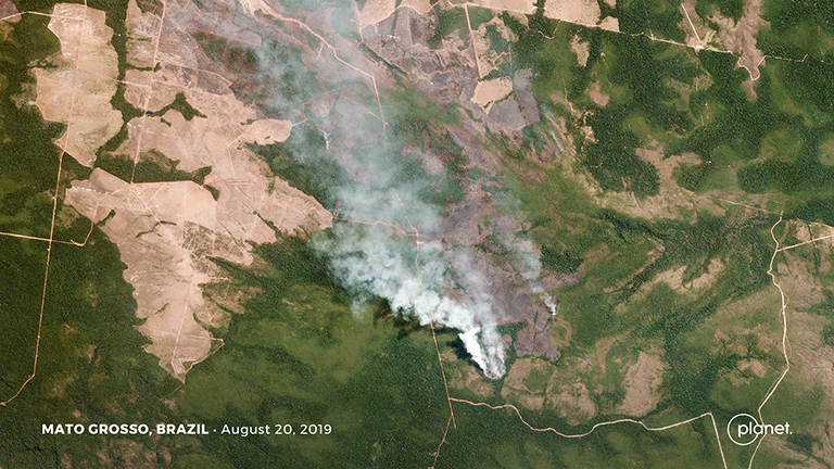
High-resolution images from satellite company Planet are revealing glimpses of some of the fires currently devastating the Amazon rainforest.
While many of the images currently being shared on social media and by news outlets are from past fires — some from as long as 15 years ago — satellites can provide a near real-time view of what’s unfolding in the Amazon. With near-daily overflights and high-resolution imagery, Planet’s constellation of satellites is providing a clear look at some of the fires now burning in the Brazilian Amazon.
Beyond dramatic snapshots, those images also provide data that can be mined for critical insights into what’s happening in the Amazon on a basin-wide scale, according to Greg Asner, the director of the Center for Global Discovery and Conservation Science at Arizona State University, whose team is using Planet’s data to assess the impact of the fires on carbon emissions.
“Planet data provides unprecedented detail in mapping forest change down to individual trees which allows us to assess the damage from these kinds of large scale disturbances,” Asner said. “Our Planet Incubator Program is currently tracking forest carbon emissi... Read more
