A long, warm plume of airborne water snaked its way from the subtropical Pacific Ocean toward the U.S. West Coast at the beginning of this month. As the so-called atmospheric river made its way north, it sucked up moisture from above-average sea surface temperatures.
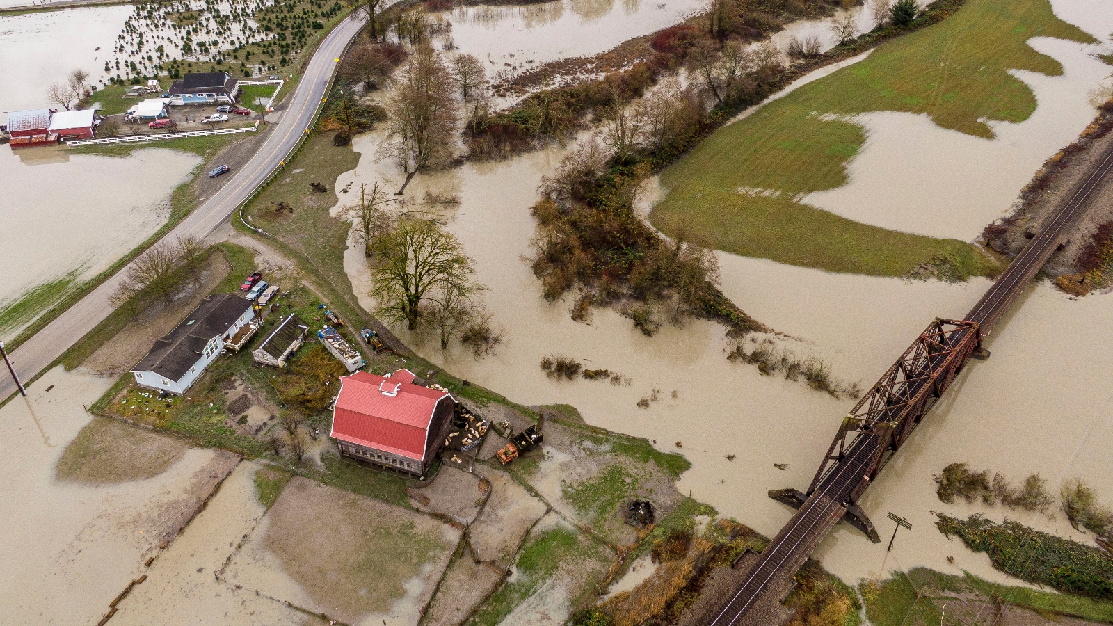
When the airborne river washed ashore on December 8, it unleashed a torrential gush of water on the Pacific Northwest that didn’t let up for the better part of a week. Now, a second atmospheric river is battering Washington state, with a third likely later this week.
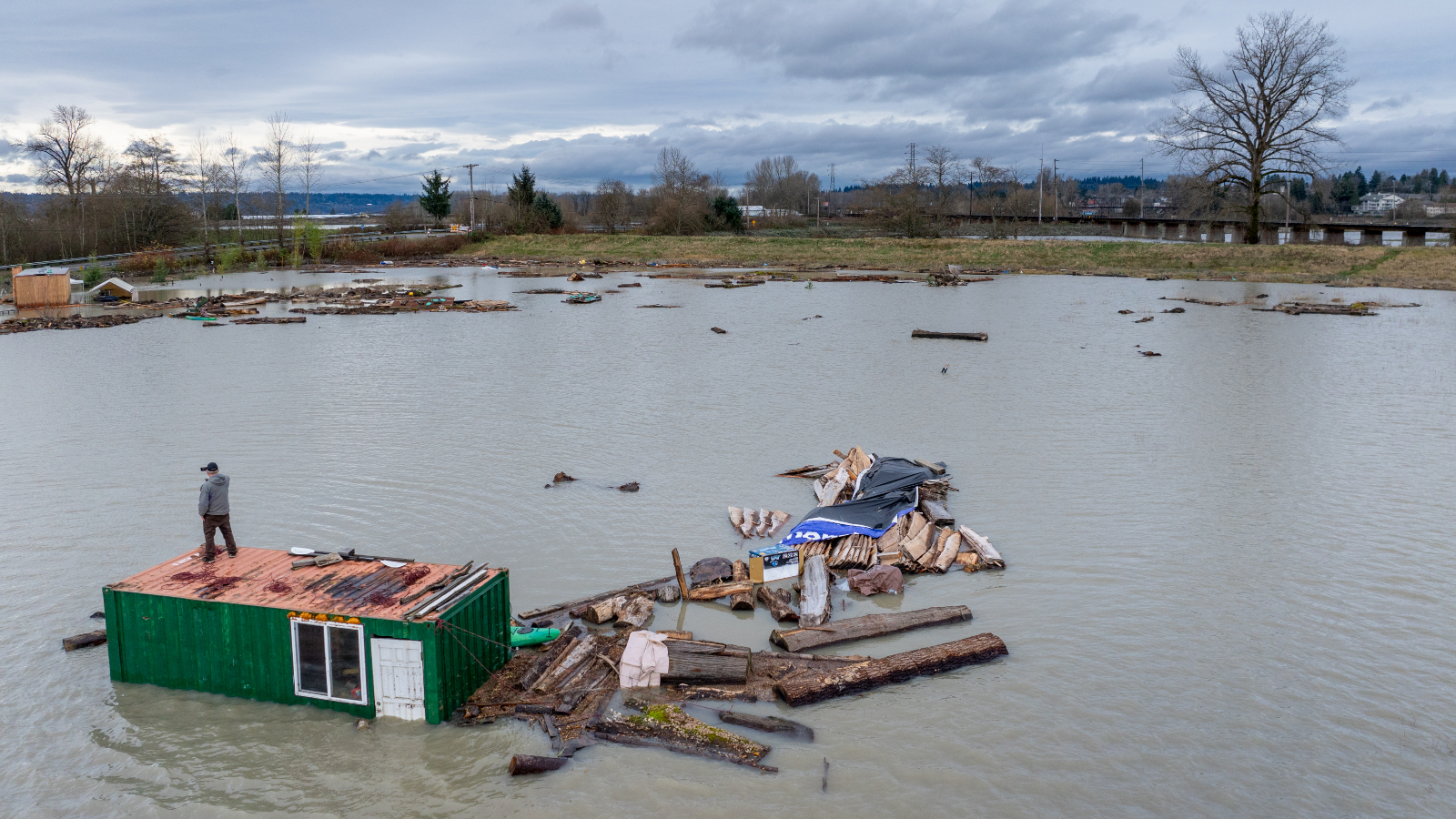
On Wednesday, Washington Governor Bob Ferguson declared a state of emergency and public officials issued “go now” evacuation alerts to 100,000 people. Thousands in western Canada also received orders to evacuate. Up to 18 inches of rain fell on parts of western Washington state last week, and rivers across the region burst their banks. At least 30 major roads were impassable or closed due to damage, and emergency crews conducted 250 water rescues.
“The flooding levels we’re looking at are potentially historic in nature,” Ferguson said at a press conference on Thursday.
They are not, however, entirely unexpected. A study published earlier this year found that atmospheric rivers have become slightly wetter, larger, and more frequent since 1980. Those changes are consistent with the basic physics of climate change: A warmer atmosphere can hold more moisture. Meteorologists say that these dynamics are boosting rainfall events from small squalls to major atmospheric rivers, contributing to a spike in sudden, extreme floods in many parts of the country this year.
Beyond that, there are other climate-charged conditions fueling the chaos in Washington. Much of the western U.S. has been unusually warm for this time of year, leading to low levels of snowpack in mountain ranges from British Columbia to California. The above-average warmth, not just in the region where the atmospheric river made landfall but also along its route through the Pacific, meant that the rain that fell on Washington was heavy and warm. That warmth, said Chris Gloninger, a senior climate scientist at the Woods Hole Group, “would be statistically impossible without the human influence of anthropogenic climate change.”
David Ryder / Getty Images
The lack of snowpack made the rainfall more deadly. Snowpack that is deep and frozen solid can absorb rain and freeze it where it lands, noted Daniel Swain, a climate scientist at the University of California Agriculture and Natural Resources, in a livestream event on Friday. But the unusually light snow that had accumulated in the mountains was easily washed away by last week’s atmospheric river, making an already bad flood event even worse.
“If you have some snow but it’s not very significant, if you get a really heavy prolonged warm rain event, you actually can melt the whole snowpack in one go,” Swain said. “That’s very likely exactly what we saw during this Pacific Northwest flood event.”
Chad Magby, a project manager for an industrial insulation contracting firm who lives in Index, Washington, started watching the river rise from his cabin along the North Fork of the Skykomish River on Monday. Magby and his wife, Jasmine (who is related to this author’s cousin) are accustomed to floods in Index, where heavy rains in 2006 and 2015 caused the river to burst its banks.
But this time was different. The area was still recovering from the 2022 Bolt Creek Fire, which left a burn scar, scorched trees, and loosened soil that made thousands of acres above the main highway in the region more prone to mudslides. So after the rains fell last week, standing water and debris blocked the roads out of town in all directions. Magby and the roughly 150 people who live in Index couldn’t get out if they tried. Chad and Jasmine sat and watched the river rise, hoping it would stop before it reached the few dozen houses on their dead-end road.
“What was different about this one is the feeling of being trapped,” Magby said. “There was no way to leave.”
Before the atmospheric rivers hit, the western U.S. had been in various stages of drought. The abnormal dryness of the rest of the year came back to bite the region when the rains finally came. Washington had issued a drought declaration for the third year running, and conditions in the entire Colorado River Basin met “drought” criteria, with parts of the upper basin in “extreme” and “exceptional” drought. In Index, the normally rushing North Fork of the Skykomish River was so low this summer that it looked like parts of it might be crossable on foot, Magby said. Six months later, the river rose to nearly the height of his house.
In the coming days, Index and other parts of western Washington are likely to get at least another 8 inches of rain as more storms hit the state. By the end of the year, Washington’s total yearly rainfall may look close to normal or even slightly above average, despite the drought.
“You’re getting so much rain in just one event and that’s how you’re maybe getting an average season on paper,” Gloninger said. “But when you pull back the layers, if it happens only over the course of a couple of days as opposed to spread out over the course of a year, it’s extremely troublesome.”
Correction: An earlier version of this story misidentified the Skykomish River.
A message from
Your support keeps our climate news free.
Grist is the only award-winning newsroom focused on exploring equitable solutions to climate change. It’s vital reporting made entirely possible by loyal readers like you.
At Grist, we don’t believe in paywalls. Instead, we rely on our readers to pitch in what they can so that we can continue bringing you our solution-based climate news. Donate today to keep our site free.