
Photo by Hannah Swithinbank.
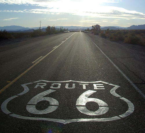
When cyclists travel down U.S. Bike Route 66, heading west out of Texas and into New Mexico, they’ll come off the high plains and pass through Tucumcari and Santa Rosa, then head north to Las Vegas — not the Vegas in Nevada, but the one that was big in the 19th century, when the Santa Fe trail passed through and the hot springs were a draw. From there, they’ll head into the Rocky Mountains, pedaling past Pecos, where they’ll find the ruin of a pueblo relinquished 200 years ago. At Glorieta Pass, they’ll pass the site of a Civil War battle, one of the most important in the western states, where the Union army pushed the Confederates back into Texas. Then they’ll roll into Santa Fe, where they can spend the night in one of the old motor lodge hotels, now restored, from the glory days of Route 66, a road that drew out the dream of getting into a car and driving west.
U.S. Bike Route 66 doesn’t exist quite yet. Like the old Route 66, Bike Route 66 is more an idea right now than a reality. But while the old road, which was decommissioned in 1985, has disappeared under Interstate 40 in some parts and beneath overgrown fields in others, the new bike route is being mapped now, on top of the old route and the newer interstate.
Bike Route 66, which will stretch from Chicago to Los Angeles, is part of the first big push to establish official national bike routes, the cycling equivalent of interstate highways. The project has been in the works for two years already, and it will be at least two years more before their work is done — the product of touring societies, volunteer cyclists, state transportation coordinators, local city officials, cartographers, and the nonprofit Adventure Cycling Association, which creates some of the best maps for long-distance cycling in the country.
The vision of a Route 66 resurrected as the Great American Bike Trip is so compelling that bike clubs and transportation departments from Illinois to California had dreamed it up independently. “Historically and culturally, Route 66 is very important for southern California,” says Alan Thompson, who’s working on the route for the Southern California Association of Governments. “You had whole groups of people coming during the Dust Bowl, looking for a better life here. My grandfather came on that route from his farm in Texas.”
It’s that resonance, that taste of dust and kitsch and chrome, that pushed 66 up the list of priorities in the emerging network of bike routes. The idea for a U.S. Bike Route system has been around since the 1970s, but after an initial push that resulted in a few routes, work to create the system stopped. In the intervening decades, groups like Adventure Cycling have mapped thousands of miles of informal bike routes, but in the past few years, cycling advocates have revived the idea of an official, national system. In 2011, the American Association of State Highway and Transportation Officials (AASHTO) approved six official U.S. Bike Routes, the first time since 1982 that new routes have been added.

Photo by Scott & Emily.
Adventure Cycling’s mapping work on 66 began with notes from long-distance cycling legend Lon Haldeman, who runs cycling tours that trace the old 66 and who still remembers when, he writes, “The billboards with the fatman’s face were still promoting the Club Cafe in Santa Rosa. The yellow Stukeys Restaurant signs tempted travelers with the nutritious breakfast of one egg, toast and jelly of ninety-nine cents.”
With those notes and input from cyclists who know the local roads, Adventure Cycling sent out a route researcher from Chicago to the border of New Mexico in 2011. Another team just finished traveling through New Mexico, Arizona, and California. These teams judge if the route is too complicated for bike travel, and they look at the surface of the road, the traffic, and hazards like railroad tracks. They also scout for amenities such as grocery stores, campgrounds, and hotels.
“There was one [hotel] in Arizona that we really wanted to stay in where they have hotel rooms that are in wigwams,” says Melissa Thompson, an Adventure Cycling cartographer.
One of the debates at Adventure Cycling was whether to stick to the beaten path of the original road or to break away in order to make “a really excellent bike route,” says Virginia Sullivan, Adventure Cycling’s special projects director. Often, they’ve opted for the latter.
In New Mexico, for instance, riding Route 66 could mean hugging the shoulder of I-40 all the way through the state. But the New Mexico Touring Society, which has been working on the project, has chosen to snake the route up through Santa Fe, then down to Albuquerque and through the pueblos in the western half of the state. There’s some historic justification for this route: The original 66 went north to Santa Fe before heading south again. Only in 1937 did the route straighten into the smoother line that I-40 draws today.
“In New Mexico, it’s easy to stay on the freeway and miss all the interesting things,” says Christopher Marsh, a member of the touring society. “We knew all the side roads and the more interesting things that people would want to see if they were coming here.”
There’s plenty to see, in New Mexico and beyond: Dell Rhea’s Chicken Basket in Illinois, the Wagon Wheel Motel in Missouri, the Blue Whale in Oklahoma, the enormous gift shop at Cline’s Corner, New Mexico, the still-glowing neon signs, and the innumerable diners serving up the same short-order cuisine.
Thompson, the Adventure Cycling cartographer, followed Route 66 for long stretches of a bike trip three years ago. “What I loved was the enormous amount of variety that you get,” she says — the cities and the kitschy landmarks and “the big open spaces where you just feel like, ‘Wow, just look at this big expansive world in front of me.’”