Outside of its cities (and inside a lot of them, too), California is a typical car-happy American state, with about .84 cars for every person. With its miles and miles of looping roadway and ingrained car culture, it can be easy to forget how many other forms of transportation there are in the Golden State, too.
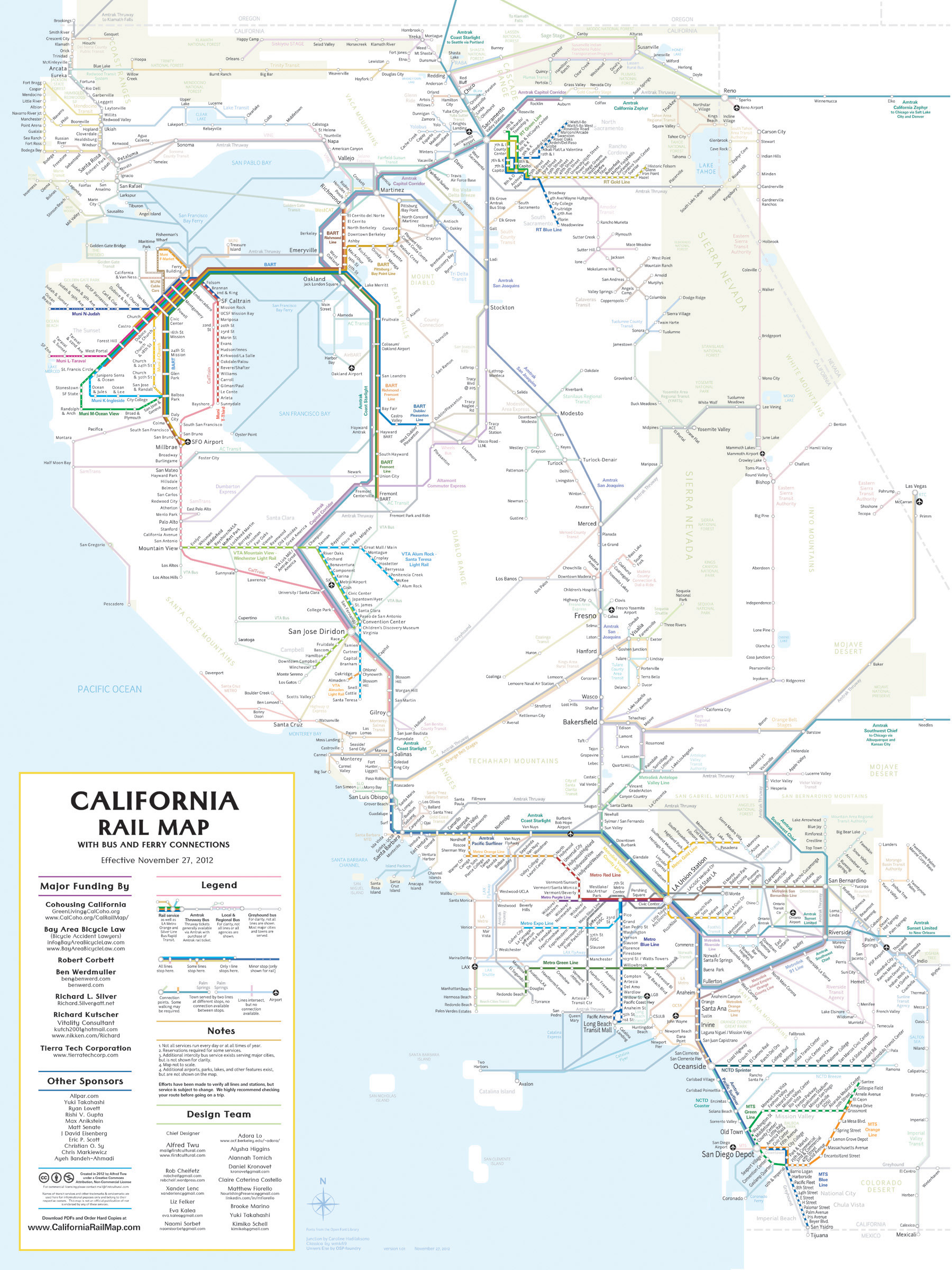
Enter the California Rail Map, one giant badass master map of California’s trains, buses, and ferries, showing routes to 500+ destinations throughout the state.
Hey, look at that, you can take the train all the way from Oakland to Tijuana. Of course, it doesn’t say how long it’ll take to get there … See you guys next week!


