Karen Salinger is a cyclist on the Go Greenbelt! Ride, a fundraiser for the San Francisco-based Greenbelt Alliance. When not balancing on two wheels, she promotes sustainable agriculture by distributing organic produce through Veritable Vegetable.

Sunday, 27 Apr 2003
LOS GATOS, Calif.
Every April for the past nine years, I have set out on a 480-mile, seven-day bicycle ride whose primary goal is to raise money for the Greenbelt Alliance. This year is no exception. The ride is in its 14th year, and there are many among the group this year who have done this ride more than once. For me, it has become something that I do without question. It would be a surprise to many if I didn’t do it. In my house, between my partner Laura and I, amongst my friends and family, it is just known as “the ride.”
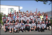
The Go Greenbelt! riders are ready.
Photo: Mike Kahn.
Unlike the AIDS Rides that attract 2,000 to 3,000 riders, the Go Greenbelt! Ride fills at 75 registrants. It’s a small, intimate group. This morning one of the other riders likened this event in April to summer camp, where you come back every year and see your friends. It’s a smaller than usual group this year. Many cite the uncertain times and the poor economy as the reasons for the low turnout.
As I have come to know many of the people who ride, I realize that we all have at least two things in common: we love to cycle, and we share the vision and hope that we can make a difference in furthering the mission of the Greenbelt Alliance, which is “to make the nine-county San Francisco Bay Area a better place to live by protecting the region’s greenbelt and improving the livability of its cities and towns.”
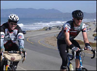
Coasting along the coast.
Photo: Mike Kahn.
Day 1 of the ride departed from San Francisco this morning. The day began early, with a nervous energy in a room at the St. Francis Yacht Club, an unlikely setting for all of us milling around in bike shorts, colorful jackets, gloves, and helmets. There was a sense of time standing still, a split second between waiting to get on the bike and begin, and those first thoughts with 480 miles to go.
The first day’s ride hugged the coastline from above on Highway 35. At times, it felt a little bit like riding along the rim of a teacup, with wonderful panoramic views of the ocean on the right, and wide-angle vistas of the San Francisco peninsula on the left.
I was born and raised in San Francisco and had no idea that some of the places I have seen on this ride existed. As the days progress, I will try to make observations about the changes I see, and also make note of the parts of the Bay Area that haven’t changed thanks to the hard, diligent work of the Greenbelt Alliance. If you’re interested, check out more images from the ride, taken by our fabulous photographer Mike Kahn.
As I sign off, rain is falling. We are all hopeful that the clouds will rain themselves out overnight.
Monday, 28 Apr 2003
SAN JOSE, Calif.
Day 2 of the ride was, in fact, a wet one. We left Los Gatos uncertain about the dark clouds looming overhead. Everyone packed some sort of rain gear, which we all had on for most of the first part of the day as the sky went from blue to gray to wet every 30 minutes. There were many variations of bike rain gear amongst the group; my favorite was the pink and blue polka-dotted shower cap that served as a helmet cover. Mary Jane and Chris and I were the “yellow jackets,” with our lightweight protective rain gear.
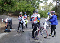
The Go Greenbelt! riders getting ready.
Photo: Mike Kahn.
Amazingly, no one was discouraged by the weather, which turned dry by afternoon, allowing us all to finish the day’s ride tired but in good spirits.
After leaving the hills above Los Gatos, dotted with multi-million-dollar mansions, we traveled through the Almaden Valley in Santa Clara. The green rolling hills are a strange contrast to more of the gated mansions built above weathered barns and grazing land. Uva Rd. eventually intersects Watsonville Rd., which inevitably collides with Monterey Rd. This is a very heavily trafficked road, which takes us to the “lunch zone” in downtown Morgan Hill, strangely quiet at noontime. This feel of an abandoned town doesn’t make any sense until you travel another couple of miles down the road and discover Morgan Hills Ranch. An interesting name for a mall, don’t you agree? The parking lot of the mall was packed. Every store and restaurant I saw was a chain business. Now let’s return just for a moment to our downtown scene. Here are numerous local businesses that both support and return monies back into the community and they are virtually empty. The mall, on the other hand, inhabited by out-of-town corporations that return their money to corporate headquarters, is full and thriving.
Morgan Hill Ranch? Perhaps a reminder of things past when farmland surrounded the outskirts of Gilroy and Morgan Hill. The new mall and the new housing developments with clever names like “Coyote Creek Estates” and “Ponderosa Homes” have paved over acres of farmland, now lost, never to be recovered. Whoever heard of a mall being torn down to put in a farm?
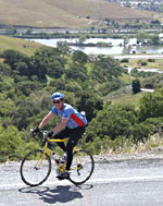
There was sun enough for a long afternoon climb.
Photo: Mike Kahn.
Part of the Greenbelt Alliance’s agenda is the protection and preservation of farmland — of ever increasing importance in a landscape where farms are disappearing at an alarming rate. Concrete continues to swallow the earth.
Tonight, we are somewhere in the eastern part of San Jose, where I’m not exactly sure. I really don’t recognize anything here. The Evergreen Valley Church has been hosting our group for 14 years. Nine years ago when I did this ride for the first time, there was an empty field across the intersection from this church. Now, there is a strip mall with a Starbucks, a McDonald’s, and a Longs Drugs. We had to search, but Steve helped us find an alternative to the Pasta Pomodoro chain. It was a locally run Italian restaurant where the owner himself came to the table to thank us for coming in. After a little bit of conversation with him, he agreed to let us take over the restaurant next year for the ride and have our entire group at his place. Now I will remember something about this out-of-the-way corner of San Jose.
We are preparing to settle down for the night, uncertain again about tomorrow’s weather. We are scheduled to climb to the summit of Mt. Hamilton, but it snowed up there today — yes, snowed. So, we’ll wait until morning and make our decision.
Tuesday, 29 Apr 2003
LIVERMORE, Calif.
The third day of the ride — usually my favorite day — has been a cycling event I will not soon forget, for many reasons. This morning, most people were dressed in their street clothes, milling around asking each other, “What are we doing?” — to which the common reply was, “I don’t know, no one is talking.” The “no ones” were Steve, the development director of Greenbelt; Derrick, this year’s ride coordinator; and Phil, one of the riders who has a friend we were counting on to give us the inside scoop on the weather at the top of Mt. Hamilton, where he lives.
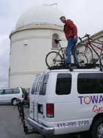
Derrick, the fearless ride coordinator.
Photo: Mike Kahn.
In the meantime, riders were coming and going from outside and gazing at the clouds, some saying, “it doesn’t look so bad,” while others were pointing to the gray mass of at the top of the mountain and shaking their heads. We were promised a decision by eight o’clock.
The announcement came right on schedule. We were told that the ride was on: We would make the climb to the top of Mt. Hamilton, 4,100 feet in elevation. We were also told that the temperature at the top would likely be in the low 30s and that rain showers would be moving through. A nervous laugh broke out in the room. It seemed a little absurd, and yet everyone began to shuffle through his or her bags, trying to decide what to wear and what to take in whatever available pocket space they had. You didn’t have to ride if you didn’t want to — you could catch a lift with your bike up over the summit to the other side — but no one jumped at this chance. In fact, everyone left on their bikes. I reflected that if I were stranded on a desert island, these were the people I would want to be with: a hardy group with a lot of heart.
Our exit out of East San Jose was a continuation of more of the same housing developments. It’s odd how they all look so much alike, and how they are being built on every square inch of available land.
Rain came quickly and at a bad time, just as we began our ascent up the steepest part of the mountain. People scrambled to put on their rain gear and continued the climb.
Our first stop was 16 miles later, at Grant Park. When I arrived, Steve was once again planning to give people a ride over the summit, now covered in dark clouds. We could ride if we wanted, but if the weather turned bad, we could expect a vehicle to come by and pick us up. Most of the riders preferred to continue their ascent. I had the pleasure of covering those next 12 miles with Kim, who was on her first ride. Her friend Cyd had convinced her that the cause was worth the effort and talked her into the adventure. Kim is a personal trainer in Concord. We talked about cycling, what we do in our jobs, and our interest in organic foods. Kim tries to combine her athletic training with educating her clients about the importance of a healthy diet.
About a half-mile from the summit, my friend Steve, providing support for the day, was positioned on the side of the road. He had his car stereo cranked up and Tina Tuner was singing “Simply the Best.” Steve was clapping his hands and swinging his hips. It was a great boost at just the right time.
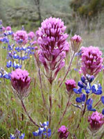
Pedals and petals.
Photo: Mike Kahn.
The summit was indeed very cold. No one lingered very long, and a few people did take Steve up on the offer of a lift. I bundled up in some dry clothes and started my way down, slowly. The backside of Mt. Hamilton is like no other place on Earth. Because Mother Nature seems to have confused the months of January and April here in California this year (January being the warmest on record since the 1930s, and April the wettest in over 30 years), the San Antonio Valley provided us with a display of wildflowers like we have never seen before. The meadows were full of purple lupine and violet owl’s clover, to name just a few. It definitely helped me get the 20 miles down the road to the lunch stop.
After lunch, we still had another 40 miles to go to our final destination in Livermore, 76 miles from where we began. It was cold and often rainy for the duration of the ride, both of which contributed to an increasing feeling of complete exhaustion. Even the strongest riders seemed beat today.
Here in Livermore, there is some good news. The city has a new mayor, Marshall Kamena, who got himself elected for the sole purpose of introducing legislation to curtail growth in his city. The Greenbelt Alliance delivered a plaque to him tonight at a dinner to commend and congratulate him for his effort.
Wednesday, 30 Apr 2003
FAIRFIELD, Calif.
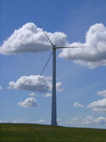
Wind: good for turbines, bad for bicyclists.
Photo: Mike Kahn.
Day Four of the ride begins with a group chant: “no wind, no wind.” Our route takes us through the Sacramento Delta Region, which can be extremely windy this time of year. Forty- to 50-mile-an-hour headwinds are not uncommon in this area. As you might imagine, when this kind of wind collides with a cyclist, it is not a pleasant experience for the rider.
Today was a good news/bad news kind of day. The good news was that the skies were clear and the temperature was considerably warmer than the past few days. The bad news was that the city of Brentwood, once a quiet farm community, has succumbed to sprawl. It has quadrupled in size since 1990, when developers set their sites on it. We made our approach into Brentwood on Vasco Road. The traffic heading out of town, toward a work destination in Oakland, San Francisco, or points beyond, was constant. Most of the traffic heading into Brentwood was construction vehicles laden with lumber or pipes or building equipment.
We stopped at the Brentwood Bicycle Shop for a quick briefing with a Contra Costa County Greenbelt Alliance representative. More bad news. There are 2,700 acres (four square miles) of ranch land at risk of development. The area has been cleverly named FUA#1: Future Urban Area #1. If developed, the area would add 140,000 car trips each day to already overcrowded roads and freeways. The Greenbelt Alliance is mounting a public-awareness campaign, informing the citizens about these growth plans. They are trying to create community involvement and public control over land-use decisions. The Greenbelt Alliance is also working to create urban growth boundaries, mapped lines that separate towns and cities from their surrounding greenbelts of open lands, a concept important to preserving the integrity of local communities.
After the stop, we rode off through the outskirts of Brentwood. After a 20-mile transition ride to Antioch, we cross a bridge that spans the Sacramento River. We lunched in the town of Rio Vista, where nothing ever seems to change. Main Street still intersects 2nd Street, trailing out of town into the Montezuma Hills, a change of landscape so dramatic, it surprises me every time.
Back to the really good news of the day.: The winds were light in the Montezuma Hills — in fact, so light that we all felt giddy, passing through Bird’s Landing where the eucalyptus trees sing with birds. People are still talking about the snow on top of Mt. Hamilton, but for me, it feels like a distant memory after such a spectacular day of cycling.
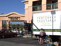
Keep on truckin’.
Photo: Mike Kahn.
Tonight, Mary Jane and I had an opportunity to speak to the group about our company, Veritable Vegetable. As a wholesale distribution company of organically grown fruits and vegetables, we have been a major sponsor of this ride for 12 years. We provide all organic fruits and vegetables for the riders and have connected the Greenbelt Alliance to other companies that have donated organic and natural foods for the ride. Veritable will celebrate our 30th anniversary next year. As a company, we work hard to sustain the small farmer. Our mission is closely linked with that of the Greenbelt Alliance and we are proud of the work we do with them and proud to help support this ride. This year, we are using one of our trucks as the gear truck. It’s particularly nice to have our name and logo traveling down the road with the riders.
Thursday, 1 May 2003
SANTA ROSA, Calif.
Morning came early on this fifth day of the ride, with the sunrise spreading shades of vermilion across the sky. Our breakfast stop was about five miles outside of Fairfield, in Suisun City, where the waitress at the Valley Cafe has been the same every year I’ve done this ride. She always seems completely undaunted by the large group of riders that comes click-clacking in with our cleated shoes. The coffee is good and the oatmeal is hot.
Riding away from the cafe, the road leaves all traces of the city behind and turns into a landscape of farmland and vineyards. It’s a lazy ride, through a place called Mankas Corner that is just that: a storefront on a corner.
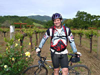
Wine, but no whining.
Photo: Mike Kahn.
Wooden Valley Road follows the creek to the intersection of Highway 121. A quick climb followed by a fast descent leads us into the Napa Valley, onto the Silverado Trail, past the famous names on the wine bottles. There is a long history of work by the Greenbelt Alliance in the Napa Valley. Dorothy Erskin, one of the alliance’s founders, spearheaded the agricultural preserve that is today’s Napa Valley. In 1968, Jack Davis, owner of Schramsberg Winery, fought for the Napa Agricultural Preserve. That same year, Citizens for Regional Recreation and Parks, Greenbelt Alliance’s earliest incarnation, convinced two county supervisors to support vineyard preservation. The resulting policy continues to protect Napa’s vineyards. If not for CRRP’s vision, the Napa Valley might look just like San Jose.
Stag’s Leap Winery hosted our lunch. In year’s past, we have eaten in a beautiful spot behind the winery by the grassy banks of a pond. Because of the amount of rainfall in April, the area was too wet this year. So, instead, we ate inside in one of the cellars, where our hosts had set a long table with a white tablecloth decorated with vine trimmings down the center. It was both elegant and generous.
After lunch and another 10 miles of the Silverado Trail, we traversed the town of St. Helena where the infamous Spring Mountain Road waits on the other side. This is one of the steepest climbs on the ride and, many riders will say, the most difficult. After peeling off my arms and legs, (bike lingo for removing excess clothing), I made my way up with Steve, the Greenbelt Alliance development director. He knew a lot of the wildflowers we passed along the way and pointed out the fairy lanterns and wild delphinium. He also taught me that following the centerline would make the climb less steep. “How much less steep?” I wanted to know.
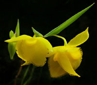
Fairy land.
Photo: Mike Kahn.
To help me out, he told me a funny story during the steepest part of the climb, about a cyclist he knew who was riding on a country road and came across a farmer in the middle of the road on a tractor. As he rode by, the farmer said, “If I had a gun, I’d shoot it.” Thinking he was talking about him, the rider started pedaling as fast as he could. About a mile down the road, his heart still racing, he realized that the farmer was talking about shooting his tractor, not the cyclist! Before I knew it, we were at the top, where our support vans greeted us with fresh organic strawberries and homemade cookies.
Tonight we are in downtown Santa Rosa. The weather report is calling for heavy rain tonight and into tomorrow morning. With only two days left of our seven-day adventure, we are hoping we can complete the ride and arrive back to San Francisco on Saturday, across the Golden Gate Bridge, on two wheels, powered by our legs.
I know that tomorrow night, we will have dinner together in Olema, no matter what happens with the weather. Each of us will be asked to reflect on the high point and low point of the ride for us. I haven’t decided on a low point yet, but the high for me was the windless afternoon in the Montezuma Hills with the white bursts of clouds spreading light and shadow across the miles of green hills.


