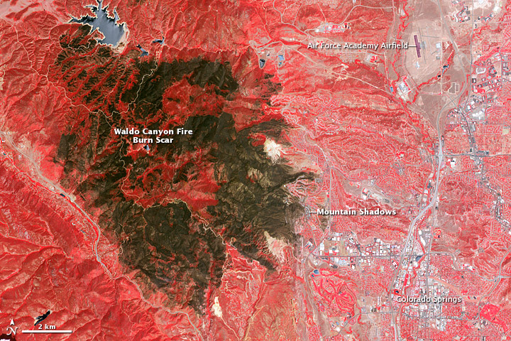
This image from NASA (click to embiggen) shows the scar from the Waldo Canyon fire in Colorado. It’s a false-color image — the fields aren’t actually running red with blood out there, yet — but the size of that burned patch is no illusion. Compare it to the city of Colorado Springs in the lower right corner, or the Air Force Academy airfield in the upper right.
The red in this image is actually vegetation — NASA’s satellite covers both the visible and infrared spectrum to get a more accurate image, which is why it looks like that. So unburnt forest is bright red, and lighter vegetation is pinkish. The white parts, pretty obviously, are buildings. And that huge dark-brown chunk — well, that used to be vegetation, and some of it used to be buildings. Almost 350 homes were damaged or destroyed in the blaze, which swept over 18,247 acres.
This is normally where we put a clever joke, as a kicker to the story. We’ll get back to you when we find anything funny to say about something like this.

