This story was originally published by Bay Nature magazine.
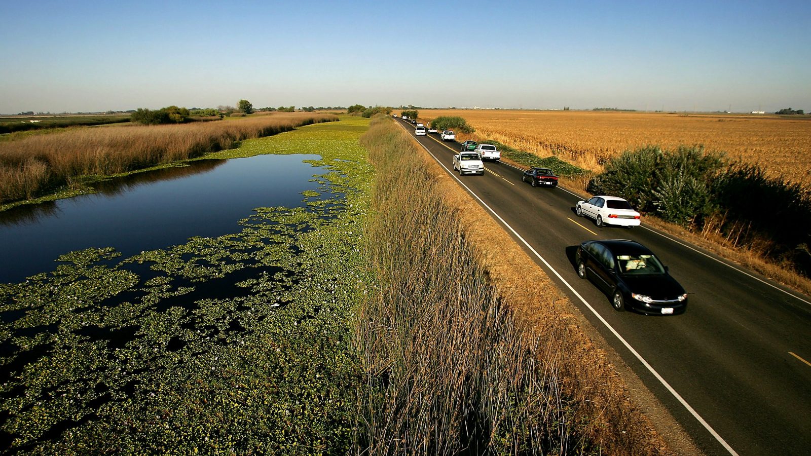
Something is amiss on Sherman Island, a whale-shaped swath of farm and grazing land at the confluence of the Sacramento and San Joaquin rivers. If you don’t know what ails the place, it might be hard to pinpoint the problem. The island, in the Sacramento Delta, is roughly 16 square miles. Its asphalt roads, cracked and sagging at the edges, look like cheese melted over a lumpy pizza. The telephone poles, many of them kept erect by taut guy-wires, stand conspicuously at non-right angles. The landscape feels Dr. Seussian — a wacky, slightly absurdist version of farmland, right down to the exaggerated industrial backdrop: a steady stream of cars driving past on State Highway 160, which traverses the island; steaming smokestacks from the power plant across the river; the Antioch Bridge arcing dramatically over the San Joaquin River; enormous wind turbines turning lazily on a hill to the northwest.
What’s wrong?
“We’re standing 10 feet below sea level,” Bryan Brock, an engineer with California’s Department of Water Resources, told me during a visit in May. Brock, who has a white-blond goatee sprouting from his chin like tuft grass, evinced supreme calm as he explained: “None of these people realize it driving past, but they’re below sea level. And that’s a problem.”
The land here, and hundreds of thousands of acres elsewhere in the delta, began to sink in the late 1800s as people started draining the region’s vast wetlands. As they walled off rivers and created dry islands from what was previously soggy marsh, they discovered incredibly rich soil. In contrast to other fertile regions like Iowa, where topsoil two feet deep was considered bounteous when farmers began plowing it in the 19th century, delta peat soils — created over thousands of years, by wetland plants growing and dying and not quite decomposing — could be 50 feet deep. No one foresaw that this very bounty — soil rich with organic material — would, over time, become a curse of sorts.
River and marsh bottoms typically have low oxygen levels, which slows the decomposition of organic material that collects there. That organic material contains copious amounts of carbon. Once the waterlogged delta soils dried out, microbes began to consume the organic detritus, transforming it into gas. Millions of tons of solid ground started going up into the air as microbial exhaust.
And the land began to sink.
In some places, including parts of Sherman Island, the land has now subsided 25 feet since the late 1800s — and continues to sink between half an inch and 1.5 inches yearly.
These “islands” aren’t really islands at all anymore, Brock told me, but empty bathtubs whose bottoms are receding. The deepening cauldrons, now sitting well below sea level, are creating a situation that grows more precarious with each passing year. The more the islands sink, the greater the pressure on the aging mounded dirt levees that keep the water back, and the greater the likelihood that they’ll fail.
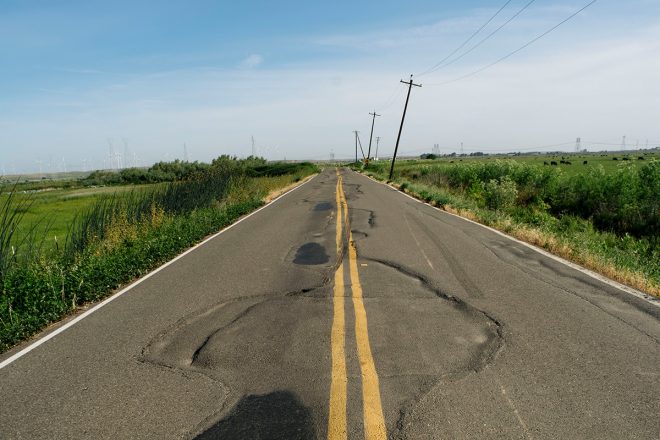
Sherman Island Cross Road is warping due to subsidence near its junction with State Highway 160. Jonno Ratman / Bay Nature
This situation, called subsidence, worries the California Department of Water Resources and many others, not just because farmers could lose pasture and farmland, but because much of the water that irrigates the Central Valley, and that many Californians depend on for drinking water, is pumped through a sprawling network of canals from the delta. A large enough breach of those levees — especially if it affected many of the delta’s 57 islands simultaneously — could hamper the flow of fresh water to the Central Valley, leaving huge swaths of the state without usable water for months, even years.
Brock describes the mechanics of the threat as the “big gulp.” Water in the 1,100-square-mile delta — nearly the size of Rhode Island — sits at sea level. Only the pressure of the fresh water flowing down the leveed Sacramento and San Joaquin rivers prevents salt water from the San Francisco Bay from pushing inland. If many levees fail at once, the fresh water that otherwise keeps the salt water away would rush to fill all those empty bathtubs. Brackish water from San Francisco Bay would then flow inland. The water used to irrigate the Central Valley and its $17 billion agricultural economy, and the drinking water for about 25 million people, could become salty and unusable.
“It’s Katrina on steroids,” Dennis Baldocchi, a professor of biometeorology at UC Berkeley who studies the delta, told me. “We’re a $4 trillion economy. Think of shutting down water for 30 million Californians.”
Because the region is prone to earthquakes — and because faults pass right through the delta region — an earthquake that could trigger a catastrophic levee failure, defined as 20 islands flooding at once, has a 62 percent chance of occurring in the next two decades if subsidence isn’t addressed, DWR’s own analysis suggests. The event would likely incur tens of billions of dollars’ worth of damage and could take a year and a half to repair. Nor is the flooding of delta islands unprecedented. When Jones Tract, a delta island, flooded in 2004, the damage cost $90 million to fix. In earlier times, several islands that were inundated were simply abandoned: Google Maps reveals lakes — the Mildred Tract, Franks Tract — where farmland once existed, discernible by the ring-shaped remains of levees rising, like coral atolls, from the delta water.
“We’re not paying attention,” Baldocchi told me; the disaster-in-waiting, he asserts, has not drawn the concern it deserves. Action to address the problem has been stymied for years by, in part, the sheer number and variety of agencies, sometimes with competing agendas, operating in the delta. Interagency rivalry and distrust have yielded what Ray Seed, a UC Berkeley professor of environmental engineering and an expert on the delta, once described as a “60- to 70-year stalemate” in which “we will all lose together.”
“It’s truly a wicked problem,” agrees Campbell Ingram, head of the Delta Conservancy, a state agency tasked with ecosystem restoration in the area. Yet for the first time in his 13-plus years working on the issue, he says, the majority of stakeholders now concur that the subsidence issue needs to be addressed urgently. “We’re kind of in this weird space where we simultaneously can’t prevent the delta from failing, and we can’t allow it to fail,” he adds.
One solution is for the landowners, with some state funding, to keep repairing the levees, building them higher and wider. But as sea levels rise and the islands continue to subside, the costs of fortifying and maintaining the structures may exceed the value of the land and agricultural production behind them, says Alf Brandt, counsel to the State Assembly Speaker Anthony Rendon. For some of the deepest islands, the conclusion of that cost-benefit analysis already looks unfavorable, he says.
For decades, DWR has been working on another more ecosystem-based fix. Since the 1990s, the agency has experimentally re-flooded pieces of land in the delta, with the goal of reestablishing wetlands like those that created the soil in the first place. The reasoning is that once wet, the land will stop losing carbon and the sinking will come to a halt. Even if that doesn’t entirely resolve the problem, Ingram says, it prevents the situation from getting worse. And over the long term, marsh plants may, through photosynthesis, capture enough carbon from the atmosphere that the ground begins rising again.
It’s through this last mechanism — plants’ ability to pull carbon from the atmosphere — that a project originally conceived to protect California’s water infrastructure has, over the years, evolved into something more interdisciplinary, and of potentially greater importance. Although they can produce powerful greenhouse gases, wetlands can also sequester and store immense quantities of carbon. Policymakers have historically ignored these places in discussions about greenhouse gas emissions, but that’s now changing as they come to appreciate the huge stores of carbon that wetlands already contain — and the large quantities of greenhouse gases they release when destroyed.
An expanding body of research has prompted land managers to consider, for the first time, creating wetland carbon credits that might be traded in carbon markets. In California, at least, efforts to address one worsening disaster could enable prevention of another. Mounting anxiety over global heating may be what spurs creation of carbon credits that, by providing funding for delta wetland restoration, also produce badly needed funds to protect California’s water infrastructure. “It would have been great to have done this 30 or 40 years ago,” Kristopher Tjernell, deputy director of DWR’s Integrated Watershed Management Program, told me. “But you know, it wasn’t ripe. And it’s ripe now.”
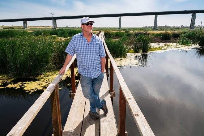
Bryan Brock, an engineer with DWR. Jonno Rattman / Bay Nature
“Blue carbon” refers to carbon momentarily trapped — or slowed down, really — in waterlogged ecosystems. Because the microbes that break down carbon in wet conditions work much more slowly than those in more aerated environs and through different biochemical pathways, wetland ecosystems can accumulate and store far more carbon per acre than forests and savannas can. Scientists have known this in a roundabout way for a long time: After all, the coal and oil deposits that have fueled civilization since the Industrial Revolution come from ancient marsh and marine ecosystems that, after accumulating huge quantities of carbon, were buried and fossilized over millions of years. Fossil fuels, you might say, are an aged form of blue carbon.
Historically, policymakers and scientists have been daunted by the many variables involved in calculating the amount of carbon held in wetlands and, more broadly, in the web of living things we call the biosphere, according to Stephen Crooks, cofounder of Silvestrum Climate associates in San Francisco. It’s far more complicated than quantifying how much comes out of smokestacks and tailpipes, he says: “It was seen as more challenging and somewhat scary to include.” But the omission has always been, in his view, untenable.
Worldwide, about 450 million tons of carbon dioxide enter the atmosphere yearly from wetland degradation — destroyed mangrove forests, drained marshes, and smothered seagrass beds. That’s equal to the yearly human-caused greenhouse gas emissions of France, the U.K., or California. “When your emissions are the size of California’s economy and you weren’t counting it,” he told me, “that’s a very big surprise.”
Wetland ecosystems comprise just 5 to 8 percent of the planet’s land area but contain between 20 and 30 percent of the world’s soil carbon. “When you destroy a wetland, you can release thousands of years of carbon in just a few decades,” Crooks says. On the flip side, by preserving wetlands, you can protect millennia’s worth of accumulated carbon with, in theory, relatively little effort. The Sacramento Delta, the largest estuary along the western edge of the Americas, has become a test case for this idea.
The delta may have once held the largest freshwater wetland carbon reserves on the West Coast. Since it was drained over a century ago, it has released an amount of carbon equal to one-quarter of California’s forests — all the redwoods, pines, and oaks in the nation’s third-largest state, according to Baldocchi and his colleagues. And it’s still emitting carbon. Although it comprises less than 1 percent of the state’s cropland, every year the delta releases a quantity of carbon equal to one-quarter of all plant-related agriculture — all the tractors, plows, and combine harvesters operated in the state. “I’ve been making measurements my whole career, and I’ve never seen fluxes as large as what’s happening from these peat soils,” Baldocchi told me. The near-term goal in the delta, and in any degraded wetland really, is to stop subsidence and emissions. The longer-term goal is to reverse them.
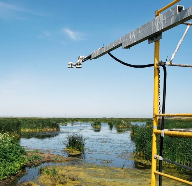
DWR measures the CO2 and methane emissions from the wetlands it created on Sherman Island. Jonno Rattman / Bay Nature
Crossing over the blue-gray San Joaquin River on the Antioch Bridge, you can just glimpse the glittering wetlands to the west on Sherman Island. They’re easy to miss at 60 miles an hour. But as I stood with Brock on a wooden walkway a few feet above them in May, the low roar of the semi-industrial landscape — cars speeding over the bridge and boats motoring by on the other side of the levee — receded as I watched birds flit acrobatically among the rustling tule reeds and dragonflies hover over the dark water. The wetlands, hemmed in as they are by levees, roads, and fields of grazing cows, look remarkably healthy. They represent the implementation phase of DWR’s ongoing project, which seeks to shore up the threatened levees by creating wetlands on their subsided “bathtub” sides.
“Isn’t it beautiful,” Brock said, looking out over the reeds. “Sometimes nature can do things better than humans.” Which is not to say the DWR restoration project was as easy as opening the floodgates and watching the cattails return. Before water was allowed back, he explained, the land had to be carefully sculpted to ensure the optimal water depth for marsh plants to grow.
Brock’s predecessors created the first experimental wetlands, on nearby Twitchell Island, in the 1990s. Not only did bringing water back halt the loss of carbon from the soil and stop subsidence, experts discovered, but the wetland plants grew so rapidly that, as they died and left tangled masses of roots and stalks, they raised the elevation of ground at an average rate of 4 centimeters per year. A common assertion among soil scientists is that an inch of topsoil takes a century to accumulate, maybe longer. But these wetland plants were turning carbon dioxide into solid earth at a rate observable by humans from one year to the next.
Even so, given the magnitude of the subsidence problem, that rate of soil accretion can seem sorely inadequate. It will take roughly 150 years to get the most sunken areas of these islands back to sea level, Baldocchi told me. “People have trouble thinking in 100-year time scales,” he said. “We can’t get bored with these projects in 15 years.”
Yet the long-term time frame doesn’t mean we have to wait till the end for the project to bear fruit. Campbell Ingram of the Delta Conservancy emphasizes the importance of “stopping increased risk” — of halting subsidence. What’s key to understand, he says, is that the risk of levee breach does not increase linearly with subsidence, but exponentially. So by halting subsidence, you prevent the ballooning probability of catastrophic failure.
And if the ground regains just a few feet over the years, the risk of catastrophe declines non-linearly as well. Meaning you don’t need to grow the ground back to sea level to dramatically reduce the possibility of a calamitous breach. Some modeling suggests that just gaining half the lost ground back — about 50 to 75 years as opposed to 150 — could bring the likelihood of widespread failure to nearly zero.
Even so, the major challenge facing the project is how to reach a scale of wetland restoration that’s meaningful for the greater Sacramento Delta. DWR has so far flooded about 1,700 acres in four separate wetlands. But altogether there are about 250,000 acres of deeply subsided land in the delta, most of it owned by farmers. So success depends in part on convincing farmers to forgo cash crops and flood their land instead, something that’s unlikely to happen without adequate monetary incentive.
Ideally, Ingram says, the state would pay farmers to convert cropland to wetland. (There is also an intermediate option, a wetland that sustains a crop: rice in flooded fields. In experiments, rice paddies stopped subsidence, but they didn’t reverse it.)
California does have a relatively new program, called the Healthy Soils Initiative, whereby state money goes to farmers who implement practices thought to benefit soil health. It’s a model of what’s possible, Ingram says, but regrettably no such program exists for Sacramento Delta wetlands. Marsh provides critical habitat for various species, so other income sources for farmers might include duck clubs or federal and state programs that pay for creation of endangered-animal habitat. But for now Ingram is betting on carbon markets, particularly California’s cap-and-trade system.
“We want to get to a point where a farmer wakes up and says, ‘I can earn more flooding my land than growing corn,’” Ingram told me.
Established in 2006 by the law AB32, the cap-and-trade system seeks to reduce the state’s greenhouse gas emissions by harnessing market forces. The state establishes an upper limit on greenhouse gas pollution — the cap — and then gives polluters a certain number of allowances to emit the offending gases. The quantity of allowances given out declines over time, forcing polluters to either clean up their operations or to purchase allowances from polluters who have a surfeit. Polluters can also buy a certain number of offset carbon credits from projects that either prevent the emission of greenhouse gases or remove them from the atmosphere. This is where restored delta marshes might come in — as a source of offset credits for purchase.
Ingram and Steve Deverel — one of the scientists who, when with USGS, conducted the original pilot projects on reversing subsidence in the delta and is now with the consulting firm Hydrofocus — developed a delta wetland carbon protocol that the American Carbon Registry approved in 2017. Meaning that they can sell offsets in the voluntary carbon market.
Approval for the state’s cap-and-trade system, where offset credits now trade for roughly double the rate seen on the voluntary market and might actually compete with earnings from crops, is likely a year and a half away, Ingram says.
And these are complicated carbon offsets. Freshwater wetland plants can pull carbon from the atmosphere at a spectacular rate — about 5.7 tons per acre per year in the delta — but freshwater wetlands also emit the greenhouse gas methane, which has about 30 times the warming potential of carbon dioxide. According to Baldocchi, the warming caused by the methane released from delta wetlands about equals, in the short term, the cooling potential of the carbon dioxide removed from the atmosphere.
Why go through all the trouble, then, if we end up right where we started? Think of it as preventive medicine. By re-flooding one acre of peatland in the Sacramento Delta, you prevent between 10 and 20 tons of carbon dioxide from entering the atmosphere — via the organic material that microbes would have turned into gas if the land remained dry. That’s equivalent to between two and four years of driving your average car. In addition, you prevent worsening of the subsidence problem and its threat to the state’s water supply.
Lisamarie Windham-Myers, a scientist with USGS, thinks she may eventually be able to improve the climate-cooling potential of these wetlands by emulating what happens in certain marshes that don’t produce greenhouse gases. Saltwater and brackish marshes don’t release nearly as much methane as freshwater wetlands, she explains. That’s because ocean water contains sulfate, which changes the biochemical pathways available to microbes that break down organic material. With sulfate present, instead of creating methane as a byproduct, microbes produce sulfide, which isn’t a greenhouse gas.
Windham-Myers studies the Suisun marshes, not far from Sherman Island. She’s found that even trace amounts of sulfate in the water prevent those counterproductive methane emissions. In Suisun, the sulfate comes from the small quantity of seawater that pushes into the system from San Francisco Bay. But even freshwater systems, she emphasizes, can contain trace amounts of sulfate — or iron, which also prevents methane production. In fact, she has observed that methane emissions from different parts of the restored DWR wetlands vary greatly, likely because of how water moves through them — carrying tiny concentrations of sulfate or iron to some areas, but not to others. Once scientists better understand such dynamics, they may be able to control the flow of water through resurrected wetlands in a way that limits methane, increases the net climate benefit, and raises the value of the carbon credit sold against restored delta wetlands.
“The role of hydrology is definitely emerging as a knob we can turn,” Windham-Myers told me. “Let’s fine-tune these wetlands to make them as amazing as possible.”

