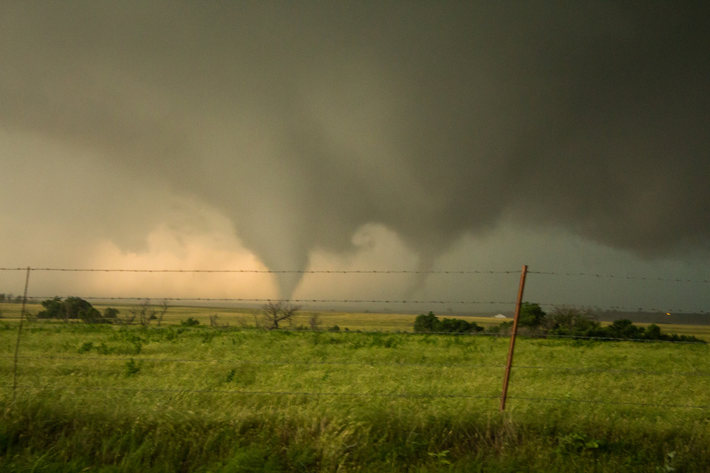
Brian KhouryA scene from Oklahoma last Friday.
Not only did Friday’s tornado outburst in Oklahoma lead to at least 20 deaths, but analysis by NOAA has revealed that it included the widest tornado ever recorded in the U.S. and one twister that spun the wrong way.
The diameter of the El Reno tornado, which on Friday killed three famous weather chasers, reached a mind-boggling and record-breaking 2.6 miles. Both the El Reno cyclone and the Moore tornado, which struck nearby a week earlier, were rated EF5, the most damaging type of cyclone on the Enhanced Fujita scale. From LiveScience:
“To have two EF5s within less than two weeks in the same general area — that’s highly unusual,” [University Corporation for Atmospheric Research scientist Jeff] Weber told LiveScience. “Off the top of my head, I haven’t heard of it happening before.”
The tornadoes were made possible by “perfect” tornado conditions in the area, which have been intermittent for weeks, Weber said. Specifically, the alignment of the jet stream is bringing dry, cold air down from the north and allowing it to interact with warm, moist air from off the Gulf of Mexico, which sets up a volatile situation.
Like a wedge, the cold air collides with the warm air and causes it to rise, since warm air is less dense, Weber said. This rising warm air has created thunderstorms that have, in turn, spawned tornadoes.
It’s not just the size and power of the tornadoes that was remarkable. NOAA says that one of the tornadoes that struck Friday was a rare anticyclonic tornado:
The tornado count for May 31 will rise as analysis continues, including an anticyclonic EF2 tornado SE of the El Reno tornado. #okwx
— NWS Norman (@NWSNorman) June 4, 2013
You might think that an anticyclonic tornado would work in reverse of a typical tornado, replacing house roofs and putting cars back where they were before the normal tornado struck. But in fact, an anticyclonic tornado spins clockwise, whereas most other Northern Hemisphere storms spin counterclockwise.
From The Washington Post‘s Capital Weather Gang:
Leading tornado researcher Joshua Wurman (of the Center for Severe Weather Research) and his team were in the field monitoring the deadly EF5 twister when they spied another funnel, but spinning backwards, on their two “Doppler on Wheels” mobile radar units.
“At that point we bailed east towards Oklahoma City,” Wurman said. “I’m very happy my team had a radar out there. We only knew about [the anticyclonic tornado] because of the radar; otherwise we may have driven into it.”
Amazingly, Wurman’s encounter was not El Reno’s first with cyclonic and anticyclonic tornado pairings. On April 24, 2006, such a duo touched down in the area.


