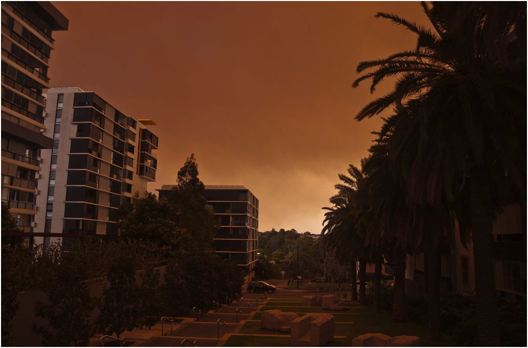
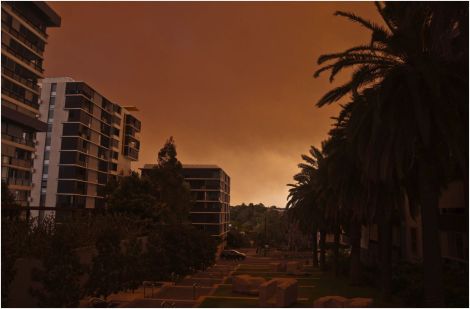
Going outside in many parts of southeastern Australia right now is like sucking on a stogie filled with smoldering grass and bark. The countryside is alive with flame from nearly 100 rampaging blazes, which are drawing strength from feverish weather to slam a dirty-black lid of smoke over Sydney.
This breakout will go down as the worst regional fires in a decade. More than a third of the fires are out of control and behaving erratically thanks to screwy yet strong wind patterns. The Sydney Morning Herald has put together a timeline of events from Thursday, and it’s laden with cruel portents:
7am Day begins with warnings. There were 65 fires in NSW, 25 uncontained. Forecasts of hot and windy conditions. …
3pm Multiple fires through the Blue Mountains. Ash starts to fall across Sydney. …
6pm Parts of fuel store set alight at Blue Wren Drive near Wyong. Reports of explosions.
6.40pm RFS Commissioner Shane Fitzsimmons: ”This is as bad as it gets. We may be counting homes lost in the dozens or hundreds.”
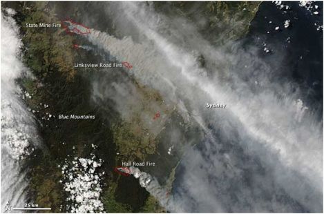
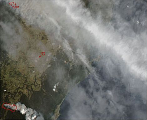
While the situation on the ground must be nerve-racking, from space it looks fairly terrible, too. The above image, taken on Thursday afternoon by NASA’s Aqua satellite, shows the earth spewing smoke like a titanic beater with a blown head gasket. The blazes are outlined in red; the largest in this shot is the State Mine fire at top left, a sower of destruction to more than 50,000 acres of land.
“In addition to the threat posed by the fires, the image shows that smoke pollution was a problem in populated coastal communities,” says NASA. “The densest plume of smoke hangs directly over Sydney, though the brighter white streak is probably a cloud.” Aside from the smoke, the locals are also having to deal with burning embers falling onto their properties, according to the New South Wales Rural Fire Service. That agency is advising people to stamp out any spot fires they see, and also to (in very good advice) find shelter “if the fire impacts on your property. Protect yourself from the heat of the fire.”
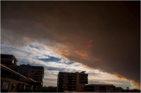
Here are photos from local observer Maarten Danial of the glum scene in Sydney:
And this is a zoom of the NASA image over the vicinity of Sydney. You can almost see a city (on the coast below the densest white cloud) through all that haze:
 This story first appeared on Atlantic Cities as part of the Climate Desk collaboration.
