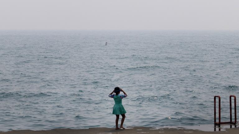
Tropical Storm Hilary made landfall in Mexico and crossed into California over the weekend, knocking out power and drenching wide swaths of Southern California. Parts of the desert terrain in the region, which typically receives less than a quarter inch of rainfall a year, received between two and four inches of rain. According to the National Weather Service, downtown Los Angeles received 2.48 inches of rain on Sunday, breaking a single-day record from 1906 of 0.03 inches.
The downpour felled trees, caused mudslides, and closed roads. East of Los Angeles, in San Bernardino, police ordered evacuations in several communities. More than 35,000 Californians are out of power as of Monday, and several school districts canceled classes to assess the damage of the storm. Major sporting events including a Major League Soccer match and several Major League Baseball games over the weekend were also rescheduled.
The storm made landfall as the rest of the country was grappling with other climate-fueled disasters. Devastating wildfires in Lahaina, a historic town in Maui, Hawai’i, killed more than 110 people and caused billions in damage. Across the country, dangerous heat conditions persisted, with the National Weather Service warning that a heat dome will “consume” the Plains and Mississippi Valley into the South this week. Two major fires burning in Spokane, Washington, have also torched a combined 20,000 acres, leading officials to order the evacuation of the nearby town of Medical Lake. On the East Coast, meteorologists are tracking two storms brewing in the Atlantic.
Hilary strengthened in a hurry last week. On Thursday, the National Weather Service reported that it was a Category 3 hurricane with wind speeds of 120 miles per hour, and by Friday, it had strengthened into a powerful Category 4 storm. The center warned that Hilary would bring “life-threatening and potentially catastrophic flooding” over the weekend. The forecasts triggered California’s first-ever tropical storm warning. But as the hurricane crossed cooler waters off the coast of Southern California, it lost its strength and was downgraded to a tropical storm.
Still, Tropical Storm Hilary “really did produce all-time, record-breaking summer rainfall across most of the region,” said Daniel Swain, a climate scientist at the University of California, Los Angeles. “In terms of the incredible frenetic pace of global extremes we’re seeing this summer, that is only going to get worse as the climate continues to warm.”
Tropical storms and hurricanes rarely make landfall in California. That’s because powerful storms need warm waters to gather moisture and energy, and the eastern Pacific Ocean is generally much cooler than the western Pacific or the Gulf of Mexico — typically as much as 9 degrees Fahrenheit.
This year, however, after record heat in July, the waters in the Pacific are not as cold. In fact, temperatures off the coast of Cabo San Lucas, Mexico are about the same as the waters around Key West, Florida, which helped Hilary intensify rapidly before reaching California waters.
El Niño, a weather pattern that also leads to warmer Pacific temperatures, appears to have played a role in Hilary’s formation. The climate phenomenon affects a hurricane’s wind shear, a term used to describe the change in wind speed at a given height. If a hurricane has high wind shear, it will dissipate quickly. El Niño creates the conditions in the Pacific for low wind shear, which aids in the formation of stable hurricanes.
The weather pattern “tends to decrease vertical wind shear in the eastern Pacific off the coast of California and so allows more hurricanes to develop,” said Ned Kleiner, an atmospheric scientist at the risk assessment firm Verisk. “And so we’ve seen a series of hurricanes in the eastern Pacific, including Hurricane Dora, which is partially responsible for the really damaging winds which fueled the wildfires in Maui.”
While the exact role that climate change played in Tropical Storm Hilary’s formation is not yet fully known, Kleiner said climate scientists are confident that rising temperatures are leading to the formation of more intense hurricanes. After all, oceans have absorbed 90 percent of the heat trapped in the atmosphere by greenhouse gases. As hurricanes pass over these warmer waters, they pick up more moisture, which leads to more intense rainfall. Research also shows that hurricanes are stalling more often, giving them more time to drop rain over an area. Forward motion speeds of Atlantic hurricanes have decreased 17 percent compared to previous decades.
The science for hurricanes in the eastern Pacific is less clear. Since few storms develop off the West Coast in the first place, scientists have less data to work with. “There are certainly theories that there will be more intense landfalling storms on the West Coast, but it’s just a very difficult thing to be confident in because it’s so rare,” said Kleiner.
Hilary is likely to bring more rainfall and flooding as it makes its way across Nevada on Monday. The storm is expected to bring between 1 to 3 inches of rainfall in Idaho and Oregon through Tuesday morning.
“Across the Southwestern United States, the ongoing and historic amount of rainfall is expected to cause life-threatening flash, urban, and arroyo flooding including landslides, mudslides, and debris flows today,” the National Hurricane Center warned on Monday.