Writer Don Rogerson (who’s working on a book about Manhattan street names) has noticed something interesting about Zone A in Lower Manhattan, an area that’s been evacuated. At his blog Manhattan Past, he writes:
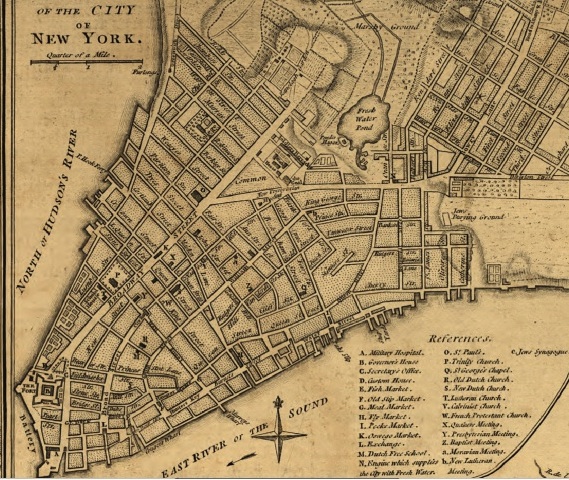
The eastern line of Zone A along the Hudson River runs along Greenwich Street, which was at the waterfront in 1776. The old slips on the East River extend inland to Queen Street, now Pearl Street, which is near where Zone A runs along the East River.
In other words: All that area that’s been evacuated? That’s land that we built in order to make Manhattan bigger.
Rogerson dug up maps that make it even clearer:

This isn’t to say that people living on the original actual land of Manhattan would be safe, of course: They benefit from the buffer zone and would be totally screwed if the city hadn’t been expanded. Thanks, landfill residents! Uh, sorry about all this.
A message from
Your support keeps our climate news free.
Grist is the only award-winning newsroom focused on exploring equitable solutions to climate change. It’s vital reporting made entirely possible by loyal readers like you.
At Grist, we don’t believe in paywalls. Instead, we rely on our readers to pitch in what they can so that we can continue bringing you our solution-based climate news. Donate today to keep our site free.