The natural world is under siege by climate change. Rising temperatures are pushing plants and animals outside their current range. To keep pace with climate change, species will need a path to follow northward or up in elevation, minimally interrupted by human development.
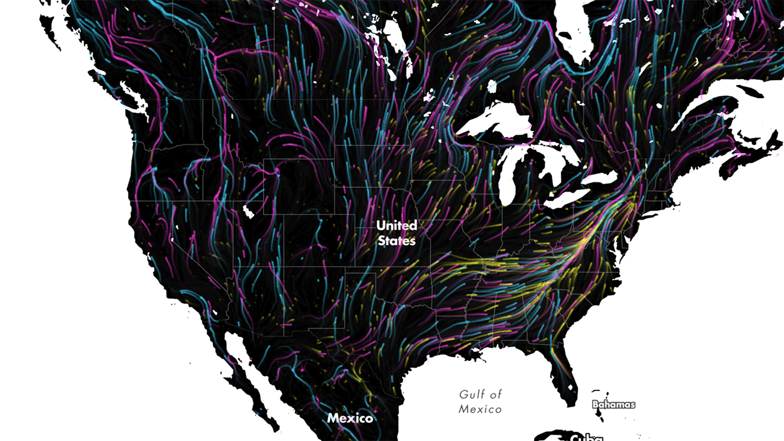
This map shows that path (well, paths actually) in the most beautiful way possible.
It uses the dreamy Earth wind map for inspiration. But rather than using temperature, wind, and sea level pressure data, Dan Majka, a web developer at The Nature Conservancy, used data from two studies to show all the feasible paths that mammals, birds, and amphibians can use to find their way to a more suitable climate as their habitat becomes too hot.
The map doesn’t show specific species (you’re not going to be able to find the grizzly bear path, for example), but rather shows the general patterns scientists expect animals to follow as the world warms.
The visualization is stunning, but also hopeful. It shows that despite the challenges of climate change and increased urbanization, there are still pathways for the natural world to deal with those threats.
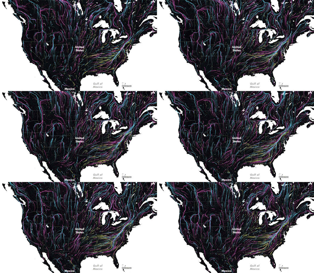
Zoomed out, it’s clear that the Appalachians are a crucial funnel for climate-induced migration. They’re smack dab in one of the most developed parts of the country and represent some of the last wild land in the eastern U.S.
“Much of the land outside of the mountain range is developed or in agriculture,” Brad McRae, an ecologist with the Nature Conservancy, said. “So as species ranges shift north, the Appalachians are providing some of the least-developed routes for movement. They also provide some climate relief due to their high elevation.”
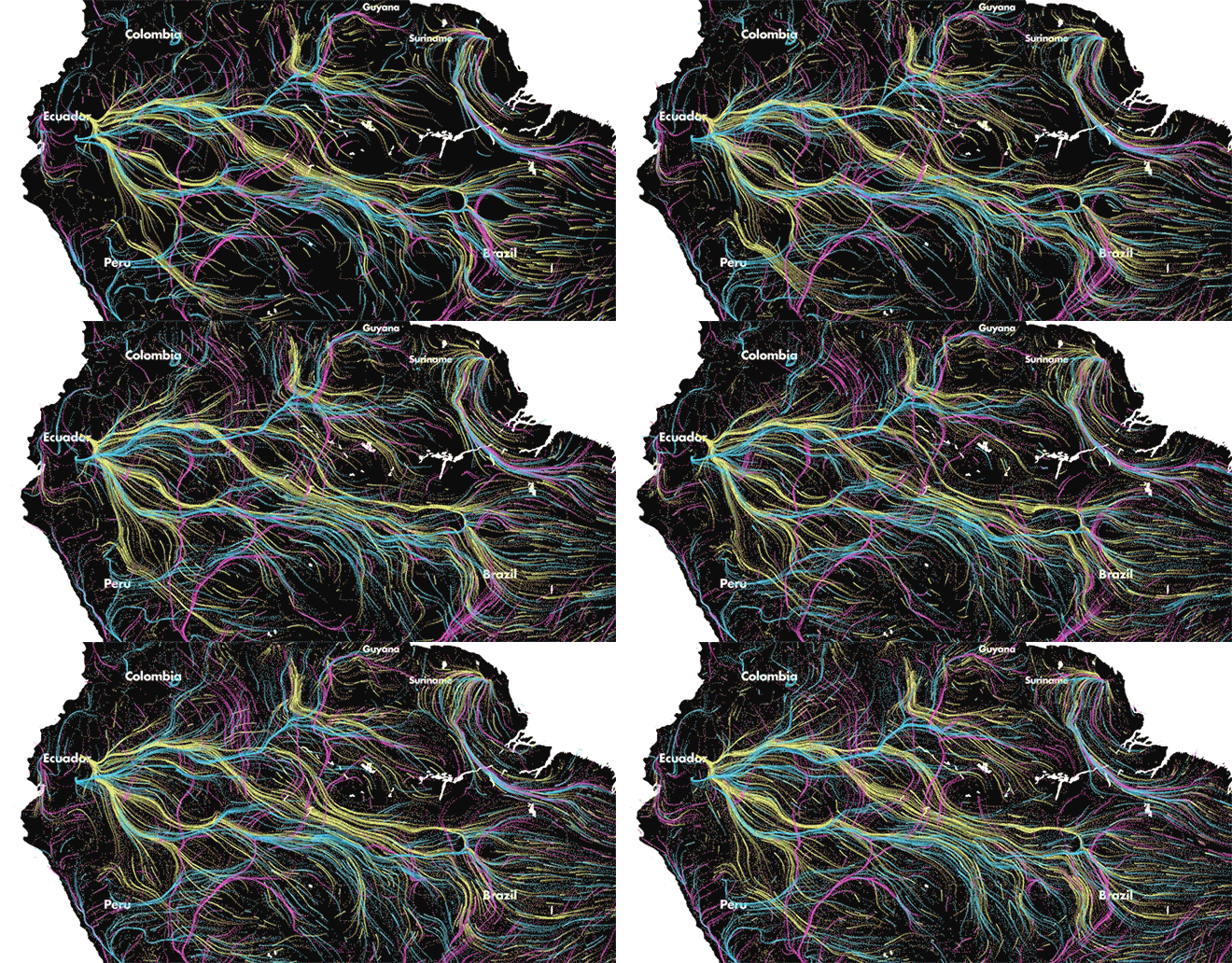
Amphibians — represented by yellow lines — are likely to migrate westward out of the Amazon as the world warms.The Nature Conservancy
Those high elevation lands will take on added importance and zooming in on the map only reinforces that reality. In South America, there’s a bright swath of yellow moving west out of the Amazon basin to higher elevations. In the Catskills of upstate New York, it’s the same story.
Beyond high elevations, zooming in anywhere on the map gives a glimpse into not just the geography of where and how species will move to beat the heat, but where humans live, work, and grow things. New York may be the most populous city in the U.S. but it’s a veritable ghost town when it comes to animal migrations spurred by rising temperatures.
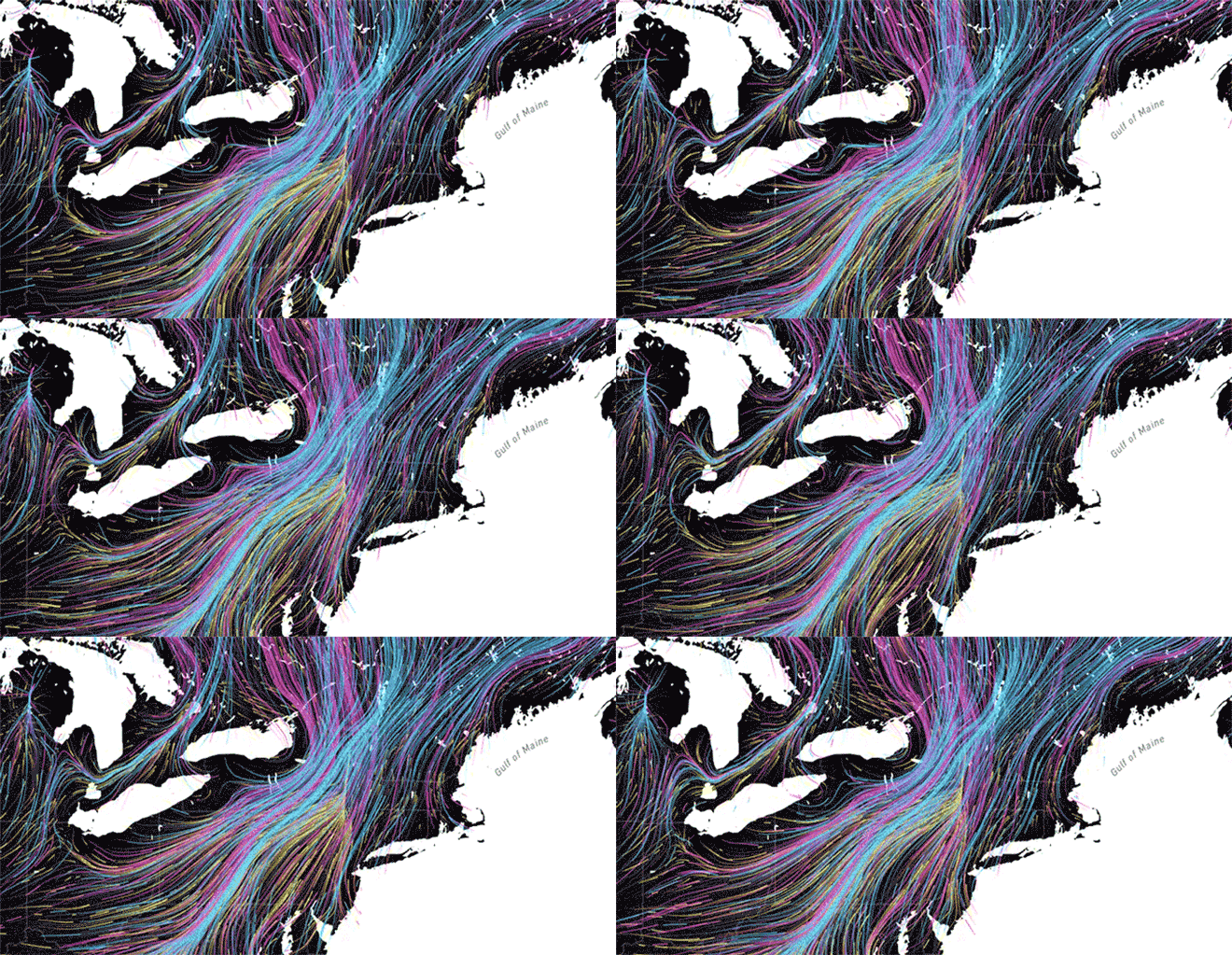
New York City is a relatively quiet spot on the climate migration corridor but the Catskills located northwest of the city will be an important climate migration pathway for wildlife.The Nature Conservancy
According to one of the studies on which the map is based, only 2 percent of natural areas east of the Mississippi are connected in a way that allows species to migrate north or up in elevation. Because of the dismal state of connectivity, a small increase in conserved land could provide major benefits in the region.
National parks are the lynch pins of wild land out West and could be part of a future solution in the East to ensure species can handle climate change. The recently dedicated Maine North Woods National Monument is a step in that direction, but more land will be needed if plants and animals are going to find new homes.
