Just a few weeks into the hurricane season, the National Oceanic and Atmospheric Administration, or NOAA, has declared the end of El Niño, the warm streak of water in the Pacific that influences global weather. That makes an already dire outlook for cyclones even more dangerous — in April, scientists forecasted five major hurricanes and 21 named storms in the North Atlantic alone — because El Niño tends to suppress the formation of such tempests.
NOAA now predicts a 65 percent chance of La Niña, which is favorable for cyclones, developing between July and September, when such events are most common. (La Niña is a band of cool water forming in contrast to El Niño’s warm band.) At the same time, sea surface temperatures remain extraordinarily high in the Atlantic — the kind of conditions that power monster storms.
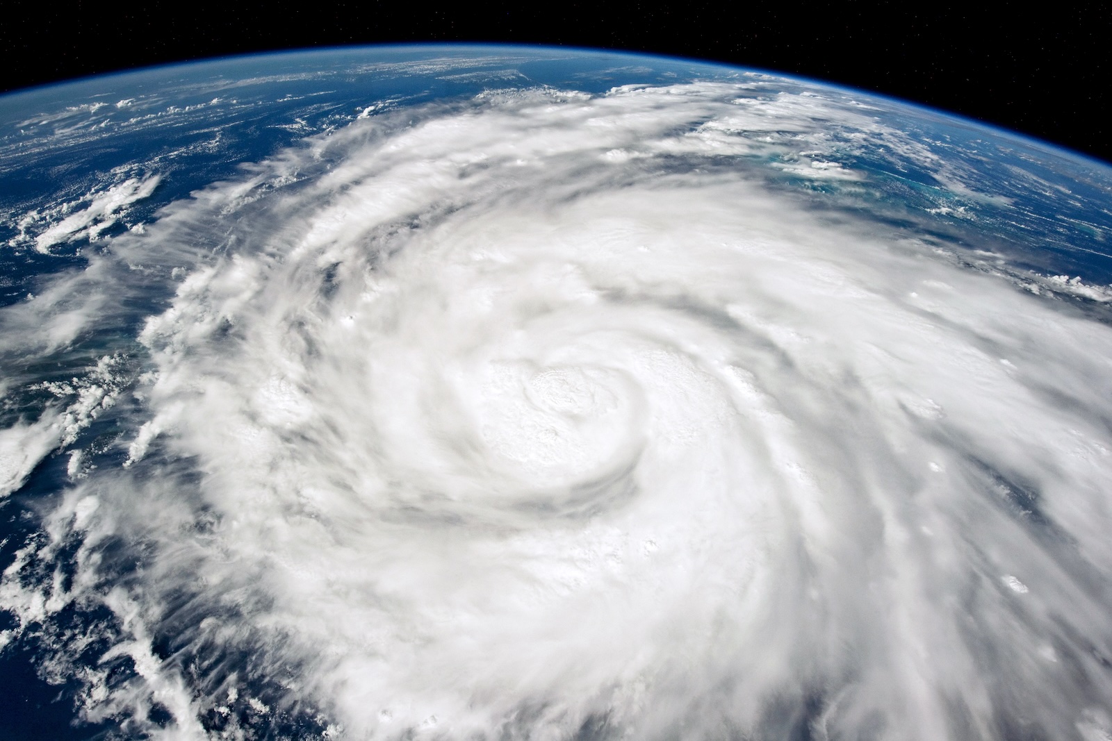
The Atlantic is primed for a brutal hurricane season. But these cyclones aren’t just made of devastating winds and rains — they’re full of invaluable data that scientists will use to improve forecasting, giving everyone from local meteorologists to federal emergency planners better information to save lives.
Such insights would be particularly critical if, for instance, a hurricane rapidly intensifies — defined as an increase in sustained wind speeds of at least 35 mph in 24 hours — just before it reaches shore and mutates from a manageable crisis into a deadly one. “Those cases right before landfall, where people are most vulnerable, is the nightmare scenario,” said Christopher Rozoff, an atmospheric scientist at the National Center for Atmospheric Research who models hurricanes. “That’s why it’s of such great interest to improve this, and yet it’s been a huge forecasting challenge until somewhat recently.” (Which is not to say weaker storms can’t also be catastrophic — for instance, they might stall over a city and dump torrential rain.)
For such calamitous phenomena, hurricanes feed on a certain level of atmospheric boringness. El Niño suppresses the development of these storms by encouraging vertical wind shear, or winds moving at different speeds and directions at different elevations. That messiness tilts the vortex, interfering with a hurricane’s ability to spin up uniformly. The La Niña that could form this summer, on the other hand, decreases that wind shear in the Atlantic, providing ideal conditions for cyclones.
On the ocean’s surface, extremely high temperatures have already turned the Atlantic into a vast pool of fuel for hurricanes to start forming. When this water evaporates, the vapor is ingested by the storm, forming buoyant clouds that release heat and lower the atmospheric pressure. This draws in air to create wind, which spins up into a vortex.
If the sea is warm enough, and vertical wind shear is low enough, a hurricane has the potential for rapid intensification. “The atmosphere usually drives the bus when it comes to rapid intensification — it is definitely something that is on my mind this hurricane season,” said Eric Blake, a senior hurricane specialist at the NOAA’s National Hurricane Center. “When you have extremely warm waters, it just increases the chances that it can occur in areas that maybe it wouldn’t normally occur in.”
Last year, several hurricanes quickly strengthened, including Hurricane Idalia, which tore into communities along the Florida coast. Over in the Pacific, Hurricane Otis evolved into a monster with stunning speed before devastating Acapulco, Mexico. “That storm intensified from a tropical storm to a Category 5 in just over a 24-hour period,” said Rozoff. (For context, a Category 1 hurricane has sustained winds of at least 74 mph, while Category 5 is at least 157 mph.) “We’ve seen improvements in forecasting and our ability to capture these events, but that particular forecast still fails, unfortunately, by the numerical models. None of them were foreseeing this intensification to such an extreme storm that would be so damaging.”
Because blistering strengthening involves highly complicated interactions between the sea and the sky, it’s notoriously hard to predict. As the planet warms, hotter oceans provide more energy for hurricanes, and complex ripple effects across the atmosphere might also reduce wind shear along the Atlantic coast going forward. Indeed, a paper published last year found an explosion in the number of rapid intensification events close to shore in recent decades.
Not only are scientists trying to parse why a particular hurricane would quickly intensify in 2024, they have to figure out what to expect as the oceans get hotter and hotter, providing more and more cyclone fuel. It’s a moving target, one made of torrential rain and 160 mph winds. “We have a great database of weather that happens now, and we don’t necessarily have a great database of weather that will happen in the future,” said Sarah Gille, a physical oceanographer at the Scripps Institution of Oceanography. “So extreme storms are one window into that, that can help us get a better picture of what we might see.”
As hurricanes spin across the Atlantic this summer, scientists will be ready. They can fly “Hurricane Hunter” aircraft into the cyclones while collecting oodles of data like wind speed, pressure, and humidity. (That’s another factor in major hurricanes: They love humidity and hate dry air.) They’ll then feed this data into models that try to predict rapid intensification. Increasingly, scientists are using artificial intelligence to supercharge these algorithms, for instance training an AI to recognize patterns in satellite images of a hurricane, or precipitation in the core of the storm, to predict whether it will rapidly intensify or not.
Whether from an aircraft or a satellite, every new observation of these cyclones feeds into models that are getting better at understanding why hurricanes behave the way they do. That means better information for coastal cities to decide whom to evacuate and when. “We’ve gotten a lot of good data at a time when the technology is improving, so I think that’s why we’ve made so much progress,” said Rozoff. “Every case of rapid intensification before landfall — whether forecasted well or not — is a tragedy, or at least a serious challenge for humanity. But it has provided us some good data as well.”
A message from
Your support keeps our climate news free.
Grist is the only award-winning newsroom focused on exploring equitable solutions to climate change. It’s vital reporting made entirely possible by loyal readers like you.
At Grist, we don’t believe in paywalls. Instead, we rely on our readers to pitch in what they can so that we can continue bringing you our solution-based climate news. Donate today to keep our site free.