 Photo: Trey CampbellCross-posted from the Natural Resources Defense Council.
At the bottom of this post are two short videos about Detroit, both featuring architect and planner Mark Nickita, principal of the city’s Archive Design Studio and a lifelong Detroit resident. In a very refreshing change from the mind-numbing negativity one usually hears about the city, Nickita is upbeat and hopeful. His point of view, emphasizing revitalization, is much closer to my own than much of what I read, which effectively takes the approach that the city has somehow been abandoned beyond redemption, leaving the only question how to manage its more-or-less permanent shrinkage.
But it’s not that simple.
There has indeed been a decline in part of the region. In 1970, 1,670,144 people lived within the city limits of Detroit. By 2010, that number had declined to 713,777, an astounding apparent loss of some 57 percent of the 1970 population. Recently, much has been made the 25 percent population decline over the last decade, from 2000 (951,270) to 2010.
But the extent to which Detroit is such a tragically “shrinking city” depends on your definition of “city.” The population of metropolitan Detroit — the jurisdictional inner city and its immediate suburbs — did decline from 1970 to 2010, but only from 4,490,902 to 4,296,250, a loss of only 4 percent. Big difference.
Do the math: What that means is that, while the inner city’s population was declining so drastically, its suburbs added some 761,000 people, growing at the handsome rate of 27 percent. (In the most recent decade of 2000-2010, the suburbs added some 91,000 people, or between 2 and 3 percent.) Patrick Cooper-McCann writes on his blog Rethink Detroit that, far from shrinking, the physical size of metro Detroit grew by 50 percent in those 40 years. As I’ve written before, neither the economy nor the environment pay attention to jurisdictional lines; neither should analysts.
Look at the maps below. On the left, the physical size of metro Detroit around 1900; in the middle, by 1950, the developed area had grown; and on the right, by 2000, it had become immense:
 Images: CNU19
Under current trends, it’s only going to get more expansive: As of 2004, the region’s planning agency was predicting that, over 30 years, the amount of developed land in metro Detroit is going to expand yet another 36 percent or more. “390,000 more acres bulldozed for progress. The development will continue to be mostly single-family housing, and will require more sewers, more stores and more schools,” wrote Sheryl James of the Detroit Free Press (published on the website Urban Planet).
Shrinking city? Really? What this tells me is that an even bigger problem for Detroit than the decline of the Rust Belt economy has been that the fringe of the region has been allowed, more than in most places, to expand, not shrink, and to suck the life and hope out of the inner city. So why aren’t the self-styled progressive responses to “the Detroit problem” addressing this critical aspect of the situation?
Maybe they are, but the only ones I hear and read are about “right-sizing” the inner city — demolishing vacant (and even some occupied) housing, letting vast areas revert to nature or farming, and so forth. Let sprawl, the cause of the problem, be someone else’s issue to address. But, in fact, the areas that are sprawling are where the “right-sizing” most needs to occur.
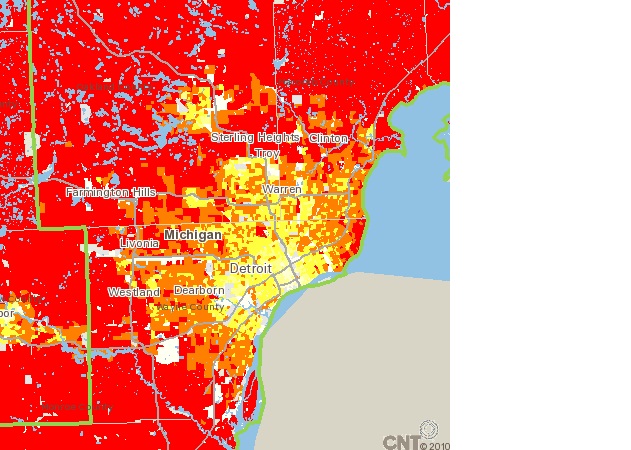
 Image: Center for Neighborhood Technology
Whether or not there is any good in the current approach for Detroit as a community, it is impossible to see how it will be good for the region’s carbon emissions. Just as is the case in every other U.S. metro area, households on the fringe emit far more CO2 than households in the center of the region, because their inhabitants walk less, drive longer distances, and drive more often. On the map above from the Center for Neighborhood Technology, households in the areas in red emit, on average, 8.6 metric tons or more of carbon dioxide per year from transportation; households in the pale yellow areas in the center emit 3.3 metric tons or less. Again, big difference.
The way to stem pollution is to address the unchecked expansion on the fringe and keep the center as urban as possible. In this troubled place even more than in others, Detroit needs a regional approach, not just demolitions in the center.
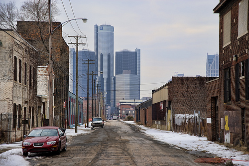
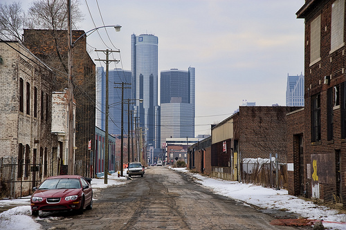
In the first video below, Mark Nickita discusses the importance of, and prospects for, revitalizing the Woodward Avenue corridor (above) that forms the Detroit region’s historic and economic backbone:
In the next (which actually was recorded first), Nickita discusses what’s really been happening with regard to population in the Motor City:
(Note: Nickita’s numbers on the region’s population are bigger than mine because I conservatively used the six-county, census-defined Metropolitan Statistical Area (MSA) to define the region; Nickita used the nine-county Combined Metroplitan Statistical Area.)


