

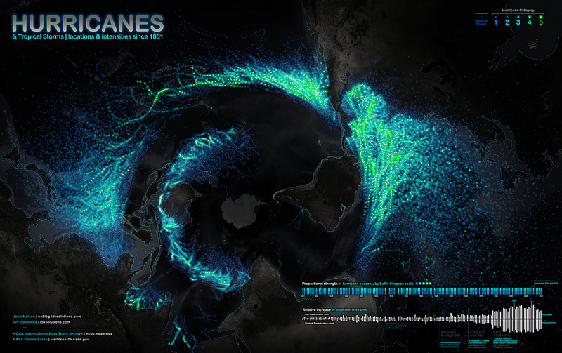
John Nelson, the guy who brought you the gorgeous maps of wildfire and tornado data, has really outdone himself this time. This is more than 150 years of hurricanes, presented in an unusual orientation (Antarctica is at the center of the map), and it is downright stunning.
The bottom-up perspective makes the hurricanes arrange themselves into bands and plumes, and the whole thing (you can click it to embiggen, by the way) looks like flame or peacock feathers or, from a zoomed-out perspective, one alien eye. It’s so pretty, you could almost forget that the green bits represent severely destructive storms!

