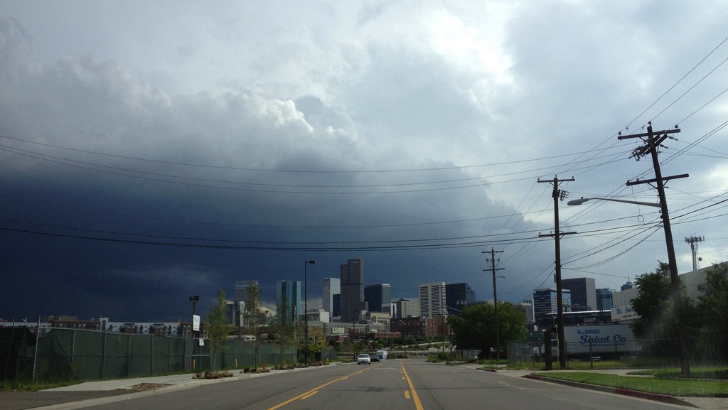
A lot of wild weather has afflicted North America this year: deluges in Colorado and Alberta, a heatwave in Alaska, and bitter cold in Florida. But there’s a high-altitude link between each of these unusual events which itself might be tied to climate change: erratic behavior by the polar jet stream.
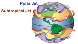
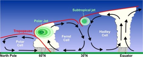
This famous current of air zips eastward at high altitudes from the continent’s West, normally passing over North America somewhere near Seattle. It is one of two jet streams in the Northern Hemisphere — the other being the subtropical jet stream. Together, these powerful currents have long held weather patterns in their normal places, one year after another. But something weird is going on up there.
The normally direct polar jet stream has been swinging wildly this summer, dipping north and south like the line graph on a U.S. jobs report. At times it splits in two. From Popular Mechanics:
The jet stream is a year-round feature of our atmosphere, but the double jet stream phenomenon is more common in winter. When it shows up in the summer, watch out.
“Usually at this time of year the jet stream is a single band around the Northern Hemisphere,” [Texas A&M University atmospheric science professor John] Nielsen-Gammon says. “But in the last month what we’ve seen is a smaller jet stream over the Arctic Ocean, and another jet stream in the midlatitudes.”
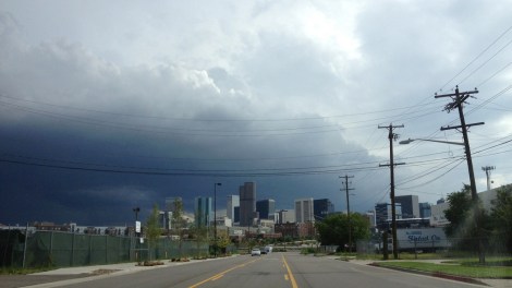
That article was published in June after more than 100,000 people were forced from their homes by flooding in Calgary. Media and scientific interest in the jet stream’s newfound vagaries rose again after the recent flood-inducing rainfall in Colorado. From NPR:
During the summer, the double jet stream produced a very strange temperature pattern along the Pacific coast, Nielsen-Gammon says. Down in Southern California it was unusually hot — in Death Valley the temperature reached 129 degrees. Meanwhile, up in British Columbia, it remained unseasonably cold.
Even farther north, in Anchorage, Alaska, residents experienced a relative heat wave, with a record number of 70-degree days. But even farther up in the Arctic, temperatures were relatively cold again.
The double jet stream also played a big role in the Colorado flooding this month, [Rutgers University researcher Jennifer] Francis says. High up in the atmosphere, one stream was carrying moist air from the Pacific to the Rockies. Then, lower down, an unusual eddy was pulling in more moist air from the Gulf of Mexico. Finally, an unusual bulge in the jet stream was causing all this weather to stall near Boulder.
There’s no scientific agreement right now on what role, if any, climate change is playing in the polar jet stream’s erratic behavior. But Francis points out that it is the product of vast temperature differences between the equator and the North Pole. As the globe warms, the Arctic heats at a disproportionately fast rate, and that chips away at the temperature gradient. If that turns out to be what sent the jet stream into a weird spin cycle, then the Northern Hemisphere has a lot more extreme weather coming its way.
“It could be drought. It could be heat waves. It could be flooding due to prolonged rainfall,” Francis told NPR. “All of those kinds of patterns should be becoming more likely.”
A message from
Your support keeps our climate news free.
Grist is the only award-winning newsroom focused on exploring equitable solutions to climate change. It’s vital reporting made entirely possible by loyal readers like you.
At Grist, we don’t believe in paywalls. Instead, we rely on our readers to pitch in what they can so that we can continue bringing you our solution-based climate news. Donate today to keep our site free. All donations DOUBLED for a limited time.