Deborah Schultz is the education coordinator for the Barataria-Terrebonne National Estuary Program, a watershed restoration program in southeast Louisiana.
Monday, 21 Aug 2000
THIBODAUX, La.
Today I will travel 20 minutes to Houma to meet with a film crew from CNN that is coming to film local teachers and school children. Just what is CNN doing coming to Houma, Louisiana? Let me back up and explain.
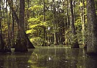
Feeling swamped.
When I landed in this part of the country eight years ago, I felt I had landed on another planet. The name itself is exotic, with Barataria referring to the impenetrability encountered by early explorers, and Terrebonne meaning “the good earth.” This is a land of vast marshes, swamps, and bayous, of abundant wildlife, “Cajuns,” and the rich culture the Cajuns have created. In my time with the Estuary Program, I have come to recognize that this is indeed a unique corner of the world, and it is disappearing before my eyes.
In order to become a part of the National Estuary Program, a nominated area must be proven both nationally significant and threatened. Barataria-Terrebonne had no trouble with either. Estuarine systems are known to be among the most biologically productive systems in the world, and B-T is no exception. With substantial finfish, oysters, shrimp, and crabs, and annual commercial fisheries landings of more than $220 million, these wetlands and bays are a mecca for both commercial and recreational fishermen alike, and they help to feed Louisiana and the nation.
Yet the threats to this area are numerous. Foremost is land loss. The wetlands of Barataria-Terrebonne are disappearing at a rate of 25 square miles per year. That is equal to a football-field-sized area every 45 minutes. Unlike other regions, our wetlands are not being filled in, not developed, not paved over. Ours are subsiding into the Gulf of Mexico. In order to understand this, one must understand how this area was created.
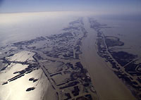
A view of the estuary from above.
Barataria-Terrebonne is a gift of the Mississippi River. The Mississippi receives the drainage waters of two-thirds of the United States and two Canadian provinces. The “Big Muddy” has historically carried her cargo of water and sediment across the continent, and, upon reaching the shallow continental shelf, she disperses her load. In the annual cycles of spring snow melt, her northern tributaries would swell her load to uncontainable limits, and she would rush toward the gulf, spilling nutrient-rich waters and rich earth sediments over her banks, and across the land, layer by layer. Every few thousand years, she would alter her course, taking a new route to the sea, and replenishing areas she had previously abandoned. That is what built Barataria-Terrebonne. And our tampering with that dynamic and powerful system is what threatens to destroy it.
In our typical way of thinking — short-term — we non-native Americans have restricted the Great River. We have confined her to her banks with hundreds of miles of levees. Flood protection efforts in the Barataria-Terrebonne, predominantly for the neighboring city of New Orleans, have kept us safe in the short term, but we have sent the river’s bed-load of sediments cascading off the edge of the continental shelf, into deep ocean waters. Ironically, we have also made ourselves more vulnerable to destruction by storms from the gulf because as our buffer of wetlands recedes, we receive more of the undampened fury. We have sterilized the womb of America, and set in motion what will eventually destroy the Good Earth, unless drastic measures are taken.
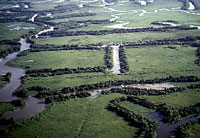
Canals now cut through the marsh.
Without the River’s annual nourishment, our wetlands are sinking, subsiding into the gulf. We have exacerbated the rate of demise by criss-crossing our vast marshes with canals — both for navigation and oil exploration. These wounds do not heal, but act as a cancer, enlarging from wave action and allowing salt water to intrude far into the system.
These wounds are not the only price we have paid for our abundant oil deposits that help fuel the nation. Barataria-Terrebonne has had more oil spills than any other location in the U.S. The marshes are also scarred with the remains of “produced water” discharges, highly saline and mildly radioactive waters that accompany oil when it is extracted from the Earth. Until very recently, these waters were legally discharged from open pits in the marsh.
Barataria-Terrebonne is plagued with other water quality problems as well, with high levels of atrazine, other pesticides, nutrients from fertilizers and sewage, and sewage-related bacteria from poorly operating or non-existent sewage treatment.
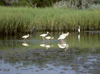
Wading ibises in the estuary.
These problems have resulted in habitat degradation. This degradation, as well as the introduction of exotic species, threatens our native and migratory populations of wildlife. When wildlife is threatened, Cajuns, who have made a way of life centered on wildlife resources, are threatened as well.
Our children know what is happening. Our children are angry and afraid. Our children — in cooperation with the Houma-Terrebonne Chamber of Commerce, the Terrebonne Parish School Board, the Diocese of Houma Thibodaux, and the B-T Estuary Program — have initiated operation S.O.S. (Save Our Soil). Our youth have written to the governor. They have written to the president. And they have written to every major newspaper and television network across the country.
Today, CNN is responding.
Tuesday, 22 Aug 2000
THIBODAUX, La.
Yesterday I watched the CNN film crew tape a teacher at Oaklawn Junior High giving a lesson on coastal land loss, and students at St. Bernadette Elementary reading letters they wrote last year asking for help from CNN. The segment will be aired on Earth Matters on Sept. 3 at 3:30 central time.
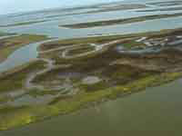
Death on the Mississippi — the brown marsh from above.
This morning I viewed more troubling video footage, showing that the south Louisiana land loss crisis has deepened. Reports had been coming in from the U.S. Geological Survey, the Louisiana Department of Wildlife and Fisheries, and others that between 20 and 50 percent of the Spartina alternaflora (smooth cordgrass), the major component of the salt marsh in our 4.2 million-acre system, is dead or dying. Last week, while I was in North Dakota at a shorebird educators workshop, a flyover took place to assess the damage. Present were the director of our program, Kerry St. Pé; Col. Julich from the U.S. Army Corps of Engineers; Len Bahr from the Governor’s Office of Coastal Activities; Martin Concienne, chief of staff for Rep. Billy Tauzin (R-La.); Troy Hill from the U.S. Environmental Protection Agency in Washington; and of course the pilot for the Louisiana Department of Environmental Quality, Bruce Stamey.
Viewing footage from this flyover of what has come to be known as “the Brown Marsh,” one cannot help but feel alarmed. Dead marsh does not hold soil, and leaves this 75-mile-long strip of
estuarine habitat completely vulnerable to the next storm. It also decreases the buffer the marsh provides to coastal and inland residents from the devastating impacts of hurricane storm surges. There are still those who remember the hurricane of 1893 that devastated the community of Cheniere Caminada. That hurricane changed the future of entire families, killing thousands of people and sending our grandparents fleeing to inland communities. Ironically, because of our incredible rate of wetland loss, many of these communities are no longer inland but are now on the coast, shielded only by hurricane protection levees fringed with fragile and shrinking coastal marshes.

A map of the area — the Estuary is in red.
What is killing the marsh? We aren’t quite sure yet. We know we have been under drought conditions, and we know that without freshwater input, the salinities in the marsh are higher than “normal,” though not beyond short-term tolerance levels for smooth cordgrass. Is there something else at work here, feeding on an already stressed situation? Efforts are being initiated to answer that question. There are many resource agencies involved in coastal issues in the Barataria-Terrebonne system, and with this new development in the crisis, I begin once again to see the strength of the partnerships created under the Barataria-Terrebonne National Estuary Program.
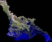
Detail of the Barataria-Terrebonne National Estuary.
The National Estuary Program is an innovative program administered under the Clean Water Act by the U.S. EPA. It uses a holistic, multi-stakeholder, consensus-based, decision-making approach to management plan development and implementation. Over the last five years, under our program, local, state, and federal government agencies, representatives from the oil, fishing, oyster, and agricultural industries, environmentalists, scientists, educators, and a host of others came together to agree on what the problems are and how to fix them. Partnerships forged over that period are indispensable in implementing the management plan that emerged from that process, and for dealing with a crisis like we are now facing.
There have been several meetings held by different groups, and the consensus arising from this latest issue is that the Estuary Program should assume a leadership role. Most of the agencies now involved with the dying marsh problem have worked closely with our estuary program. It is quite heartening to see that these people recognize the strength of pooling resources and expertise in this time of potential ecological emergency. A variety of individuals will soon take coordinated action to sample the plants, share data on salinity and other water quality parameters, and find a probable cause for the marsh demise. Once characterized, we then must decide if the reasons for this latest die-off can be remedied. And it is most probably closely related to the subsidence dilemma.
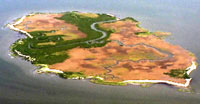
Can this marsh be saved?
There is hope, though. Funding from the Coastal Wetlands Planning Protection and Restoration Act has helped initiate a number of restoration projects. And plans for restoration projects along the entire coast of Louisiana have been drawn up in what is known as the Coast 2050 plan (what do we want our coastline to look like in the year 2050?). Rebuilding barrier islands with dredge material, creating siphons from the river, and making larger controlled diversions of river water into our system all hold promise of reducing the rate of loss.
But we all know that what we have in the plans is not enough. Solutions to our problems will take a lot more dollars than we are currently accessing. And they will take the concerted will of our people, as sacrifices will have to be made by some to ultimately save this system. In order to stem the tide of loss, we must work with the river, releasing her to flow freely as much as possible, while protecting residents, the oil industry, and fishing and oyster grounds. No small task.
Wednesday, 23 Aug 2000
THIBODAUX, La.

Clawdette, our mascot.
Today I am meeting with Dr. Eddie Landrum, who is working for our program through a grant from the U.S. EPA’s Gulf of Mexico Program. Eddie is concentrating on projects to restore harvestable shellfish beds in our estuary. We’ll be discussing an interactive CD-ROM he is developing that will help to educate our citizens about estuarine ecology, the ecological and economic value of oysters, and threats to the oyster industry. We are considering having Clawdette, our blue crab mascot, lead the viewer on an under-the-water-and-into-the-boat virtual tour of the life of an oyster.
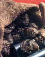
The bayou is your oyster.
Barataria-Terrebonne has enormous oyster resources. In the Barataria basin alone, there are 700,000 acres of oyster growing grounds, with even more in the Terrebonne basin. Unfortunately, 30 to 50 percent of these grounds are closed to harvesting because of water quality concerns, predominantly bacteriological. Pathogens from sewage are very closely monitored by the Louisiana Department of Health and Hospitals. If there is the slightest indication of, or potential for, contamination, the beds will be closed to harvest. This protects not only the health of the public but the reputation of the industry as well. Where we have municipal sewage collection systems, sewage problems are minimal. However, many parts of our system are very rural, with linear housing settlements spread down finger ridges (natural levees along old bayous) extending deep into the estuary. And then there are the camps. If you have ever visited our area, you will not forget these rustic weekend getaways. Perched on stilts at the edge of the marsh or the swamp, often accessible only by boat, this is where Cajuns and northerners (those from north of Interstate 10) alike come to fish, hunt, crab, and play bourré (boo-ray), a Cajun card game. Effective sewage treatment in these areas has been next to impossible.
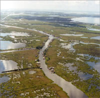
Camps in the coastal marsh oyster areas.
In our coastal areas, elevations range from zero to eight feet, and are only slightly higher on bayou ridges in the upper portions of the system. (New Orleans, on the East Bank of the Mississippi River, is actually below sea level.) We surround our communities with a series of interconnected hurricane protection levees, which offer us a measure of protection from storm surges from the Gulf of Mexico but leave us sitting in bowls of rainwater. To remedy this, we have ingeniously devised a series of pumps to remove rainwater from our communities. There is a common joke around here that we take care of the water problem by pumping it out of one parish (county, in any other state), over the levee, and into the next parish. This water eventually gets pumped into the shallow bays where oysters are grown. You can imagine that this storm water has picked up a few substances in its path, including fertilizers, pesticides, soil, and bacteria from inadequately treated sewage.
Eddie, through the Gulf Program, is helping to remedy this. One very promising project he is working to i
mplement is the rerouting of storm water into wetlands. The concept here is to use the natural filtering ability of our coastal wetlands to remove contaminants, while providing the wetlands with the benefit of nutrients and soil. Soil input will help to raise the level of the marsh, while nutrients will stimulate plant growth and increase the amount of organic deposition into the wetlands. This is a win-win situation for the marsh, the oysters, the residents who depend on the marsh for food and protection, and oyster lovers across the nation. Plans are in the works for a number of these diversions.
Eddie is also working with the Louisiana Department of Wildlife and Fisheries on incentives for Marina Pumpout installations for oyster and fishing boats and other vessels in need of a place to dump sewage (somewhere other than overboard). And he is trying to find the millions of dollars necessary to install the lines to connect residents along Bayou Petite Caillou to existing municipal facilities in Terrebonne Parish.
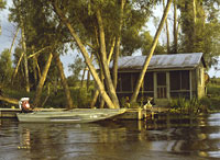
Where’s the privy?
Earlier today I got a call from Andrew Barron of the Louisiana Department of Environmental Quality and an email from Fred Kopfler of the Gulf of Mexico Program. Andrew and Fred are both working to find funding for one of my own projects involving sewage pollution reduction in coastal camp areas. Ahh, the beauty of partnerships! With the water table so close to the surface and our heavy clay soils, approved sewage systems are at best problematic. Some camp owners, trying to do the right thing, have installed an approved underground system, only to have it pop out of the ground during a flood event, like a bubble of air rising to the surface, and burst open, spilling its contents. Cajuns may appear to be simple, but you won’t see them running to buy this approved system after seeing such an experience on a neighbor’s land.
A very promising new technology, known as the Marsh Upwelling System (MUS), has been developed by Louisiana State University engineer Kelly Rush and others. With MUS, sewage is sent to a settling tank. From there it is pumped to a holding tank, then injected 15 feet below the surface of a nearby marsh. Salt water in the soil is more dense than freshwater, so the freshwater sewage effluent percolates upward through the soil toward the marsh. An initial demonstration project has shown it to be enormously effective at clearing fecal coliform bacteria from the effluent, with no apparent impact on the marsh. We are now preparing to test it using a cluster of camps along a Bayou Segnette, a freshwater bayou, understanding that there is a layer of saltier water beneath the marsh, so the system should work. Intensive monitoring of this project will take place for several years. Our state health department is behind the project 100 percent, and we all eagerly anticipate its entry into the suite of approved sewage treatment systems — if only Louisiana politics do not interfere.
Thursday, 24 Aug 2000
THIBODAUX, La
Late yesterday afternoon, our director, Kerry St. Pé, returned from another meeting on the Brown Marsh. Data was presented at that meeting which show that our smooth cordgrass marsh was recently subjected to more than 400 straight hours of dry soils. This was followed by an inundation of highly saltine water from the Gulf of Mexico. An estuary is normally a place where freshwater and saltwater combine, forming a brackish mix that the marsh grasses in our estuary are well suited for. Because of the drought we are experiencing, we have not had enough freshwater entering our system to hold the salty gulf waters back. The conservative estimate is that 15 square miles of marsh across our system are suddenly very vulnerable to erosive forces, like hurricanes. Add that to the 22 square miles of annual wetland loss in the Barataria-Terrebonne National Estuary, and the potential result is sobering. You can bet we will be watching the weather channel as storm systems work their way toward the gulf. You don’t get anywhere quickly down here and the evacuation of thousands fleeing from a hurricane can be quite tricky.
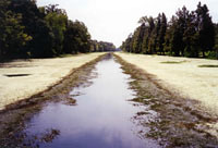
Hydrilla in Bayou Lafourche.
An official from the City of Thibodaux came to my office today to discuss a volunteer storm drain marking project we are getting ready to conduct. We talked about the Brown Marsh and its potential impacts, including those upon our drinking water supply. Bayou Lafourche (French for “the fork”) is a former major distributary of the Mississippi River. This 100-mile-long bayou is now connected at its northern end to the Great River through controlled siphons and pumps, which regulate the flow of freshwater. The tidal forces of the Gulf of Mexico are at work at its southern end. Bayou Lafourche provides drinking water for over 300,000 people and freshwater for industrial operations. As our coastline recedes, gulf waters intrude farther up Bayou Lafourche and other drinking water sources. Some water intakes are forced to shut down from time to time as this saline intrusion is felt. With the potential loss of another piece of our wetland barrier from the gulf, drinking water supplies may suffer even more.
This is compounded by the presence of exotic, submerged aquatic vegetation in the bayous. Hydrilla and other nonnative species, introduced into our waters from the aquarium trade, have impeded the flow of freshwater from the north, influencing our ability to get freshwater to our drinking water plants without raising water levels and flooding people living along the banks. As one looks at our issues of land loss, water quality problems, exotic species introductions, and subsequent loss of culture, it is easy to see how interconnected all these things are. I believe it was Chief Seattle who said, “Everything is connected to everything else,” which is why we must think holistically about restoration.
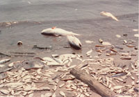
After the jubilee — dead fish.
Another example of this interconnectedness is our area of hypoxia, known as the “dead zone,” in the Gulf of Mexico. I read a press release this morning from Dr. Nancy Rabalais, from the Louisiana University Marine Consortium, a world-class marine research facility located near the coast. In her press release, Dr. Rabalais comments on a recent phenomenon of blue crabs beaching themselves on one of our barrier islands, in what is known locally as a “jubilee.” The hypoxic zone is formed when nutrient inputs from the entire Mississippi River watershed make their way to the gulf, causing “blooms” of algae. These nutrients are what make our system so productive, but an overabundance of nutrients and algae result in low oxygen in the water during biological decomposition of the tiny algae plants. This low-oxygen zone, which has in recent years grown to include a 7,000-square-mile area offshore, kills anything that cannot move out of its path. Animals that can move, do. When a north wind blows the freshwater river layer out to sea, the hypoxic zone moves onshore, causing trapped “stunned and dazed” fish, crabs, and shrimp to move to the surface, gasping for oxygen, where fishers converge, scooping them up. “Extremely low hypoxia, and the subsequent toxic hydrogen sulfide gas produced, is suspected in the ‘jubilee gone bad’ beaching of thousands of dying blue crab,” Rabalais wrote.
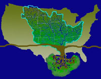
The Mississippi River watershed.
So events in Kansas, Nebraska, or the rest of the huge waters
hed affect blue crabs and other organisms in our estuary, as well as the commercial fishers looking for the fish. It is for that reason that our partnerships extend beyond the borders of our estuary. We have likened the Mississippi River watershed, with its myriad web of connected waters, to the roots of a tree, and our own system to the canopy. We were born of the Mother River, and we live through what she brings to us. We have traveled to Minnesota and Missouri, speaking with youth and adults about the problems we face in Barataria-Terrebonne. And we have worked with the Mississippi River Basin Alliance to bring farmers from the Midwest together with fishers from south Louisiana for genuine dialogue. Ecosystems under stress require the dissolution of traditional animosities. It is only through cooperation that this national treasure, the Barataria-Terrebonne National Estuary, will be saved.
Friday, 25 Aug 2000
THIBODAUX, La.
At our staff meeting this morning I was updated on the activities of some of my coworkers.
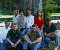
A photo of our staff. Top row from left to right: Richard DeMay, Sandra Kendrick, Deborah Schultz, Rachel Somers. Bottom row, left to right: Kerry St. Pe, Matt Phillips, Eddie Landrum, and Dean Blanchard.
Matt Phillips is gathering historical salinity data we have stored in our extensive data system and he continues to keep our website up to date.
Dean Blanchard is working on a brochure that emphasizes the sensibility of oil spill prevention. With the large preponderance of oil rigs and production platforms in our estuary, the enforcement of regulations requiring spill prevention measures is difficult. Some companies in our estuary have, however, recognized that the old adage “an ounce of prevention is worth a pound of cure” not only makes good ecological sense, but good economic sense as well. The cost of cleanup and the resulting penalties is far greater than the cost of implementing preventive measures. Dean’s brochure highlights these progressive companies and gives real-life examples of the cost savings of containing a spill before it reaches the estuary.
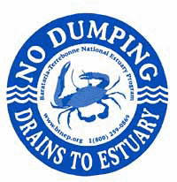
Rachel Somers is planning a storm-drain-marking program with a local 4-H group. Rachel, the kids, and the mayor of the city of Thibodaux will fan out across a neighborhood, marking drains with a sturdy decal that reads “No dumping — drains to esturary.” A picture of Clawdette (our crab mascot) is prominently displayed on the decal and on the informational brochure that will be passed out to local residents during this event. Rachel, who is serving with our program through the Delta Service Corps, also has artistic talent and is hard at work on a coloring, activity, and information book for young children.
Richard DeMay is working on projects to enhance migratory bird habitat. The barrier islands of Barataria-Terrebonne not only shield inland habitats from the fury of storms and provide habitat for resident birds; they are also the first stop for weary trans-gulf Neotropical migratory birds. With certain weather conditions, these often-colorful world travelers will literally drop out of the sky and lie in docile and weary repose on our beaches after their incredible journey across the gulf. Richard is working with the Nature Conservancy and Exxon, a large property owner, to plant live oak, mulberry, and hackberry trees for food and cover for these migrants. A poster depicting the habitats of Barataria-Terrebonne that are important to migratory birds has been developed, and a video is in the works.

A “ladybug” at La Fete.
Sandra Kendrick is coordinating our annual La Fete d’Ecologie, or Ecology Festival, held here in Thibodaux each October. La Fete is not only an opportunity to educate our citizenry about our issues, through information booths from natural resource agencies, community groups, and individuals, but a celebration of our unique heritage as well. The sounds of Cajun and swamp pop music and the smell of jambalaya and étouffée will infuse the air, as children dressed as estuarine animals throw beads while they parade through the festivities. Traditional dancers from Native American, Cajun, Italian, Islenos, Philippine, African, Croatian, and Irish backgrounds will remind us of the rich blend of ethnicities that have formed the gumbo of our culture. Demonstrations will take place of palmetto hut building, cypress baskets, blow guns, traditional boat building, and “Dancing the Shrimp” — a reenactment of the art of dancing away the hulls from shrimp dried on large platforms in the sun before the days of refrigeration. These activities remind us that we are a people who have historically made a living by being entirely dependent on this estuarine environment. Decoy carving, cast net throwing, and duck calling contests remind us that we still are.
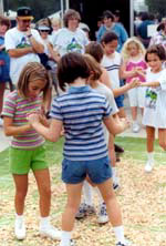
“Dancing the Shrimp” at La Fete.
Kerry St. Pé, our program director, continues to maintain some sense of sanity amidst the growing momentum created by widespread confidence in a program dedicated to preserving and restoring a place loved by so many. He is currently absorbed by the dying salt marsh issue, answering questions from reporters and pondering calls from other agencies asking for our program to take a coordinating role in the response. Doing this with such a small, overloaded staff will not be an easy task. Repeatedly, we have felt a strong sense of being guided by a higher power. Are we being steered into fulfilling the potential of the program? We will see where we are led and try our best to rise to these challenges.
Today I have been answering phone calls and tending to contract details for a number of education and outreach projects our program funds. These include educator workshops such as WETMAAP (Wetlands Education Using Maps and Aerial Photography), a program originating from Chadron State College in Nebraska. Through this workshop, teachers learn a variety of map-reading skills, including interpretation of topographic maps, infrared vegetation signatures, and physical structures. Participants are also afforded an opportunity for intensive analysis of a specific site, through aerial photographs from three different time periods. The site we have chosen to focus on is Golden Meadow, so named for the ubiquitous goldenrod flower. Golden Meadow is located just inside the end of the southern-most hurricane protection levee on Bayou Lafourche, the town where many of the survivors of the hurricane of 1893 settled after the devastation of their Cheniere Caminada community. Teachers are encouraged to study and interpret the changes observed between 1956 and the present. What they observe is that what was once a continuous carpet of marsh between Golden Meadow and the gulf has now been reduced to a vestige of the former cover, with gaping holes of open water resembling a skeletonized leaf. The changes are striking and they sound a warning call that residents of this community may soon be forced once again to abandon their roots and run for their lives to the north.
Our program has produced and is producing many educational products, including an award-winning documentary by local filmmaker Glen Pitre entitled Haunted Waters, Fragile Lands. Relying heavily on historical footage, Mr. Pitre relates the story of how this land was sacrificed, through clear-cutting of our vast stands of enormous virgin bald cypress trees, to the excavati
on of major navigation channels and the leveeing of the Mississippi River to feed the American Dream. This video was followed by a sequel, Rescuing the Treasure, also by Mr. Pitre, which outlines some of our restoration efforts. Contrasting these early productions with our most recent video, America’s Vanishing Treasure, by Craig Gautreaux, one can see the evolution of our response to the dilemma of land loss. What began as a characterization and analysis of the problem has given way to a much more serious tone. America’s Vanishing Treasure is a grave warning that without the help of the nation, the marshes, the swamps, the habitat, the seafood, and the rich culture of this estuary will disappear into the Gulf of Mexico. It is a warning that this treasure, which we call Barataria-Terrebonne, could be lost forever.

