
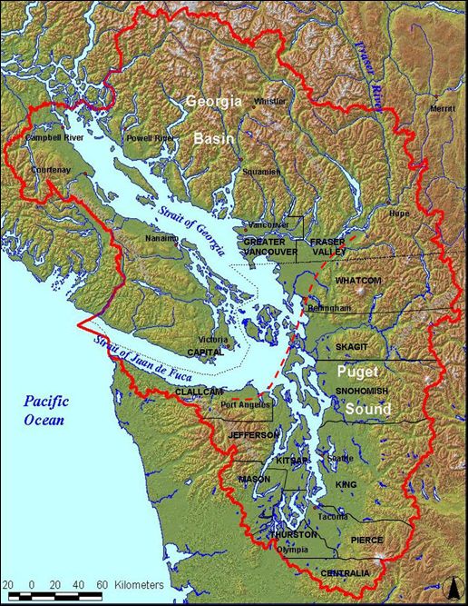
Starting today, I’ll be spending three days at the Puget Sound Georgia Basin Ecosystem Conference learning about the health — or perhaps un-health — of the Salish Sea, a term that refers to waters in both Washington state and British Columbia, including the Puget Sound, the Strait of Georgia, and the Strait of Juan de Fuca (see map at right).
Co-hosted by the Puget Sound Partnership and Environment Canada, this biennial conference is touted as the largest and most comprehensive scientific research and policy event in the region. Those attending include scientists, policymakers, Coast Salish Tribes and First Nations, biz folk, educators, and concerned citizens.
I’ll be sitting in on sessions about climate change, citizen science, and the future of tidal energy in the Puget Sound; listening to keynote speeches from tribal leaders and Gov. Chris Gregoire (D); hobnobbing with fishy folks; and generally reveling in the marine biology nerdyness of it all. I promise to report back regularly on what I learn while I’m there, wifi-permitting.
