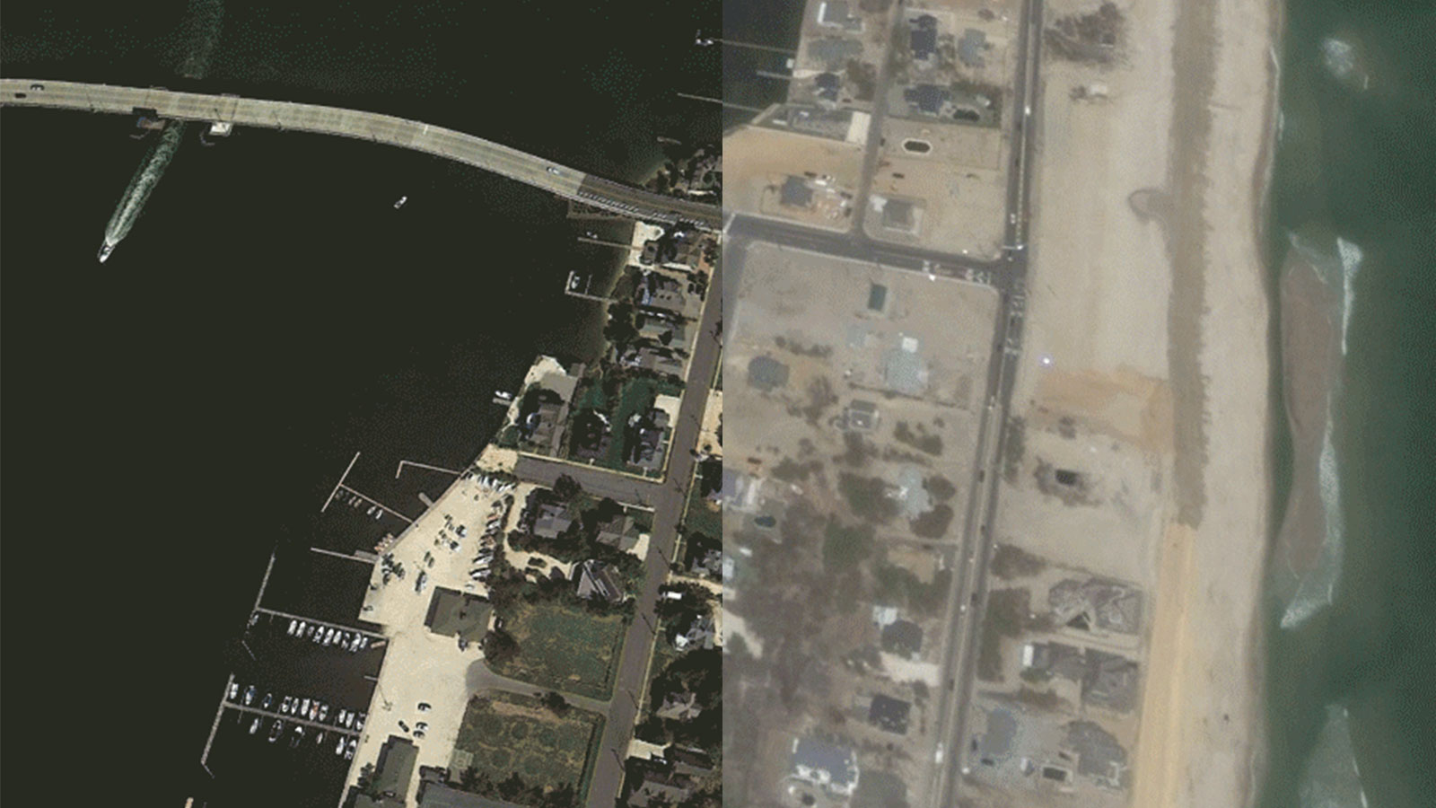
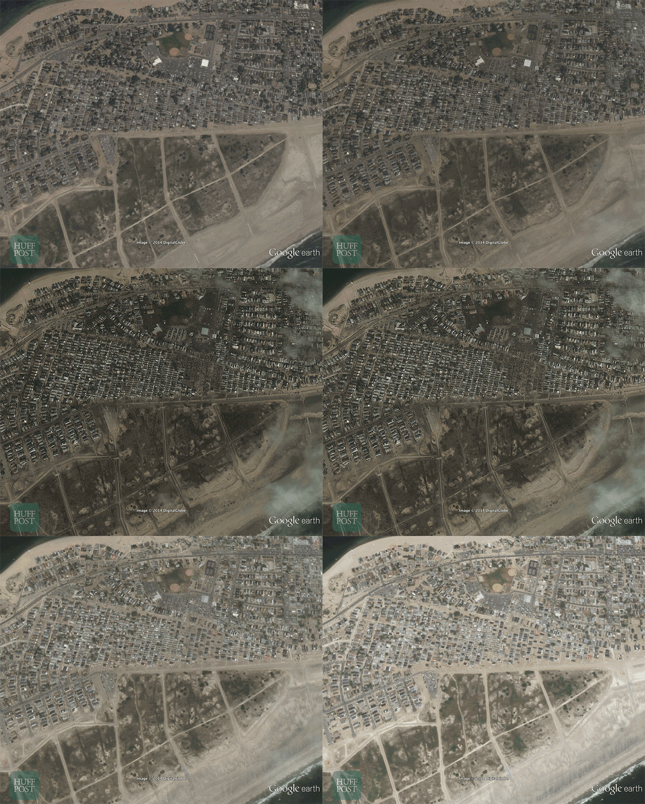
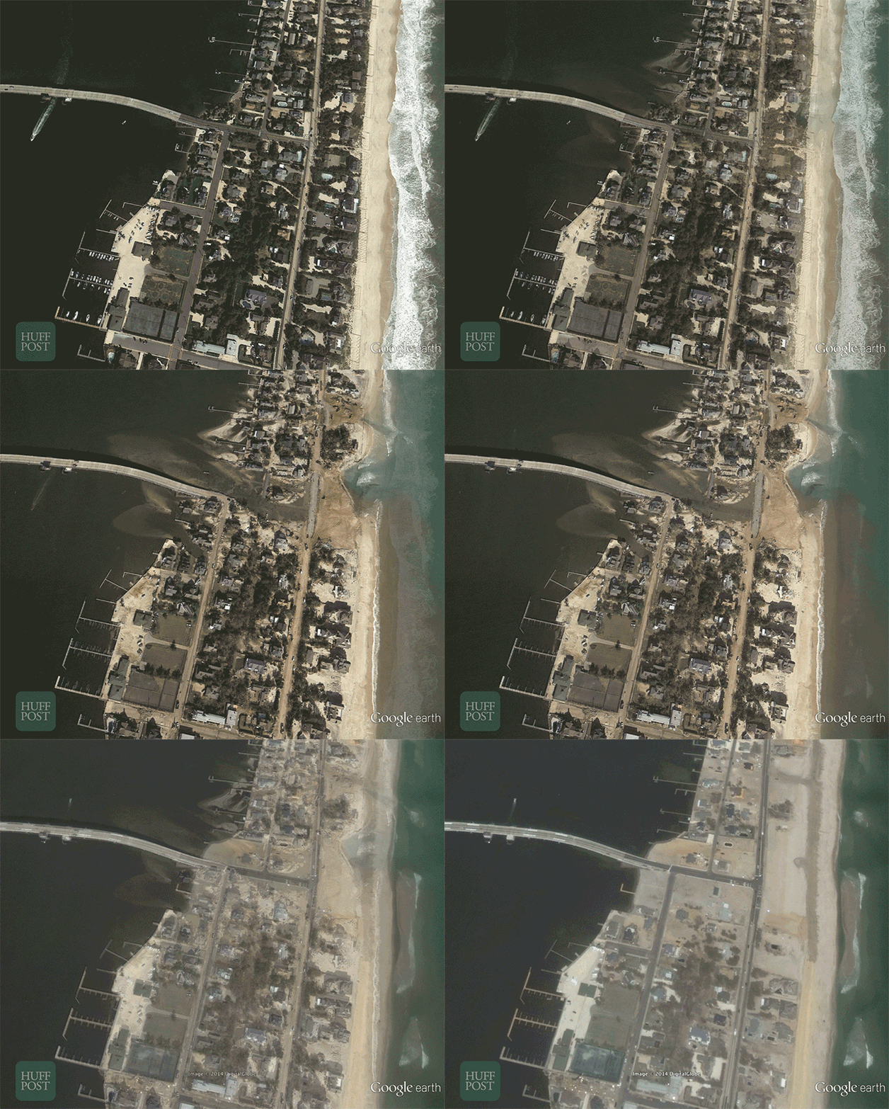
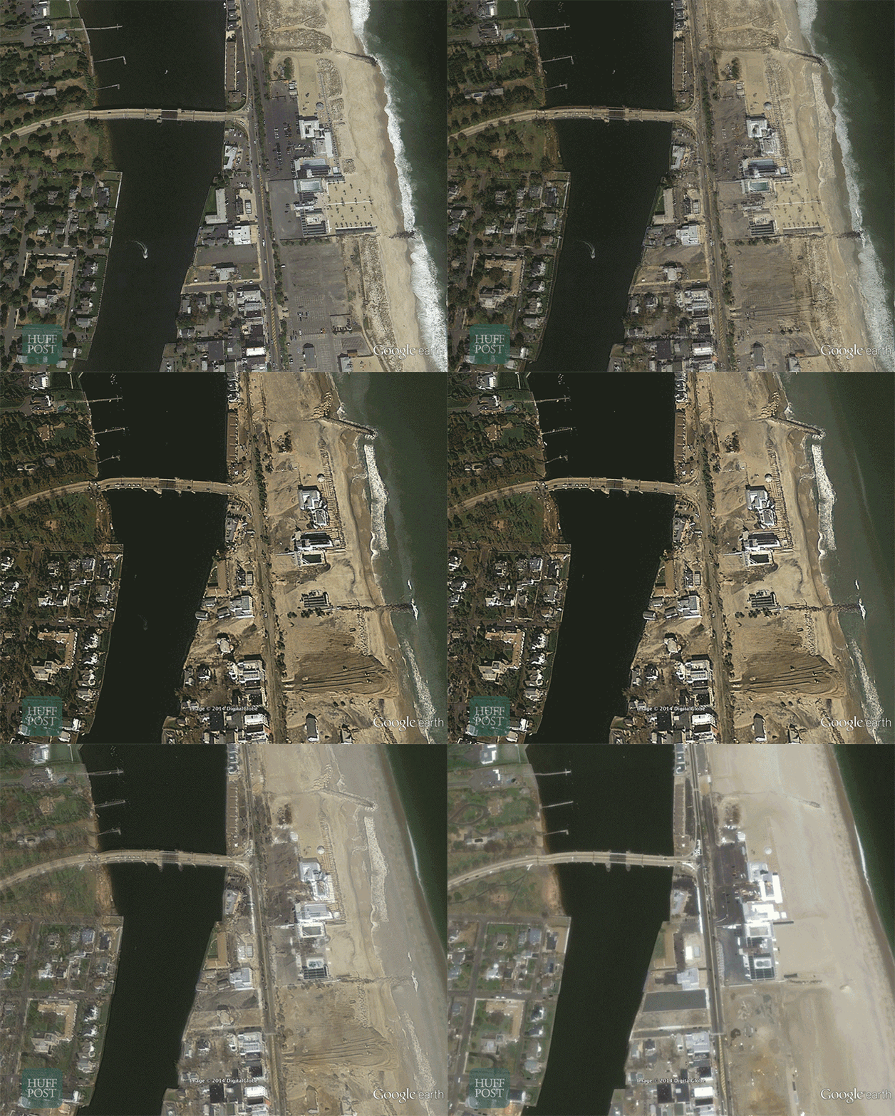
In the wake of Hurricane Sandy two years ago, shocking photos showed the huge extent of the destruction caused by the storm. Only days after the storm struck, before and after satellite images from Google revealed the widespread damage to coastal areas of New York and New Jersey. Last year, before-and-after photos showed progress but still a lot of work to be done.
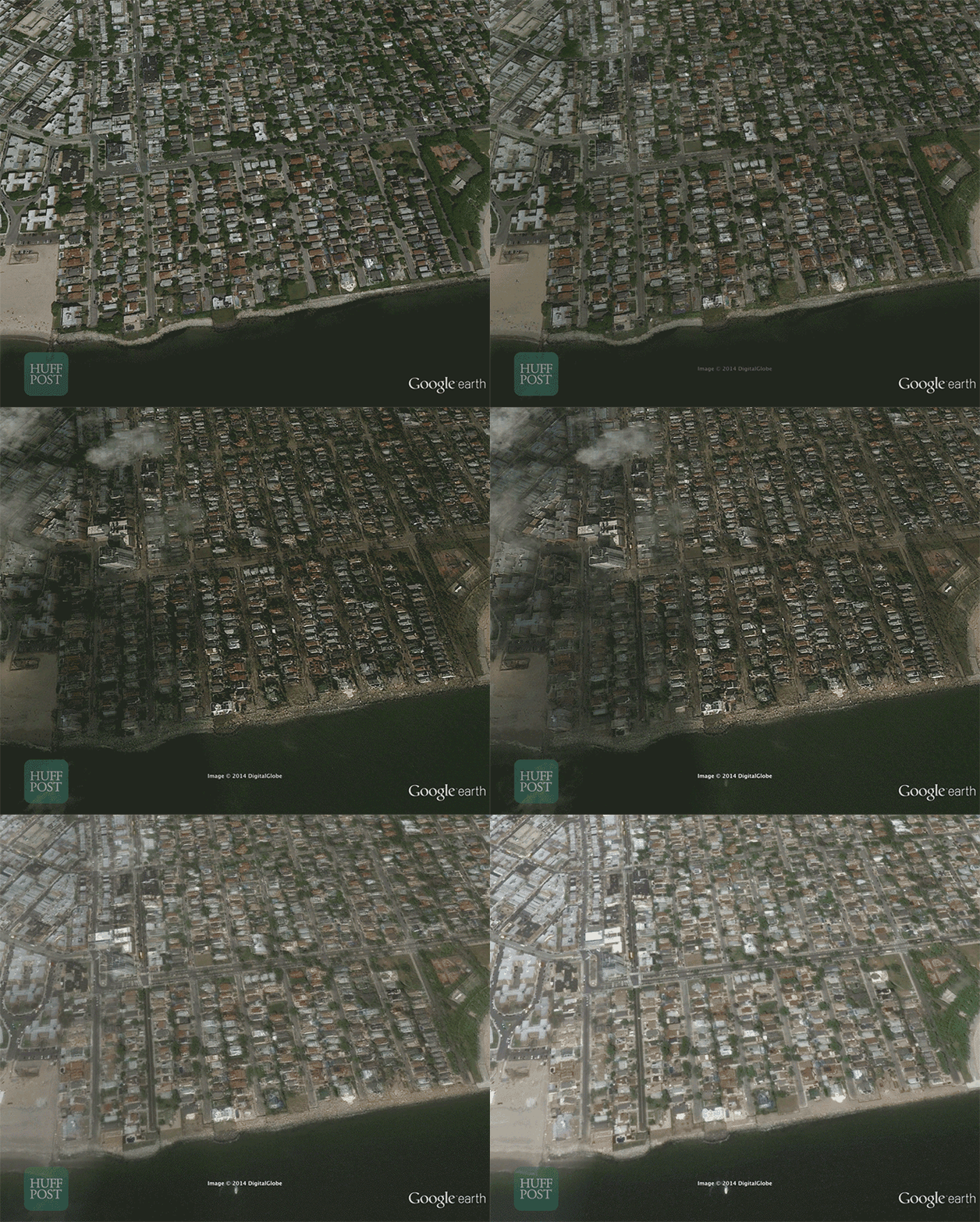
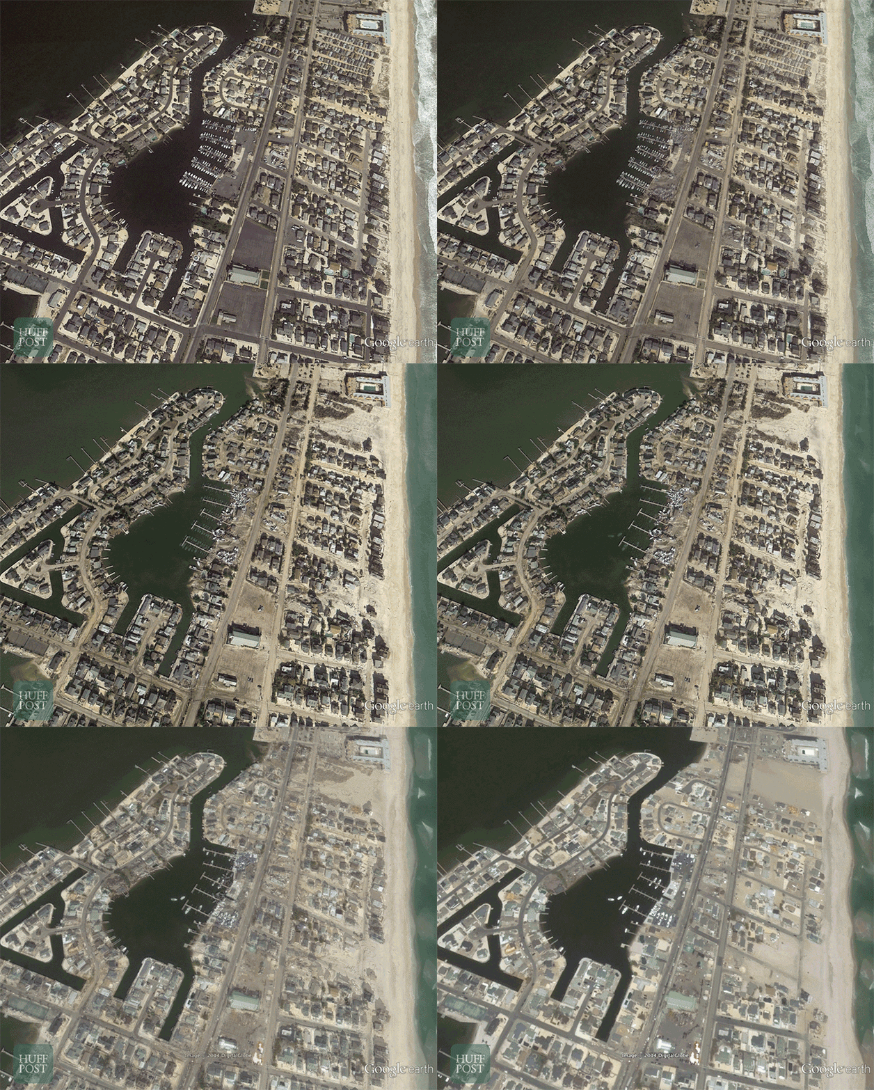
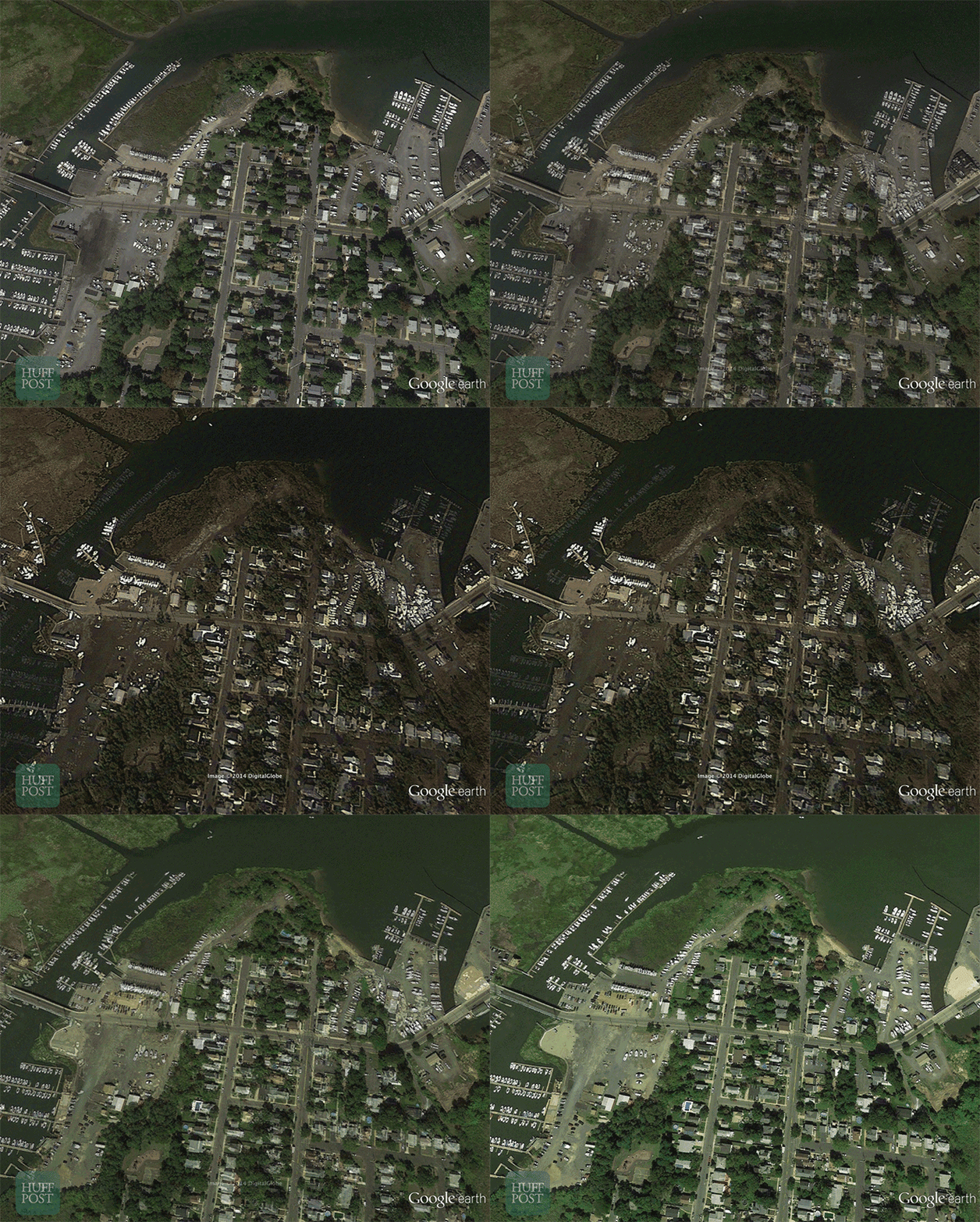
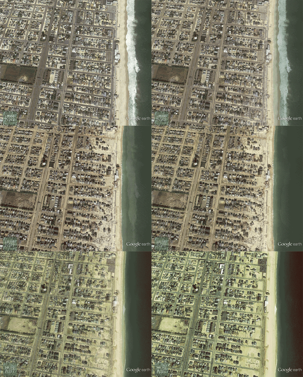
This Wednesday marks the second anniversary of the storm, and we hope to again capture the progress that has been made rebuilding in New York and New Jersey. The following GIFs show pre-Sandy satellite images, followed by immediately post-Sandy images and finally what the shoreline looks like in the most recent satellite photos.
Hurricane Sandy is estimated to have caused $65 billion in damages in the United States and was responsible for the deaths of 182 people. Efforts to rebuild and prepare for future storms are still ongoing.
Far Rockaway, N.Y. July 18, 2011 – Nov. 1, 2012 – July 1, 2014
Mantoloking, N.J. Sept. 20, 2010 – Nov. 3, 2012 – April 24, 2014
Sea Bright, N.J. Sept. 20, 2010 – Nov. 1, 2012 – April 4, 2014
Manhattan Beach, N.Y. June 17, 2010 – Nov. 5, 2012 – July 1, 2014
Normandy Beach, N.J. Sept. 20, 2010 – Nov. 3, 2012 – April 4, 2014
Keyport, N.J. Sept. 20, 2010 – Nov. 1, 2012 – Sept. 6, 2013
Seaside Heights, N.J. Sept. 20, 2010 – Nov. 3, 2012 – Sept. 6, 2013
 This story was produced by The Huffington Post as part of the Climate Desk collaboration.

