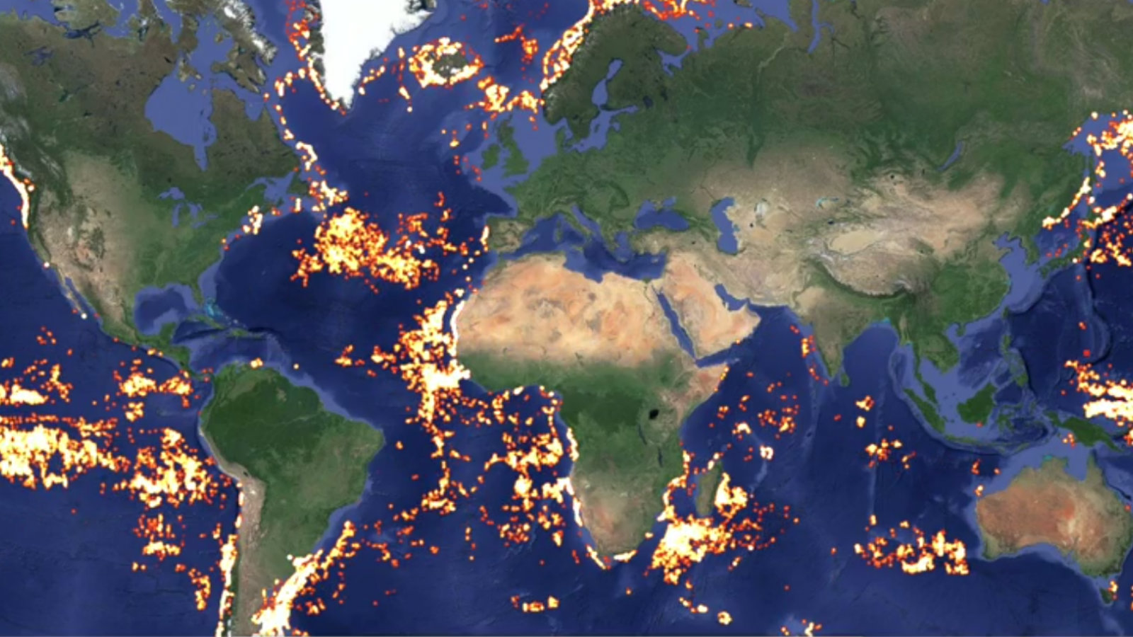
We’ve written before how the best tools to fight overfishing at sea may be found in the skies — but this past Wednesday, proof-of-concept came in the form of a satellite-tracked map of all the journeys made by 25,000 large vessels between 2012 and 2013. (Three thousand of those could be verified as fishing vessels; the other 22,000 seemed to show fishing behavior, but otherwise played their cards too close to the chest to call.)
The system is called Global Fishing Watch, and it was developed by our favorite eye-in-the-sky watchdog SkyTruth, developed and utilized by ocean-hugger nonprofit Oceana, with technical support from Google. Those are some heavy hitters to throw their weight behind the problem of illegal fishing — and they could actually make a difference. Here’s Wired‘s take:
Although the system currently displays voyages from nearly a year ago, “the plan is that we will build out a public release version that will have near-real-time data,” said Jackie Savitz, Oceana’s VP for U.S. oceans. “Then you’ll actually be able to see someone out there fishing within hours to days,” fast enough to act on the information if the fishing is happening illegally, such as in a marine protected area.
Here are the nuts and bolts: Large boats at sea are required to declare their positions by an automatic identification system, whose signals can be picked up by satellite. By feeding all these IDs and movements through some (read: a lot of very complicated) analysis, the Fishing Watch system can identify fishing boats. And, by omission, those boats who do not claim to be fishing but nevertheless behave as though they are.
So now we’re one step closer to catching fish criminals red-herring-handed.


