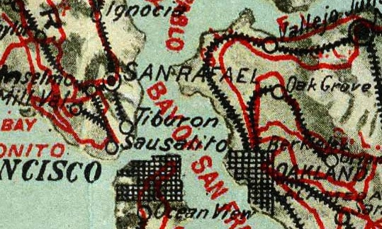
Big Map Blog has turned up a fantastically detailed map of California's bike routes in the 1890s. It was published by George W. Blum and endorsed by H.F. Wynne, the president of the California Cycling Club in 1895. Mr. Blum was based, it seems, in San Francisco, and that's where the map is centered.
It shows that more than a century ago, cyclists could follow bike roads from the Bay Area, up to Sacramento, down to Los Angeles, or out to Yosemite, on trails rated "good, fair, poor, or very poor" and "level, rolling, hilly, or mountainous." The map advises cyclists that if they want to ride down the coast, they'll likely face P. H. conditions (poor and hilly), and if they're headed to the mountains, a F.H. path can quickly turn into a P.M.
One of the most fun features of the map, though, is its border, which features advertisements from bike shops around San Francisco and gives a sense of late 19th-century bike culture. In San Jose, the California bike league's official hotel, the St. James, offered cyclists as much a dollar off its regular nightly rates. The Park Cyclery boasts of a "Large Riding School," and shops like the Columbus Buggy Co. and the Overman Wheel Co. offer name-brand bikes like the Columbus, the Spalding, the Credena, and the Victor (“the most reliable of all bicycles”). Those looking for bicycle clothing could visit Thos. E. Kent, whose ad features a dapper, mustachioed man who looks uncannily like a dude I saw riding a fixie in Williamsburg last weekend.


