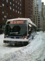
pbumpA New York City bus, stuck during a 2010 blizzard
It’s going to snow on the East Coast tomorrow, lasting overnight until Saturday. That much is known and agreed upon.
The following points are up for debate.
How much snow will there be?
Boston’s mayor, Thomas Menino, held a press conference this morning, canceling school and suggesting that people not be on the roads after noon. At that time, the city will be in a state of snow emergency. Why? Because of this:
That blizzard could dump two feet of snow on the city — perhaps as much as 30 inches. Or, according to one report: over four feet.
New York, meanwhile, could see an equal amount. Or it could see three inches. Gawker explains the discrepancy:
Right now, American (GFS) computer models are predicting a few inches of snow for much of the tri-state: a little over two inches for New York City; under an inch for much of New Jersey. Some of it might be rain. The sky-water is expected to start falling Thursday night through Friday morning, but the the brunt of the storm probably won’t hit until late Friday night. …
The European model, like a European model, is much more intimidating (and mean). According to the ECMWF (European Center for Medium range Weather Forecasting — boring name; brainstorm improvements while trapped in your home this weekend), the amount of snow in New York could reach over a foot by Saturday evening (about 15 inches). The European model is generally considered by meteorologists to be the most accurate (it was the first to accurately predict the track of Hurricane Sandy).
So the answer to the question above is: We’ll see.
http://www.newslook.com/videos/541018-winter-storm-nemo-heads-for-northeast
Does the storm have a name?
If you work in the marketing department at the Weather Channel, your answer to this will be an emphatic “yes.” The network has declared the storm to be “Nemo,” after the terrifying submarine captain in that old book, or maybe the terrifying clownfish in that newer movie.
Others, like Time TV critic James Poniewozik, don’t embrace the idea.
If this blizzard manages to popularize the Weather Channel naming system, it will be the most disastrous winter storm of all time
— James Poniewozik (@poniewozik) February 7, 2013
What’s the scariest part of the National Weather Service’s blizzard alert?
Well, of all of the words in the alert, it’s probably this section:
VERY STRONG WINDS UP TO HURRICANE FORCE ARE POSSIBLE FRIDAY NIGHT INTO SATURDAY. THIS MAY RESULT IN SIGNIFICANT DAMAGE ALONG WITH BLIZZARD CONDITIONS FOR A TIME. SCATTERED POWER OUTAGES ARE A POSSIBILITY.
Why is this storm happening?
(This issue isn’t actually up for debate.)
The Capital Weather Gang explains:
The cause of the storm is the explosive combination of two weather disturbances.
“A strong northern stream system will translate its energy to a southern stream low coming up the coast,” says [Wes Junker, the Gang’s winter weather expert]. “The latter will pull lots of moisture northward setting the stage for a major blizzard for the northeast as the low bombs out and slows off the New England coast.”
Is this a climate-change-related thing?
We can’t attribute specific weather events to climate change. It is the case that a warmer atmosphere results in more energy and stronger systems, and that incidents of heavy precipitation have increased over the past 60 years.
Will everyone who is still affected by Hurricane Sandy be OK?
God, I hope so.