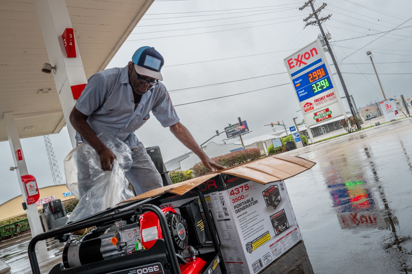
Hurricane Francine barreled into southern Louisiana on Wednesday as a Category 2 storm, packing 100 mph winds and sending a surge of water into coastal communities. Because so much of southern Louisiana sits at or below sea level, the surge could race inland unimpeded. The last hurricane to hit the state was Ida in 2021, which unleashed a catastrophic storm surge and caused $75 billion in damages and killed 55 people.
“Storm surge is really a nasty, nasty thing,” said Brian McNoldy, a hurricane researcher at the University of Miami. “It’s hurricane winds essentially bulldozing the ocean onto land. It doesn’t have anywhere else to go.”
The Gulf Coast’s storm surge problem will only get worse from here, scientists warn, because of colliding phenomena. Climate change is supercharging hurricanes as well as raising sea levels, and the coastline along Louisiana and Texas is sinking in some places, a process known as subsidence.
With every little bit of elevation lost, sea level rise and storm surges grow more severe, yet forecasts have long neglected subsidence because researchers lacked the data. That could mean some parts of the Gulf Coast are underestimating the potential damage. Louisiana’s coastal parishes already have lost more than 2,000 square miles of land between 1932 to 2016 to sea level rise and subsidence. The state’s wetlands act as a natural buffer against storm surges, but the ecosystems could be nearing collapse.
Warmer waters in the Gulf of Mexico have helped turn Francine into a fearsome cyclone. A hurricane is like an atmospheric engine. Its fuel is warm ocean water, which evaporates and sends energy into the sky. If the wind conditions are right, the storm will spin up and march across the sea. And if the water in its path is extra warm, the fuel is extra potent, allowing a hurricane to intensify into a monster. “They can start to grow very rapidly under very warm sea surface temperatures,” said Daniel Gilford, who studies hurricanes at Climate Central, a nonprofit research organization. “Almost like when your foot hits the accelerator and that fuel pours into your engine to ignite.”
The Gulf Coast is naturally warm because it heated up over the summer. But according to an analysis by Climate Central, as Francine formed, it was feeding on high ocean temperatures made at least 200 times more likely by climate change.
“What we’re seeing in the Atlantic and the Gulf of Mexico right now,” Gilford said, “is certainly an environment that is much more susceptible to stronger storms that spin faster and also carry a lot more moisture with them, which can lead to increased rainfall.” In general, a warmer atmosphere holds more moisture, meaning there’s more water for a given storm to wring out of the sky.
While that water is falling from above, the storm surge is pushing water in from the side. The stronger the winds, the bigger the storm surge. That’s happening on top of the base layer of additional sea level rise brought by climate change. “So if the sea levels, just on average, are higher than the built environment is prepared to handle, that can increase the amount of flooding that is associated with these storms,” Gilford said.
At the same time, communities are reckoning with subsidence, as parts of the Gulf Coast are steadily losing elevation. Subsidence happens when people extract too much groundwater, oil, or gas, causing the earth to crumple like an empty water bottle. It also happens naturally when sediments settle over time. (Beyond the consideration of sea level rise, subsidence can destabilize roads, levees, and other critical infrastructure.)
In a paper published last week in the Journal of Geophysical Research: Earth Surface, scientists used radar measurements from satellites to quantify subsidence across the Gulf Coast, from Corpus Christi to New Orleans, finding that parts are sinking by more than half an inch a year. That may not sound like much, but that’s happening year after year — just as sea levels are steadily rising. Accordingly, the researchers concluded that the subsidence will significantly increase the risk of hurricane-induced floods in the future.
The rate of subsidence is far from uniform, though: Some places along the Gulf Coast, like Galveston County in Texas and New Orleans in Louisiana, are rapidly sinking while others are staying put. That makes subsidence a difficult problem to reckon with, since state agencies need precise data to determine the risk that a given stretch of coastline faces. They can’t get a complete picture of how much land they’ll lose to sea level rise — and how bad storm surges will get — if they aren’t accounting for the subsidence happening at the same time.
“Once that land surface is lost,” said Ann Jingyi Chen, a geophysicist at the University of Texas at Austin and co-author of the paper, “and the buildings, the trees, the structures will be lost, that actually loses some of the protective barriers, so the storm surge can move further inland.”
Chen’s analysis found that cities that stopped over-extracting groundwater saw their subsidence pretty much stop. And with more radar data, scientists can incorporate subsidence rates into models of storm surges, helping find problem areas and take action to reduce the sinking. Any little bit of avoided subsidence will make storm surges like Francine’s that much less severe. “For planning purposes,” Chen said, “it’s good to know, so we don’t wait until it is too late.”
A message from
Your support keeps our climate news free.
Grist is the only award-winning newsroom focused on exploring equitable solutions to climate change. It’s vital reporting made entirely possible by loyal readers like you.
At Grist, we don’t believe in paywalls. Instead, we rely on our readers to pitch in what they can so that we can continue bringing you our solution-based climate news. Donate today to keep our site free.