This article was published in partnership with The Marshall Project, a nonprofit news organization covering the U.S. criminal justice system. Sign up for their newsletters here.

Additional reporting by Geoff Hing.

Alt text: A fence with razor wire stands outside Corcoran State Prison in California in March 2023, and an unseen incarcerated man named Ajamu, who has been behind bars for over a decade, says: “The flooding situation, it makes no sense. I don't see a sense of urgency.”
Ajamu, a Black man, is pictured in a busy laundry room, and says his supervisor told him: “They’re going to have to make arrangements to evacuate you guys soon.”
As incarcerated people fold clothes, the supervisor continues: “This used to be all water, so it is inevitable that the water is gonna get closer and closer and closer” and “They don’t have enough of whatever they need to help raise those levees and stop it.”
Out in the prison yard, incarcerated people talk, and Ajamu says, “We don’t actually know what’s going on. We don’t see water.”
As groups of men talk at a table, reading news reports on tablets from places such as Tulare, Stratford and Visalia, Ajamu says, “We only see what’s going on on the news. But you see these different places, and you don’t know where they're at.”
As incarcerated people mill about in a common area of a two-tiered prison block, Ajamu says, “Those of us who believe in a higher power, we’re gonna pray. There’s nothing else we can do.”
An aerial view of the Corcoran prison and the adjacent Substance Abuse Treatment Facility shows floodwaters from the lake growing, and Ajamu says, “That’s the scary part — we’ll never know until it happens.”
Over the winter, storms had battered the state. A bar chart shows the extreme precipitation of 27 inches from October 2022 to September 2023, surpassing recent years when there had been a drought by as much as 20 inches.
A chart in the shape of a mountain shows historic snowpack in the Sierra Nevadas 250-300% of average. The water flowed down to fill the dry lakebed where the two prisons stood for decades.
A front-end loader sits on a levee that protects the prisons and the city of Corcoran, and residents and officials worried about what would happen if it was breached.
Scenes of cars in flooded roads and silhouettes of wildland firefighters against a backdrop ablaze, as hundreds of other facilities across the U.S. face similar risks, with climate change promising more disaster.
An aerial map of the two-prison complex in Corcoran that’s home to 8,000 people. It was exempted from environmental law when it was first built in the lakebed.
An aerial map shows the proximity of the floodwaters to the complex, highlighting the state’s decision decades ago to build the prisons in a lakebed.
Black-colored wave-like brush strokes.
A black-colored box details that The Marshall Project spoke with a dozen incarcerated people and dozens of prisoners’ loved ones, residents, officials, farmers and experts as well as reviewed emails and state documents to report this story.

A series of flooding scenes, depicting floods and the square miles they covered, including 131 square miles in 1969, 130 in 1983, 50 in 1997 and 178 in 2023. An unseen ecologist named Rob Hansen says, “I don’t consider any of these floods to be floods.”
Hansen says, “We call it flooding because we took it over to put farms on it. But it’s a lake bottom, and lakes have water in them,” between two pictures that show farmland dry and under water.
Hansen, a White man with white hair and glasses, says, “It was just a haphazard series of events that led to the mess we’re in now.”

Black-colored wave-like brush strokes.
In 1984, lake bottom still full, Corcoran was hurting. A series of images depicts economic conditions, including 46% school enrollment and a boy sitting at a desk; a 28-35% unemployment rate and a line of workers; and a man reading a sign taped to a door that reads “$32 million in lost city revenue."
A state prison building boom presented a permanent lifeline. A line chart that looks like a chain-link fence with barbed wire depicts the increase in the number of prisons opened per decade from the 1960s to the 1990s.
A White woman with dark brown hair and a red shirt named Jeanette Todd says, “The Central Valley and other poor areas became perfect areas to establish prisons.”
Todd was then-managing editor of The Corcoran Journal in the mid-1980s, when community meetings were held about prison construction in Corcoran. Images show scenes at a meeting and an official, who is a White man, says, “The local economy would be given a boost.”
Scenes of attendees saying, “Corcoran could use the help,” “The farm economy is as bad as I’ve ever seen it. Corcoran needs another anchor,” “A state prison is a non-polluting, recession-proof industry.” Any anti-prison sentiment was drowned out.
Todd says, “We’ve always been a poor community, an ag-based community, an underserved community. Of course, they wanted it” alongside scenes of farmland and a harvesting machine, and a man of medium skin tone in a white ball cap leans against a tractor.
A citizen committee recommended three potential sites. The Department of Corrections chose the one in the lakebed alongside the Tule River. An image shows two sites outside the floodplain and one within it.
Then, the Department of Corrections convinced Corcoran and Kings County to request that the prison be exempt from state environmental law. A hand is seen taking notes on a document, and a man shows paperwork to another man while saying, “speed up this process.”
Government, citizen oversight and consultants warned against it. The comments warned of “a Pandora’s Box,” “potentially significant impacts,” “flooding,” and “subsidence.” Each quote comes from a stack of books and reports.
A hand is seen clicking a yes vote. The Legislature approved it. A vote total in the Assembly was 65-8 and in the Senate was 36-0.
he Corcoran prison broke ground in 1987, while other projects approved earlier were still in initial planning. A series of images depict scenes of a groundbreaking ceremony, construction and a finished prison.
In 1993, Corcoran courted the state for another prison — this one further into the floodplain on the same piece of land. The image shows the building outlines partially in the floodplain.
Black-colored wave-like brush strokes.
Since then, Corcoran’s unincarcerated population has doubled, while the populations of nearby towns have roughly tripled. A sign for Corcoran shows the population going from 6,454 in 1980 to 14,336 in 2020. A map shows nearby towns.
Today, the two prisons are Corcoran’s largest employers, ahead of agriculture. A series of images show guards at the Substance Abuse Treatment Facility, guards leading a prisoner at Corcoran Prison, and a worker sorting tomatoes at J.G. Boswell Company.
A map depicts Boswell parcels and the land it sold to the state for the prisons. When the Tule River broke its banks in March, Boswell’s fields were among the lake’s first casualties. A March 14 email from the state notes the potential impact to agricultural communities and the prison complex.
A series of panels show scenes of farm equipment, a house, and a car submerged; a man building a sandbag wall, another walking in knee-deep water and two people rowing a boat. As residents and officials scrambled, some accused Boswell of redirecting floodwaters to other farms and homes.
A group of elected officials sit at a table, flanked by a U.S. flag and a California state flag, at an emergency meeting of the Kings County Board of Supervisors on March 18, 2023.
A White man with gray hair named George Wurzel, the president and chief operating officer of the Boswell Company, tells supervisors, “We’re not maliciously trying to flood our neighbors” and “There isn’t anybody who cares more about the community of Corcoran than the Boswell family.”

A man of medium skin tone named William Oliveira says at a county supervisors meeting on March 28 that he doesn’t want prisoners to be flooded out, and adds, “I’m scared.” A scene as a pick-up truck drives along the water, and another of the prison in the distance.
A black box with words in white letters: Most residents of Corcoran and other lakebed towns felt much the same about the prisons today as they did in the 1980s. If the facilities closed, the lifeline they provided would vanish – but no one knew what a mass prison evacuation would look like.
George Wurzel, appearing at the April 4 supervisors meeting, says, “Getting that levee elevated is important to the community” and “Also, so we don’t have to move 8,000 inmates” - as a panel shows silhouettes of prisoners in a yard.

The flood district quickly ran out of the funds to fortify the levee. They wrote to the Corrections Department on April 25, pleading for more money. A sign reads “Road Closed” beside the levee. A bulldozer sits atop a hill near the water.
The State agreed to spend $17.2 million on the levee on May 11 following a visit from Governor Gavin Newsom. However, it added: “The state and federal government cannot continue stepping in to raise this levee.” Along the water, Newsom walks with three other people of various ethnicities and work attire. An Office of Emergency Services Advance Planning Update says there is a better outlook for the basin as water will only rise 186.3 feet, below the proposed 188 foot height of the levee.
A collection of scenes shows agricultural fields alongside rising water outside Corcoran. Rebuilding the sinking levee will be a continued burden.
On a backdrop of a path between two chain-link fences and a tower, the Corrections department said it was in “early, proactive and ongoing” communication with the state emergency office and developed an emergency plan in response to the flooding. The department also noted that the employees received training and the incarcerated population is kept informed of emergency measures. Emails show that Corrections shared its two-phase evacuation plan with the state over a month after the flooding began following the Sierra snowmelt. An image of an email from April 27, 2023 with the message: “Hi Don. Here is the high level evac plan.”
A stack of papers and folders lie stacked, slightly askew. Corrections’ emergency plans are deemed exempt from public records laws for security reasons. The state also blocked access to the environmental review for the first prison’s construction.
A watch tower rises above the top of a fence with razor wire.
“We never knew we were in any danger at all,” says an unseen incarcerated person named Greg, who has been at the Substance Abuse Treatment Facility for three-and-a-half years, in May. He says there was some talk of floods but that he and others at Corcoran are “kept in the dark.” A man with light skin tone and brown hair listens to a corrections officer in the yard at the facility. A group of incarcerated people lie on the ground beneath the purview of the officer.
A poll by a nonprofit prison reform group in California showed there are many like Greg. A chart with three bars representing wildfire, floods and heat show a majority of respondents don’t know of plans or procedures. Within the wildfire bar, a figure covers their face amid smoke. Within the flood bar, a person holds a box as a flood line creeps higher up their body. The figure in the heat bar sweats under a red glow.
For months, José Madrigal cobbled together pieces of information. “They did a big search and told us they are trying to make sure we only have six feet of property in case they need to evacuate,” he says in June. Inside Corcoran, corrections officers stand beside bunk beds wearing gloves. Madrigal, a man with medium-dark skin tone, a bald head and a medium-length black goatee sits on his bunk with his head down. “What if tomorrow we’re moving, what happens?” he asks.
By mid-June, the prison remained dry. Talk of evacuation evaporated. Water levels had peaked, according to the Department of Water Resources. Next to Corcoran, a high mound of shoreline sits above the water.
Concern turned from one climate threat to another. In July, summer heat plateaued over 100 degrees for weeks. A silhouetted figure sits in front of a wall with barbed wire. On the wall, a calendar shows only five days which were lower than 100 degrees.
The prisons’ evaporative coolers were no match for the high heat and humidity. A man of medium to dark skin tone looks at a wall thermostat as a bead of sweat rolls down his bald head. A cooler hangs above a room filled with people in prison uniforms sitting at tables.
Madrigal swats at a mosquito on the back of his neck. He says that because of all the water, they have lots of mosquitos and the little fans they have can’t combat the humidity. He holds a desktop fan close to his sweating face.
“This summer has been the worst yet,” he says. Lines emanating from a wide view of the Corcoran prison represent the heat.
Black-colored wave-like brush strokes.
“It’s very clear that people in prison are distinctly vulnerable,” says Emily Harris, Co-Director of Programs at the Ella Baker Center for Human Rights. Harris, a woman with long blonde hair and light skin tone, is an advisor on a report about climate hazards facing California prisons.
“A lot of the California prisons are located in remote areas, they have aging infrastructure, and a long history of overcrowding,” Harris says. A map of California shows black dots representing prisons throughout the state. Smoke and floodwaters border the map. The Department of Corrections says it has plans to deal with climate emergencies. And prison closures are based on mandated factors. However, those factors do not include environmental hazards or climate change.
“A lot of the planning puts an emphasis on security where incarcerated people are the hazard,” says Dr. Carlee Purdum, a woman with long brown hair and medium-light skin tone. Purdum studies emergency planning in prisons at Texas A&M.
A map of the United States highlights five states: California, Texas, Florida, North Carolina and Virginia, showing floods, fires and hurricanes over each region. These states have the most counties with high incarceration rates combined with high risk of environmental disaster. Purdum says the lack of transparency about disaster planning in prisons just adds to the stress and tension in a crisis. “If there’s no standard … how can you hold them accountable?” she asks.
A group of people wearing helmets and backpacks gather next to a cloud of smoke. Next to the scene, people pile sandbags alongside rising waters. A few people in both scenes are highlighted in yellow. California relies on incarcerated people to work the frontlines. Many emergency plans also detail how incarcerated people will be resources in disasters.
While the rest of the world logged its hottest summer on record, the heat at Corcoran was comparatively mild. Within the complex, people stand in the shadow of the prison building.
The flooding was slow, and by summer’s end, the reinforced Corcoran levee held. A slice of the landscape shows the lake water, the bare shoreline, grass and a construction crew from afar.
Dr. Daniel Swain, a man with short brown hair and light skin tone, who is a climate scientist at UCLA says, “We kind of threaded the needle in terms of severe snowmelt flooding this spring.” He says the water on the mountain is there, but that the area got lucky.
On August 4, the governor signed an executive order to release funding, in anticipation of another possible wet season due to the incoming El Niño climate cycle. Along the shoreline outside the Corcoran prison complex, a truck drives by with two people in the truck bed.
he effects of climate change overlay an aerial view of the California mountains near Corcoran. One label reads, “Warm atmosphere holds more water vapor,” another says, “More rain, less snow.” There’s no telling what impact another wet winter might have. Tulare Lake is expected to remain for the next year, or more.
A view inside of a cell with Ajamu sitting on a bed, saying: “But some of these prisons that are in the worst condition need to be closed, like these two Corcorans.”
silhouette of Ajamu sitting with his elbows on his knees, talking about how prisoners in Corcoran now know about the potential for flooding and the risk of climate change.

Illustrations and reporting by Susie Cagle. Cagle is a 2023 Alicia Patterson Foundation journalism fellow.

Citations


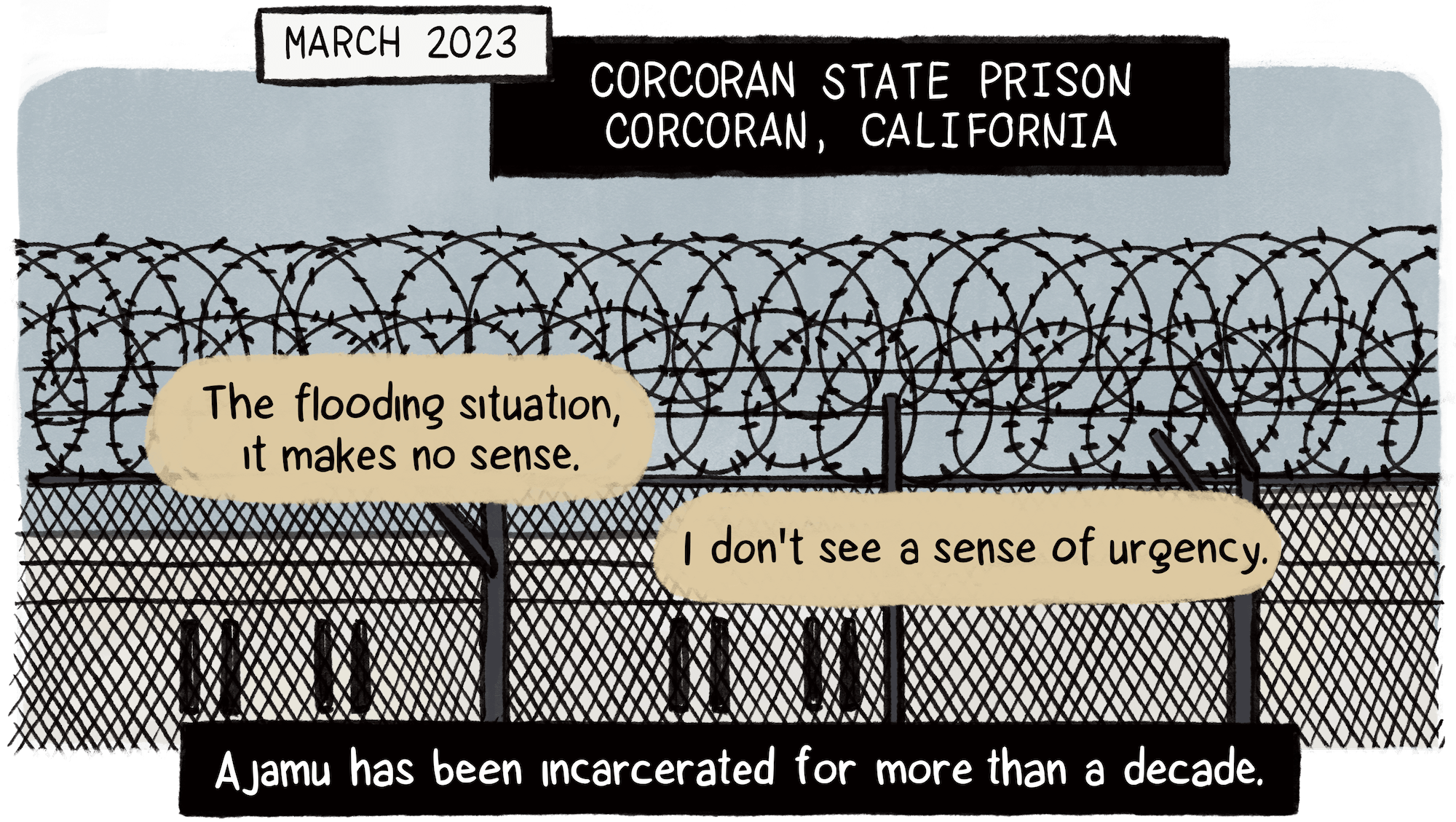
Ajamu spoke with TMP on the condition that his nickname, “Ajamu,” be used to identify him because he feared retribution for speaking out.

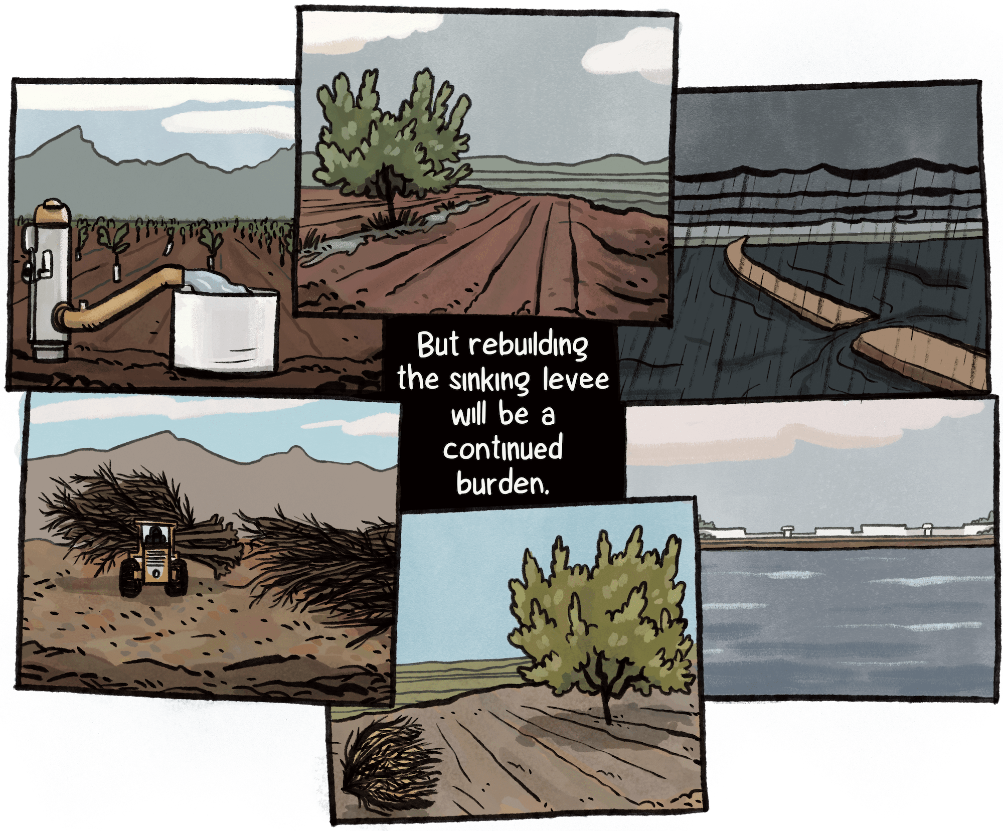
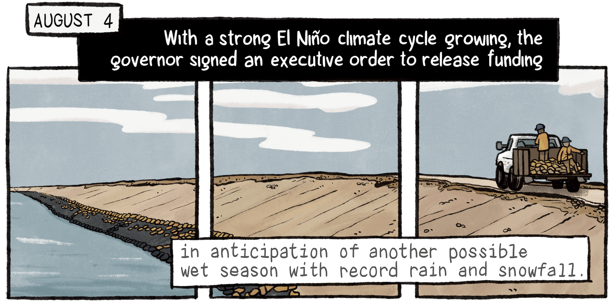
The landslide was stabilized by private contractors in the summer of 2022, but unprecedented flash flooding across eastern Kentucky on the morning of July 28 triggered the property’s second slide. While flooding is Kentucky’s most frequent and costly natural disaster, landslides — typically triggered by rainfall — follow close behind.

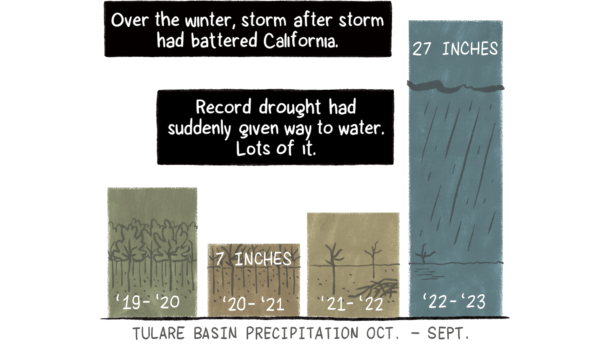
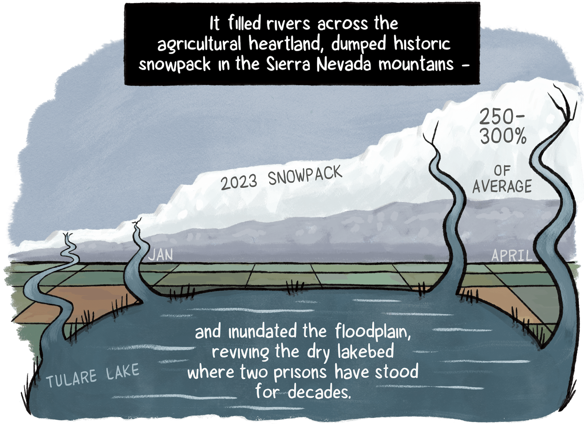
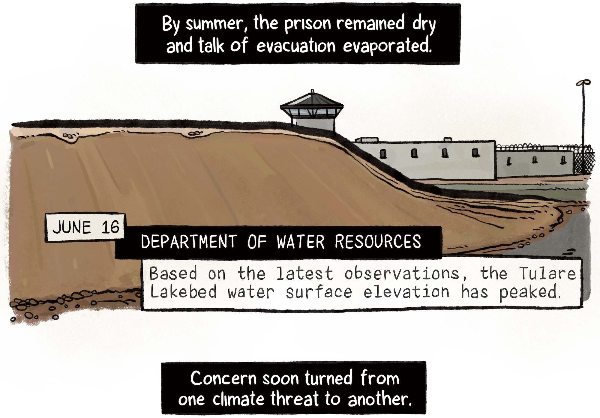
Precipitation and snowpack data from the California Department of Water Resources.

National analysis based on data from the Federal Emergency Management Agency and U.S. Census Bureau.

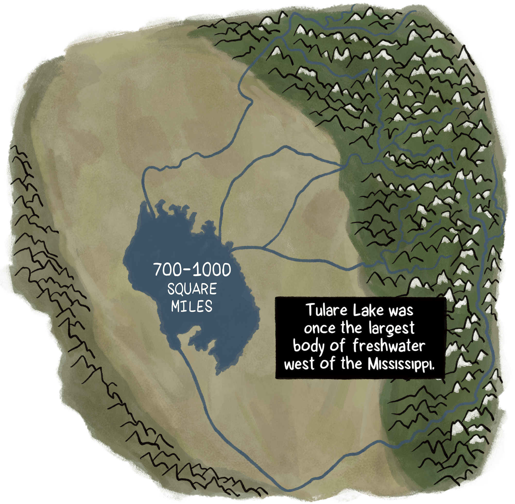
Floods and Droughts in the Tulare Lake Basin, by John T. Austin; Department of Water Resources.

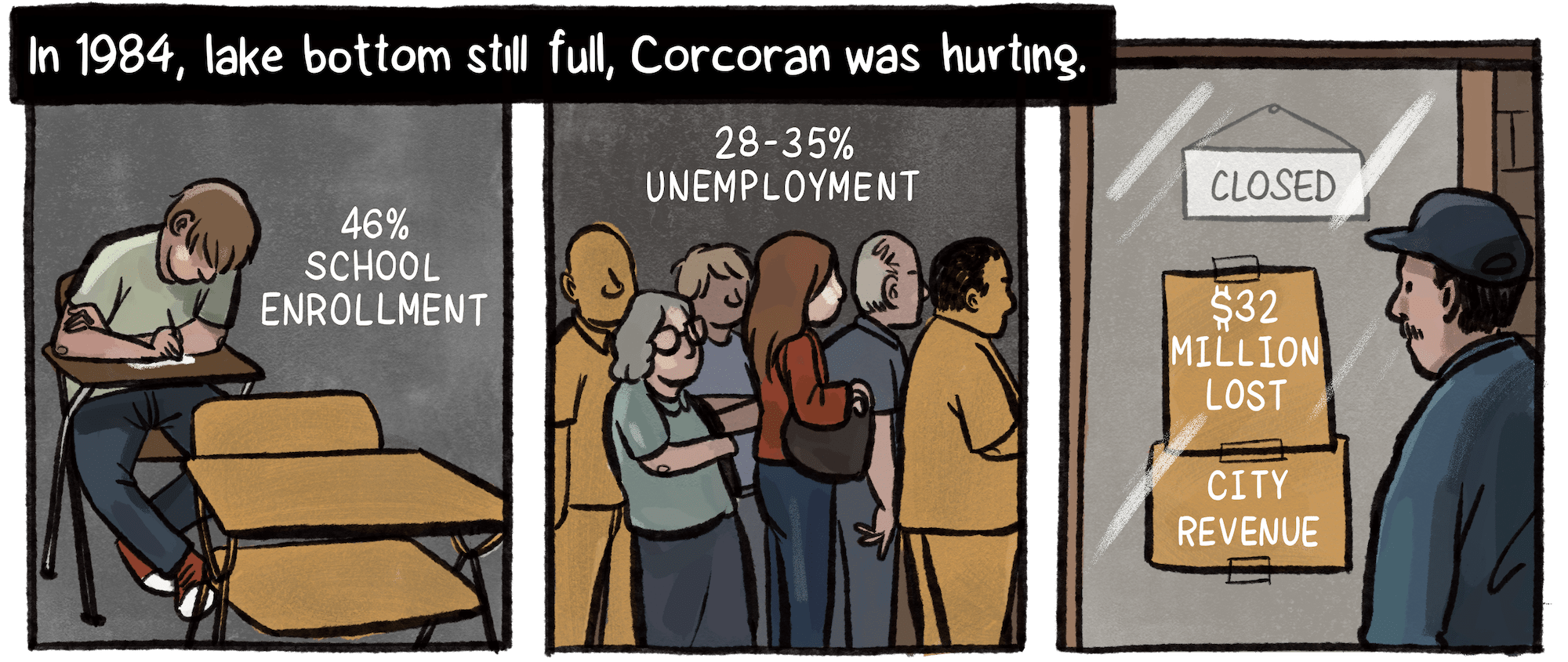
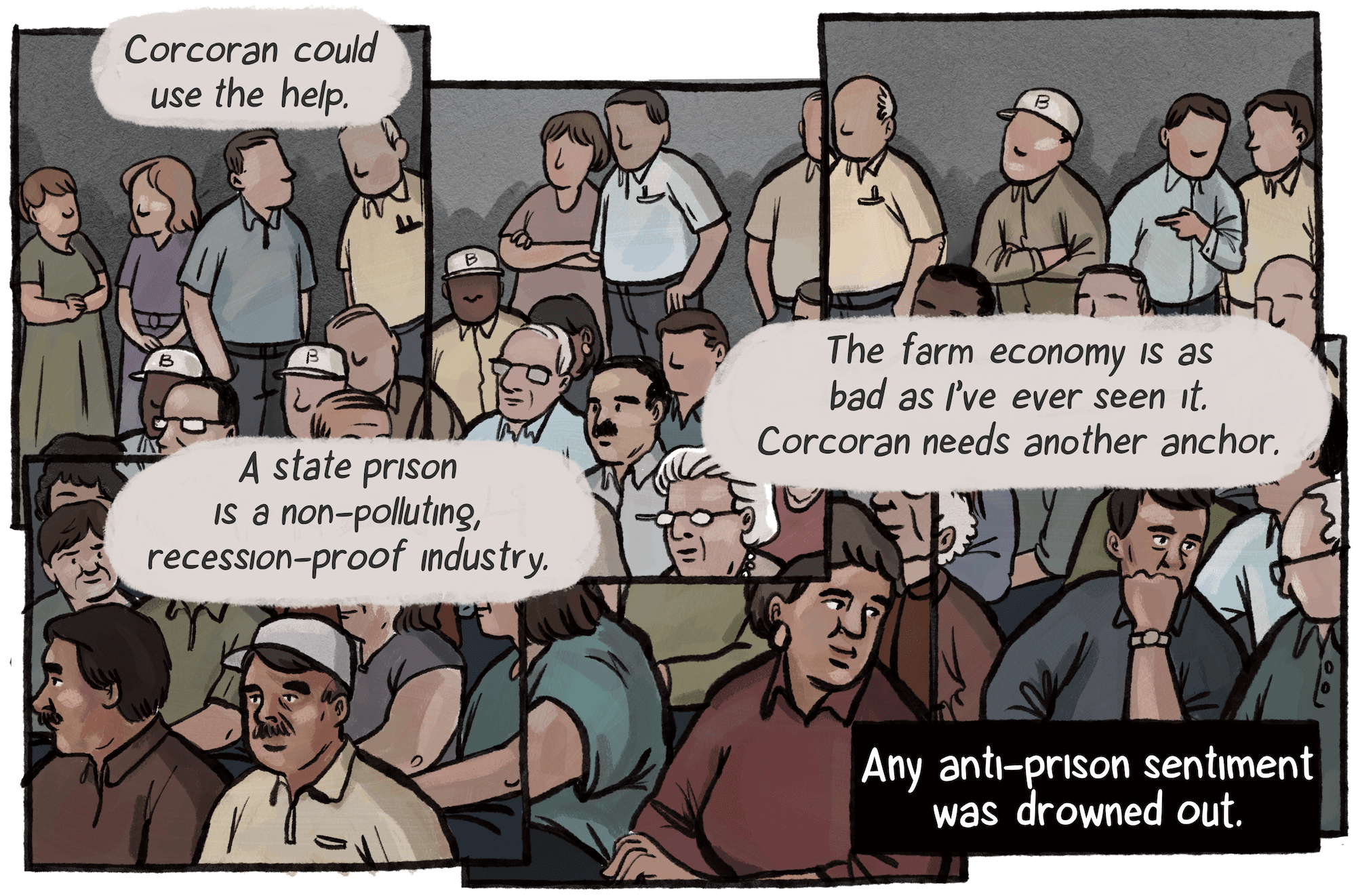
School enrollment data, Hanford Sentinel, October 17, 1984; unemployment and lost city revenue, April 26, 1986.

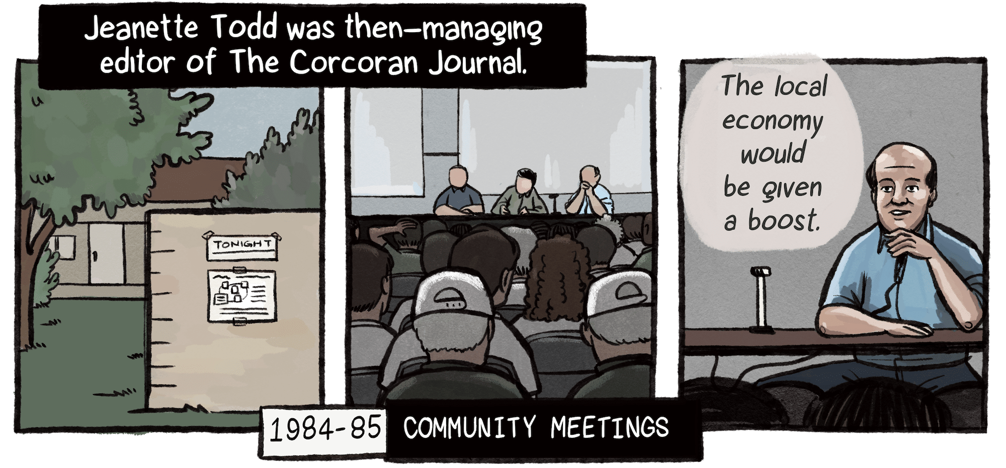
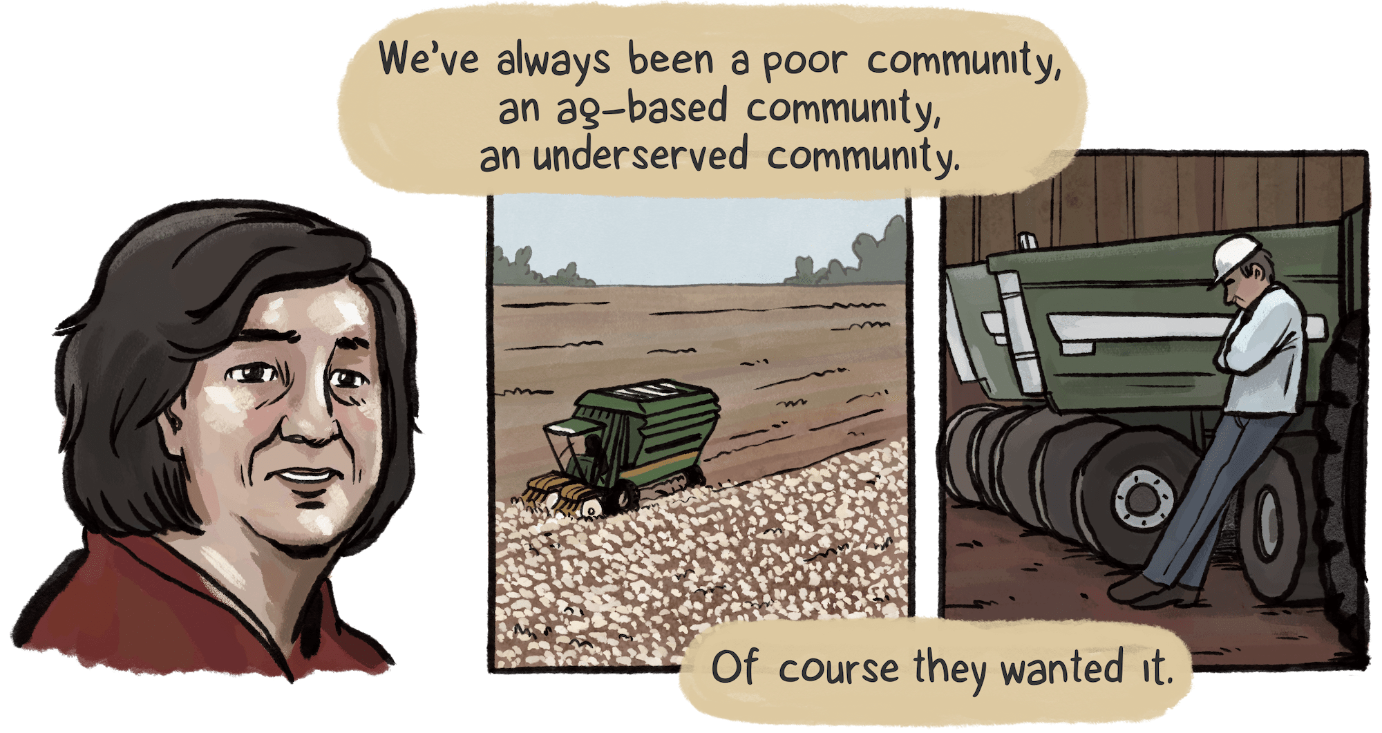
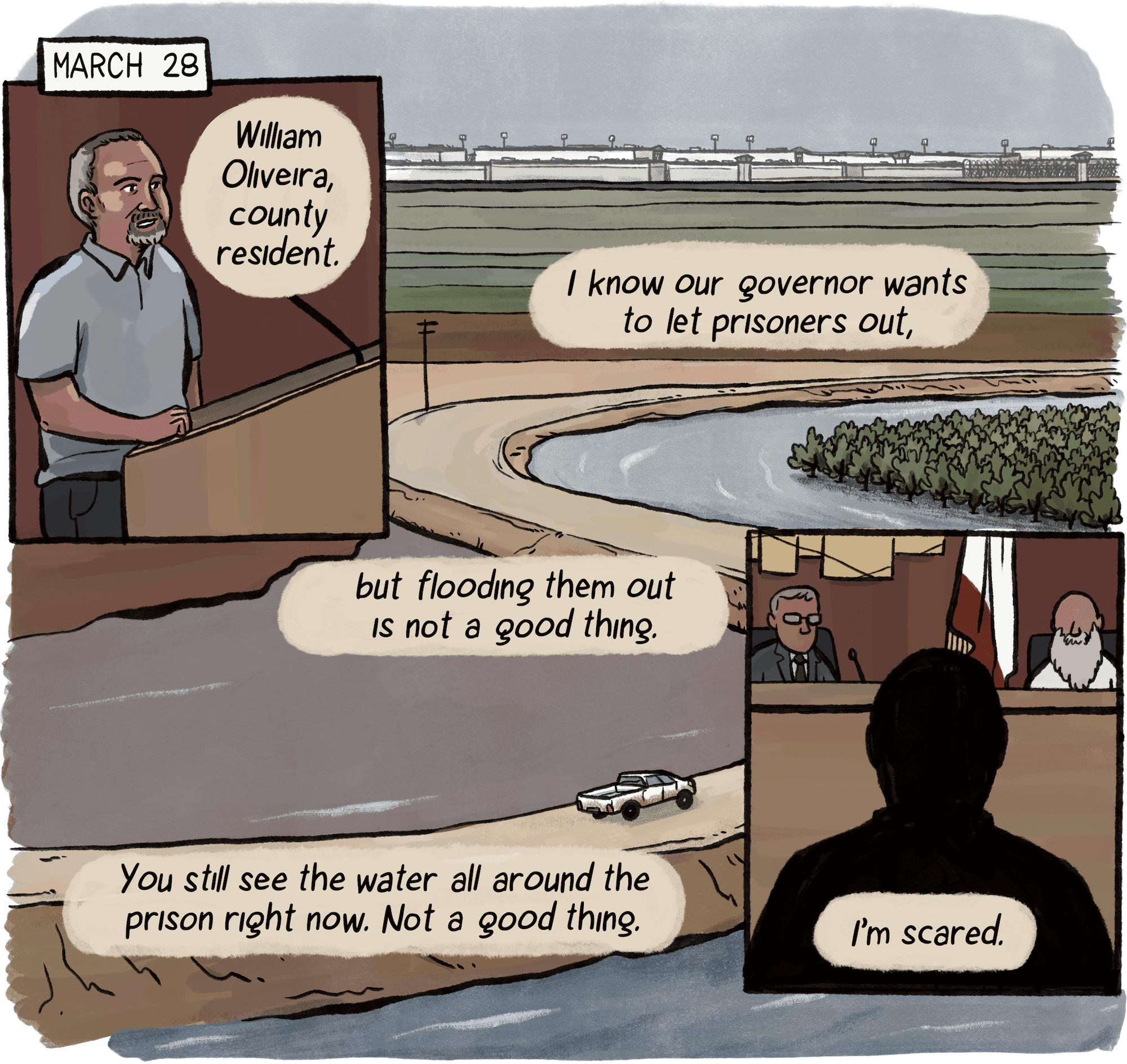
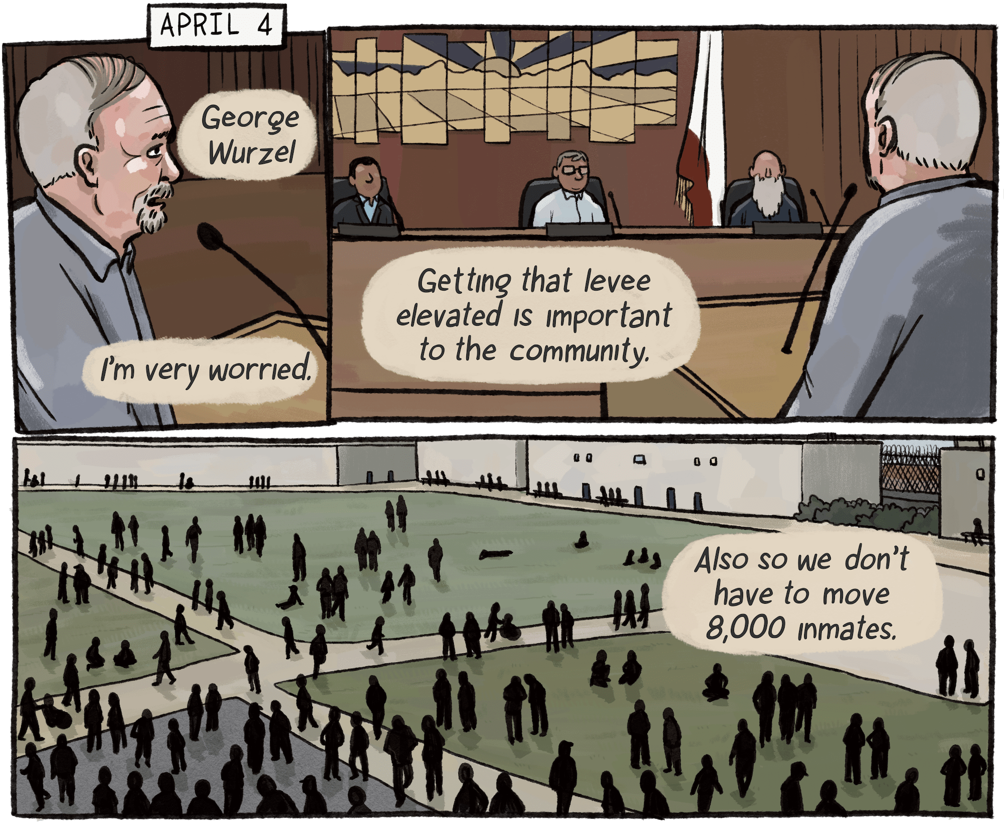
Residents and officials at local meetings were quoted in the Corcoran Journal and the Fresno Bee, from 1984 to 1986.

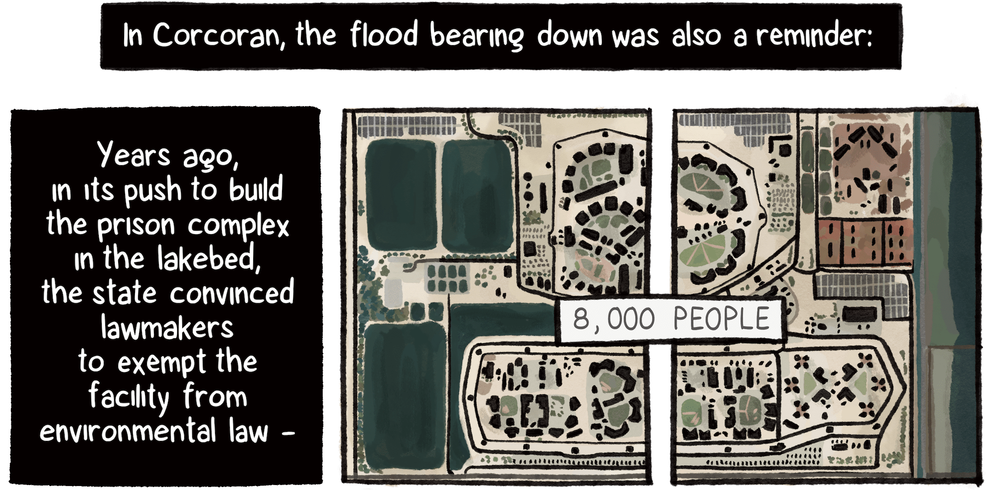
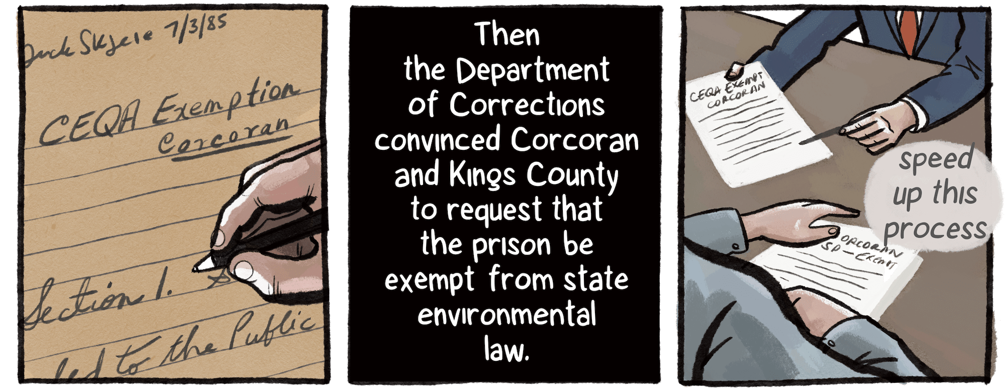
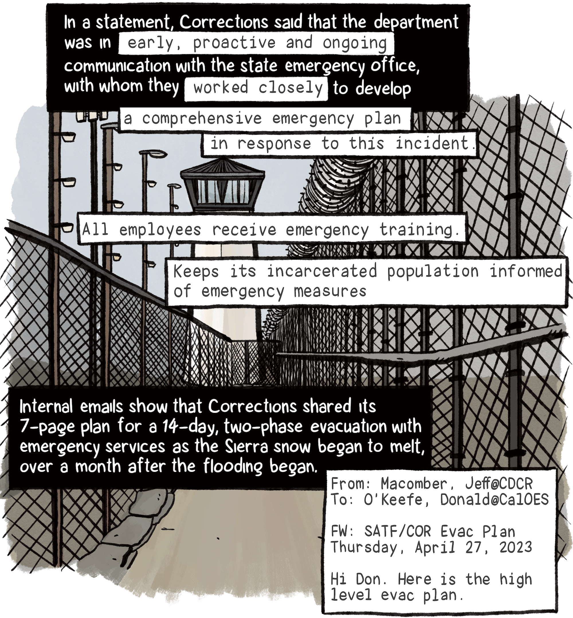
“CEQA Exemption-Corcoran” notes dated July 5, 1985, authored by attorney Dick Skjeie, held at state archives. “We are not seeking to avoid having environmental impact studies. But we are seeking to try to speed up this process,” said Gov. George Deukmejian on July 17, 1985, The Los Angeles Times.

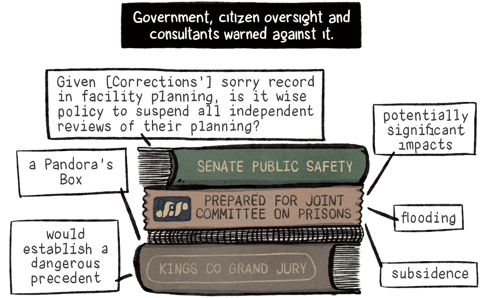
“A Pandora’s Box” and “would establish a dangerous precedent,” Kings County Grand Jury, June 13, 1985; “Given CDC’s sorry record in facility planning, is it wise policy to suspend all independent reviews of their planning?” Assembly Committee meeting notes on Senate Bill 146, August 26, 1985; “Potentially significant impacts,” “flooding,” “subsidence,” 1986 report by consultant firm Jones and Stokes assessing Corrections’ internal environmental review of the Corcoran project.

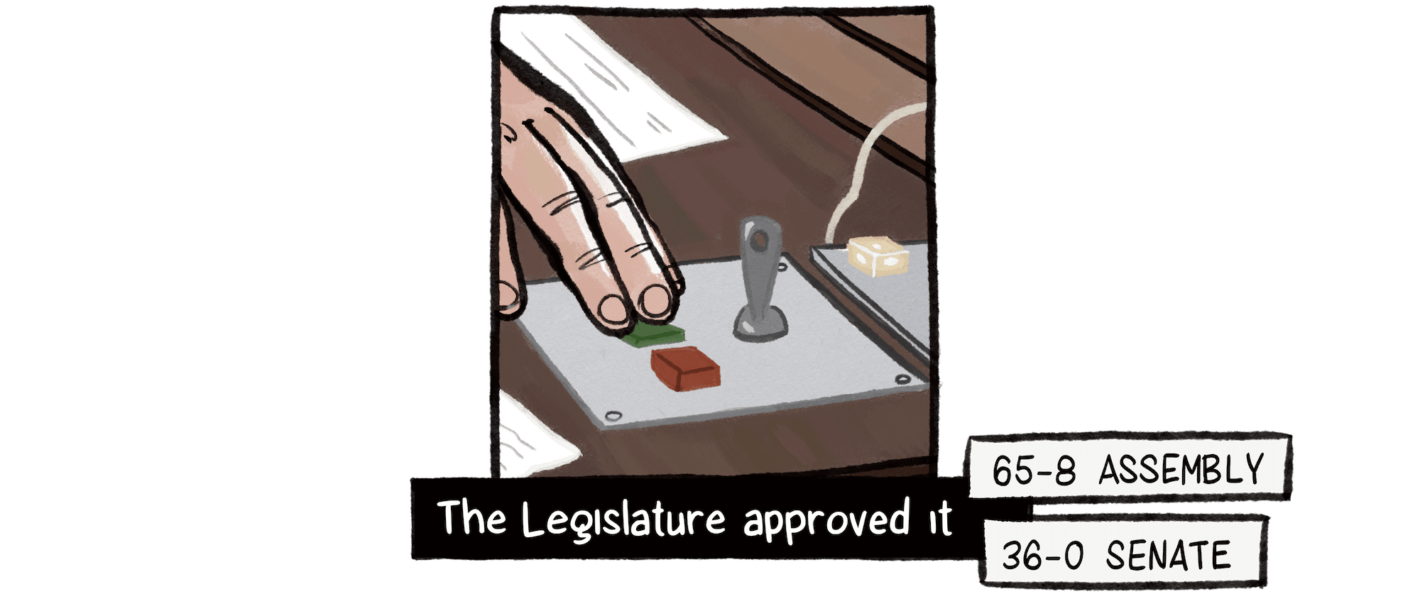
Vote count, McClatchy News Service, September 13, 1985.

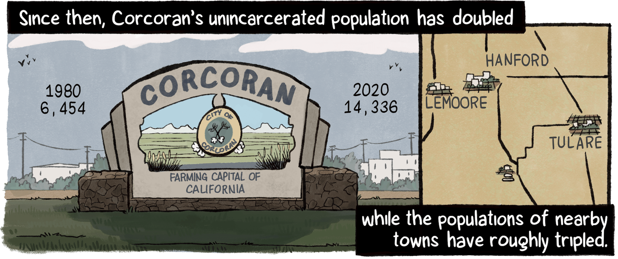
Population counts, 1980 and 2020, U.S. Census Bureau.

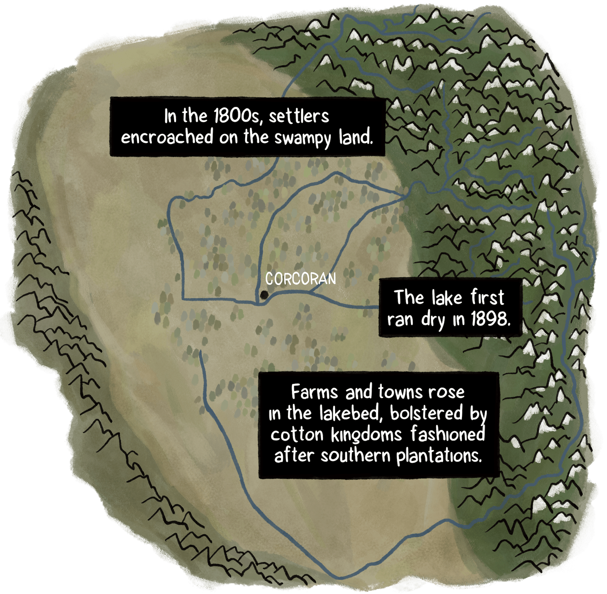
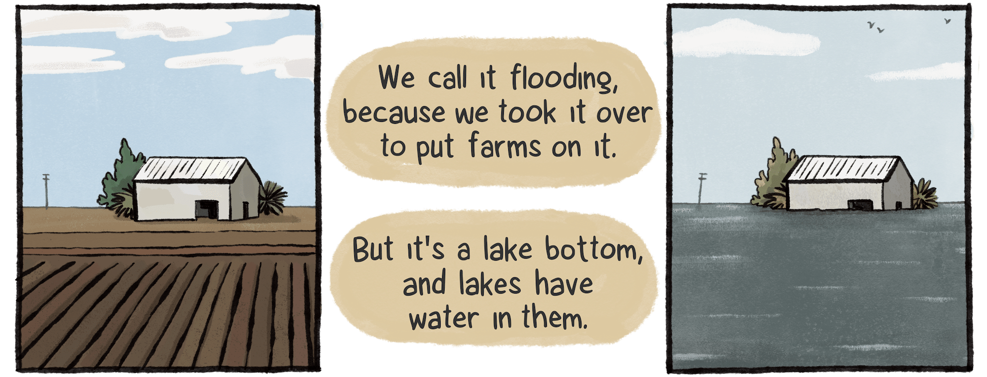
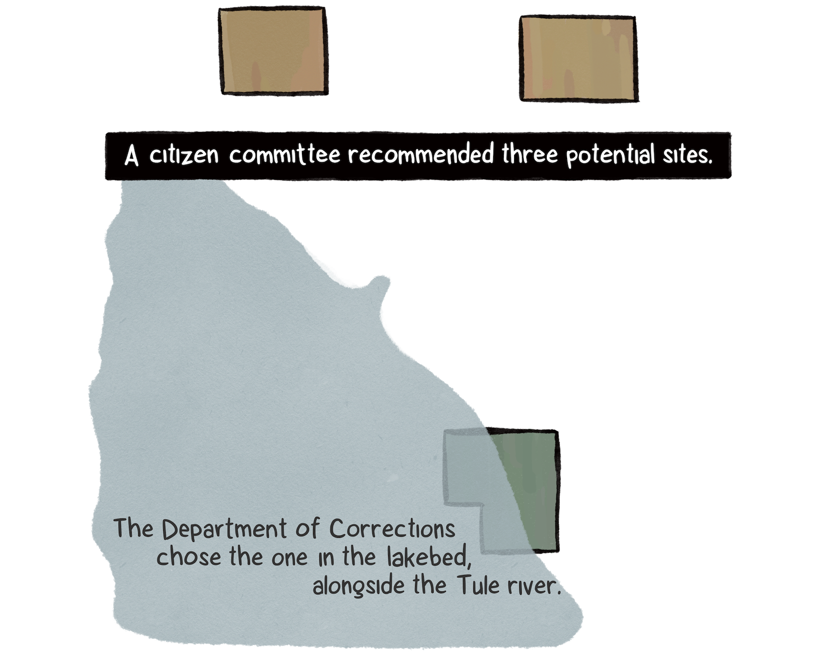
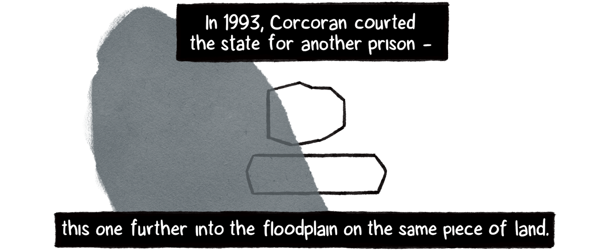
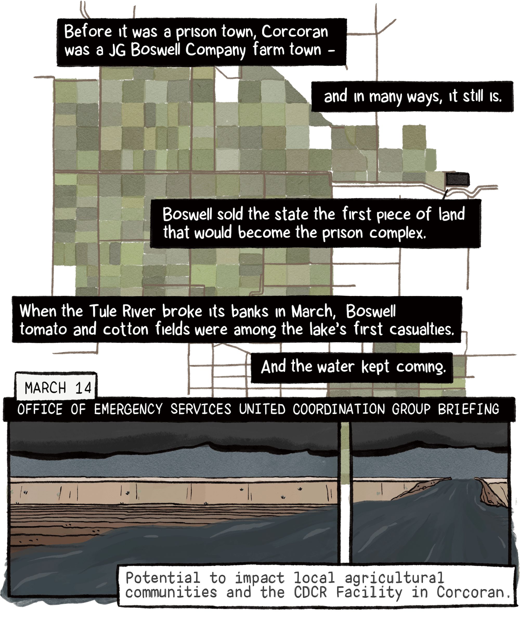
“In 1985, the CDC bought the least desirable of the three parcels from the J. G. Boswell Company,” Golden Gulag by Ruth Wilson Gilmore. Boswell land ownership data, ParcelQuest.

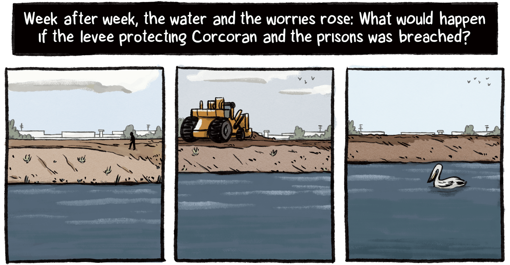
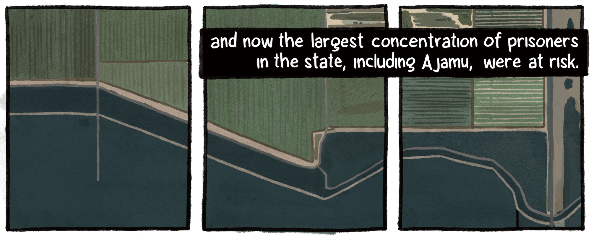
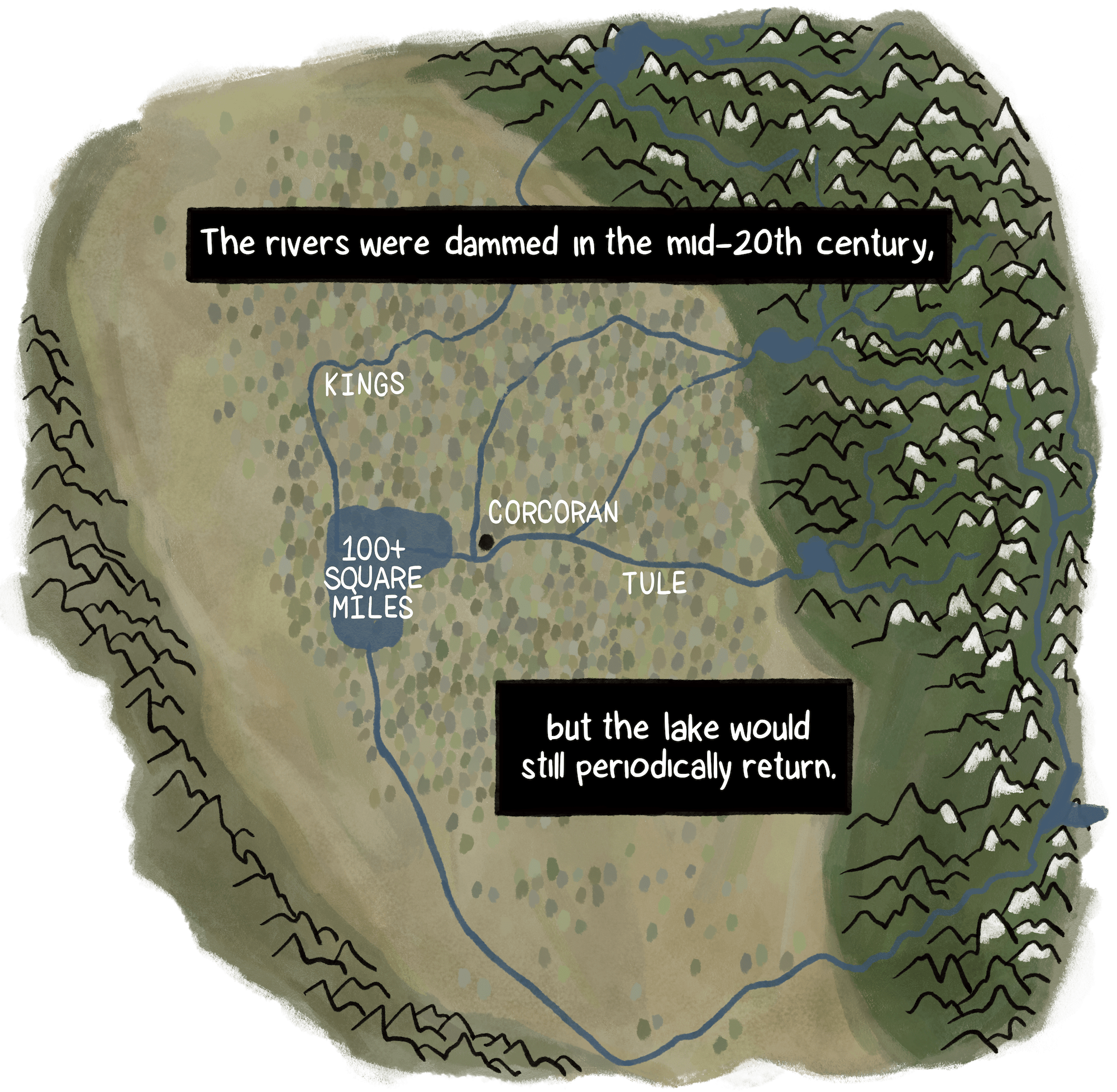
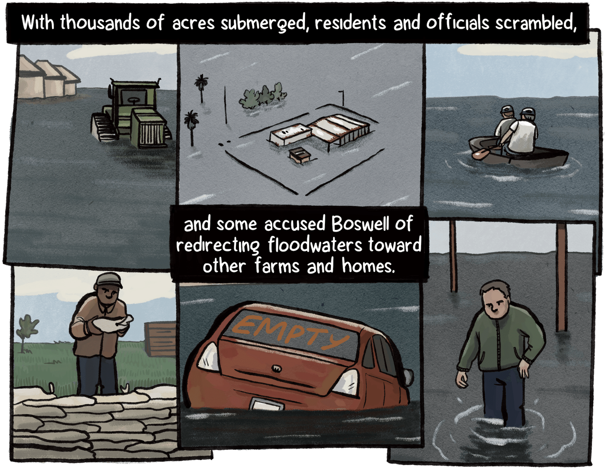
Mark Grewal, former Boswell Company VP, calculated the flooded acreage using local flood district maps and observations, estimating the lake grew 10,000 acres each week in the initial flood phase.

Repeated attempts to reach Boswell officials for comment went unanswered.

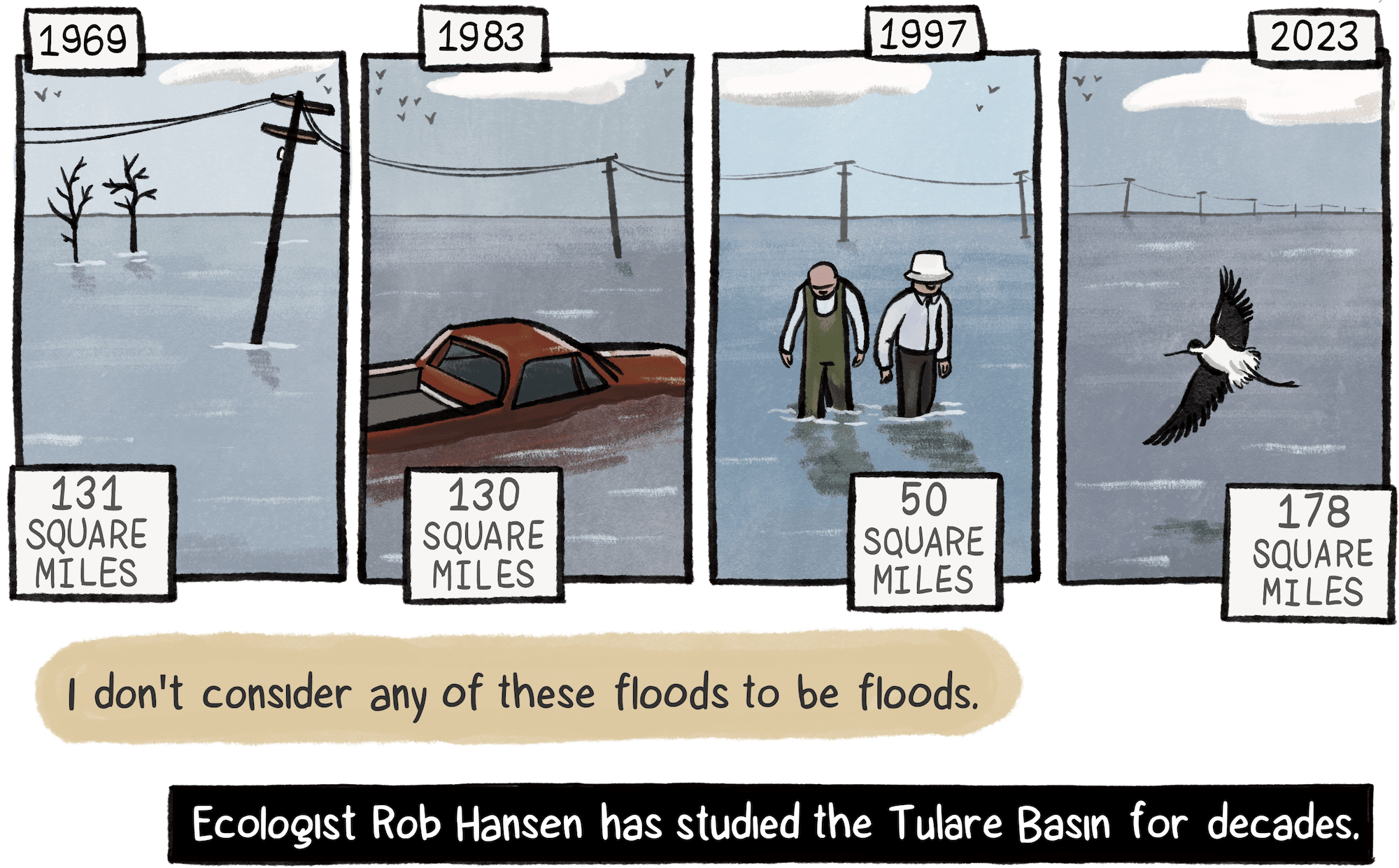
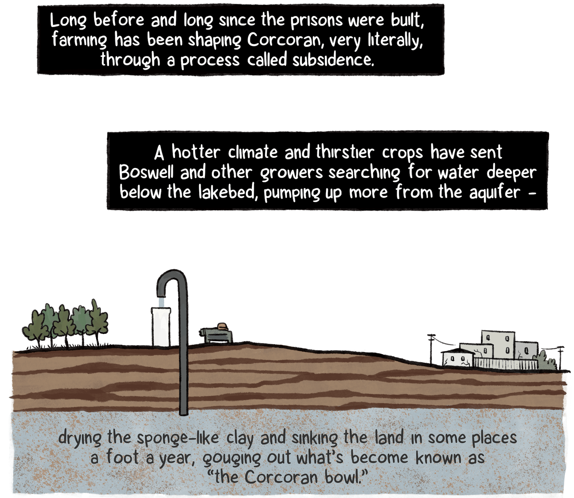
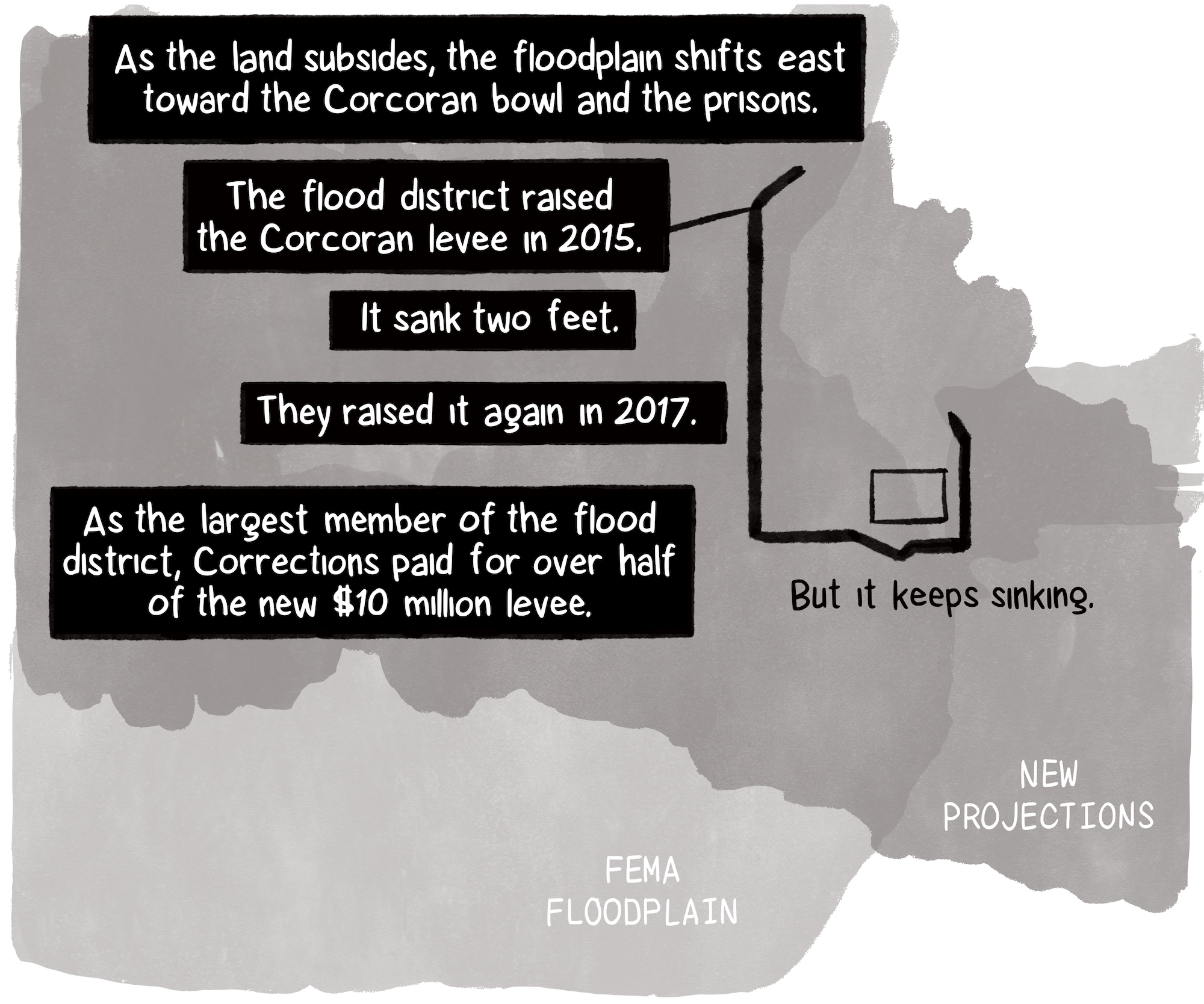
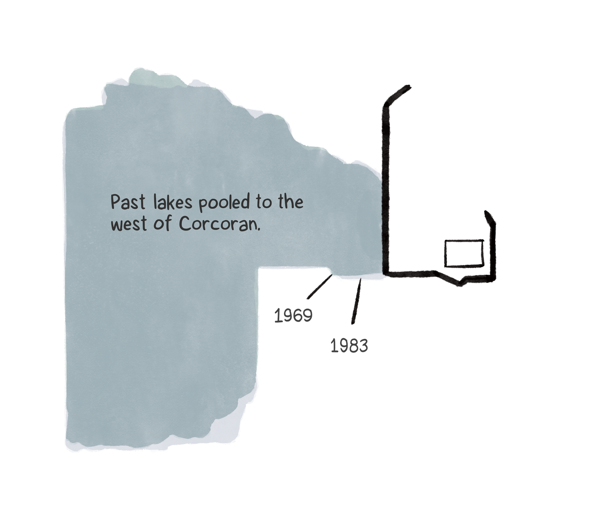
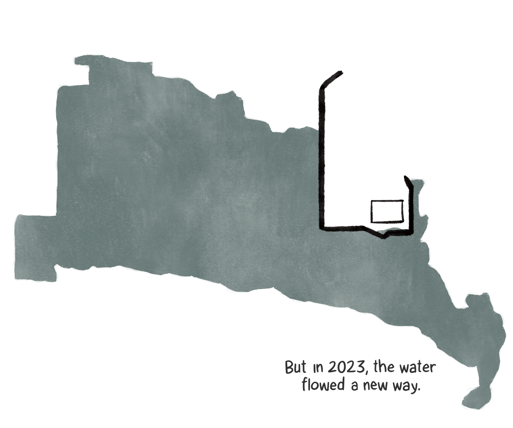
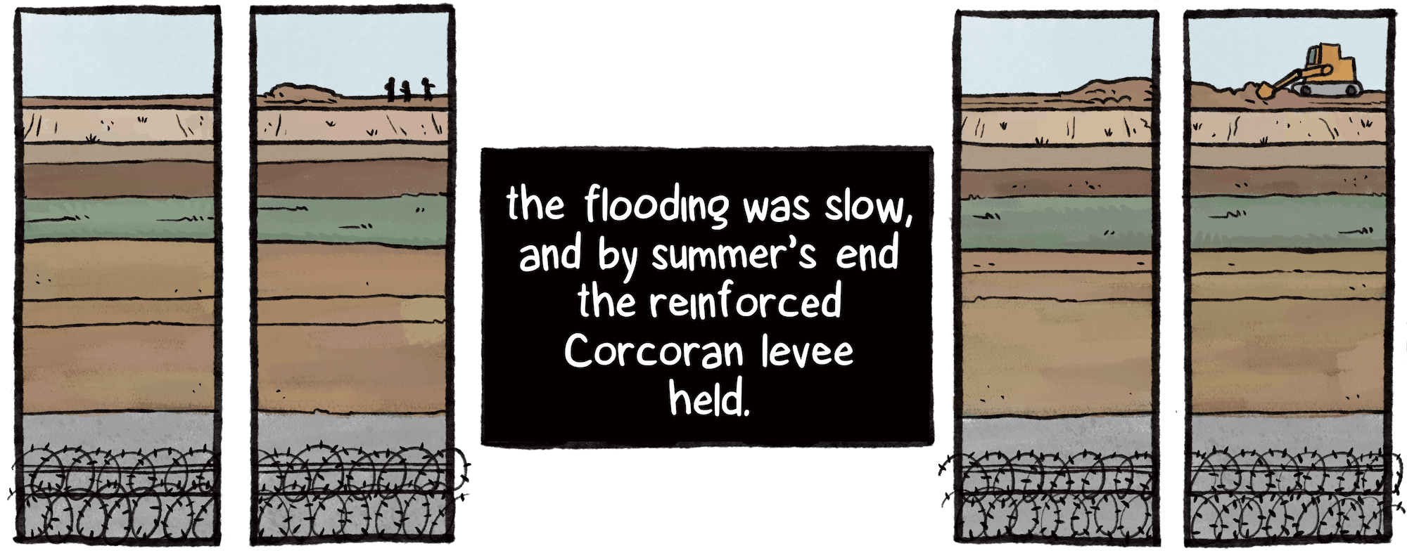
2015 and 2017 levee work, Hanford Sentinel, August 30, 2017; “Ground Subsidence Study Report, Corcoran Subsidence Bowl,” Amec Foster Wheeler Environment & Infrastructure, 2017; 1969 and 1983 flood satellite images provided by Rob Hansen; 2023 flood map, California Department of Water Resources.

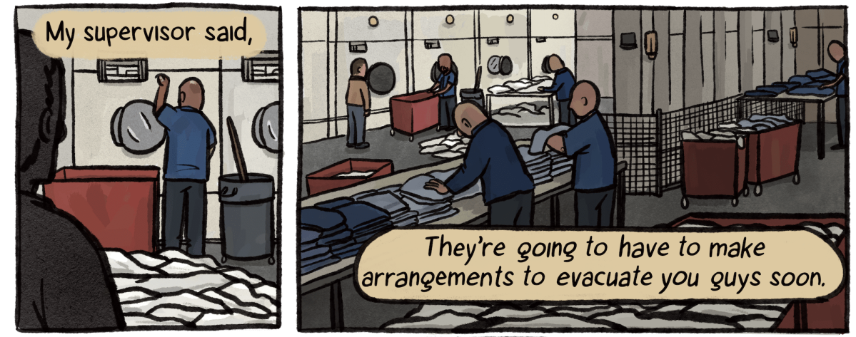
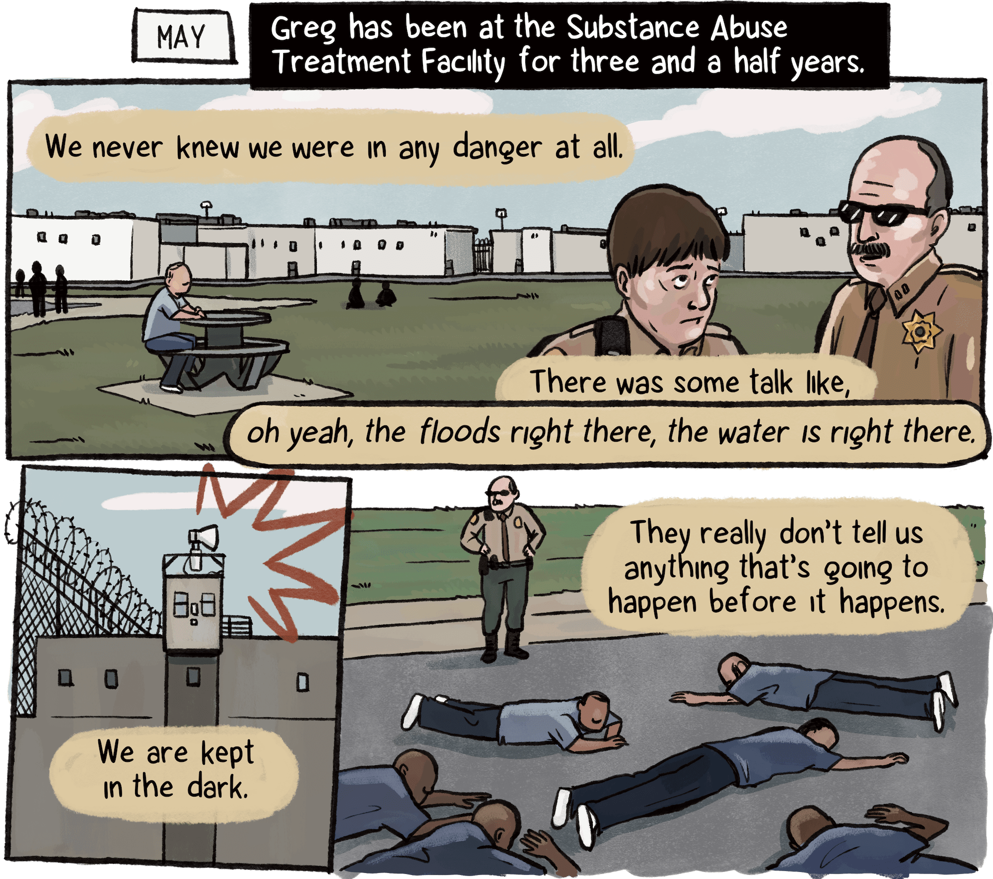
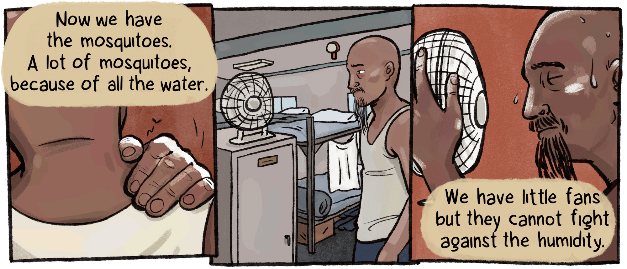
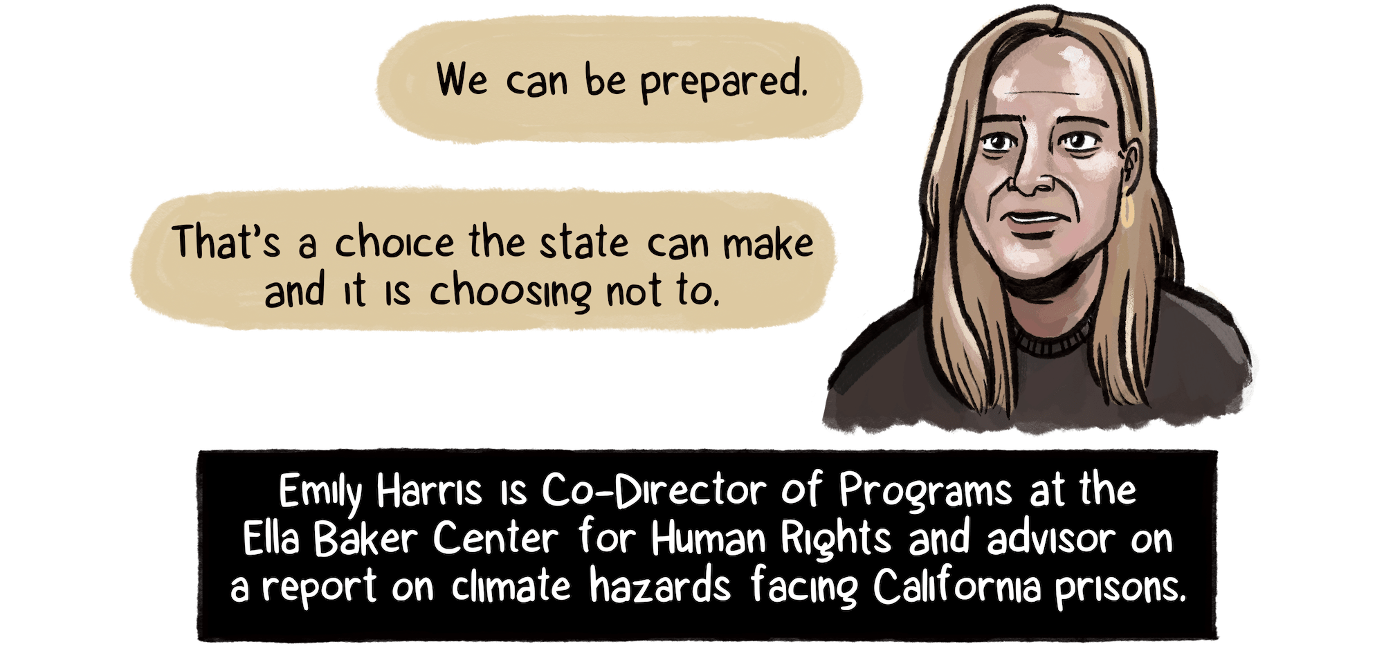
Greg, an incarcerated person at SATF, asked that his last name be withheld because he feared retribution for speaking to a reporter.

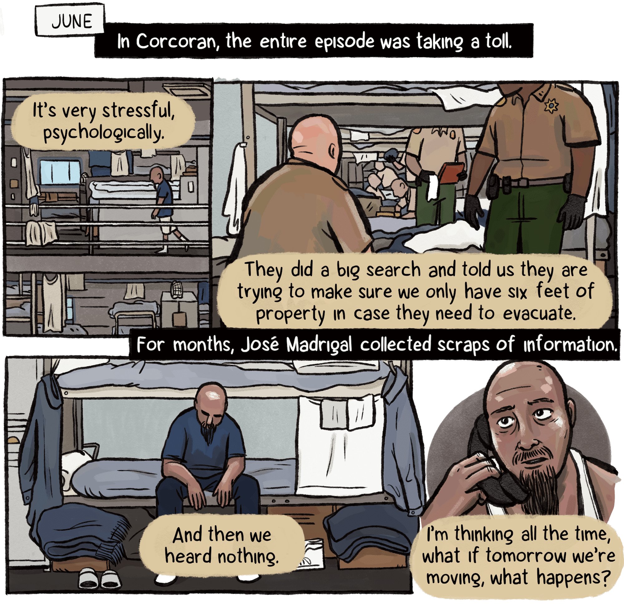
José Madrigal spoke with TMP over the course of several months in the late spring and summer.

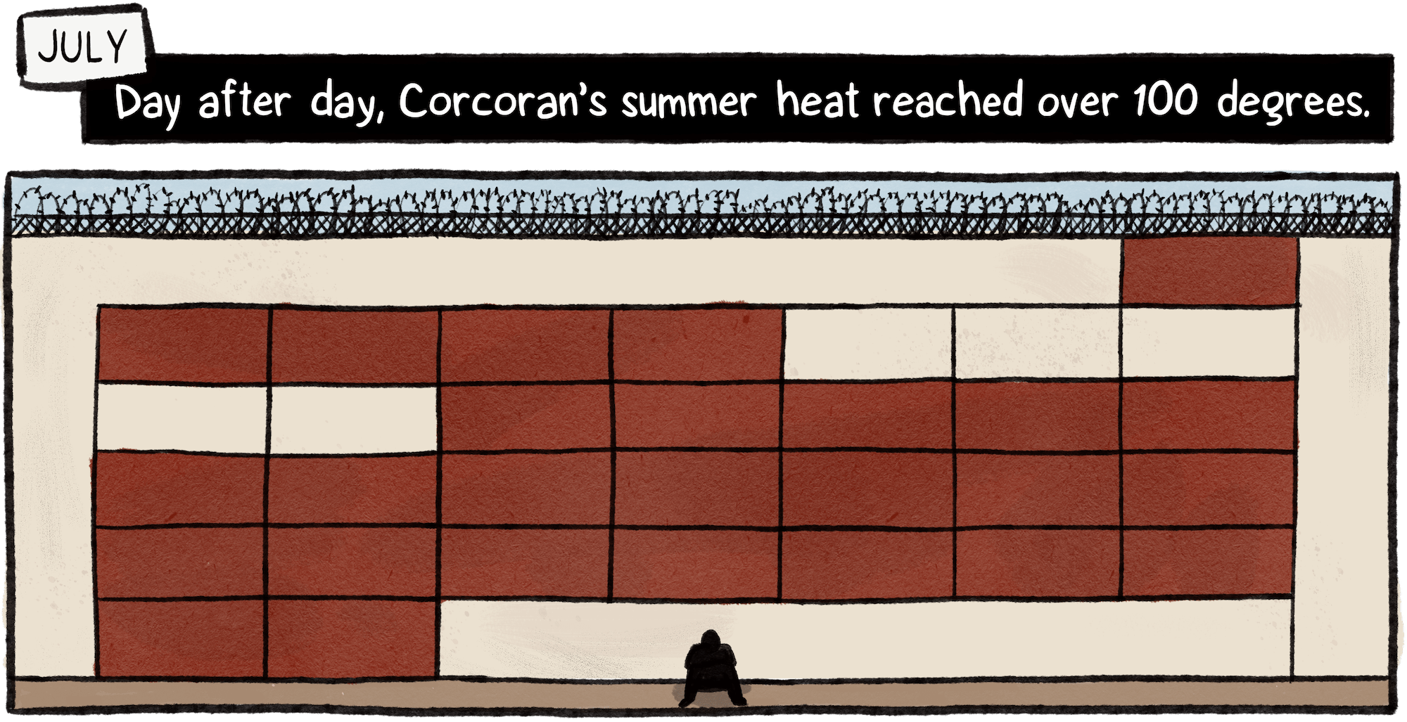
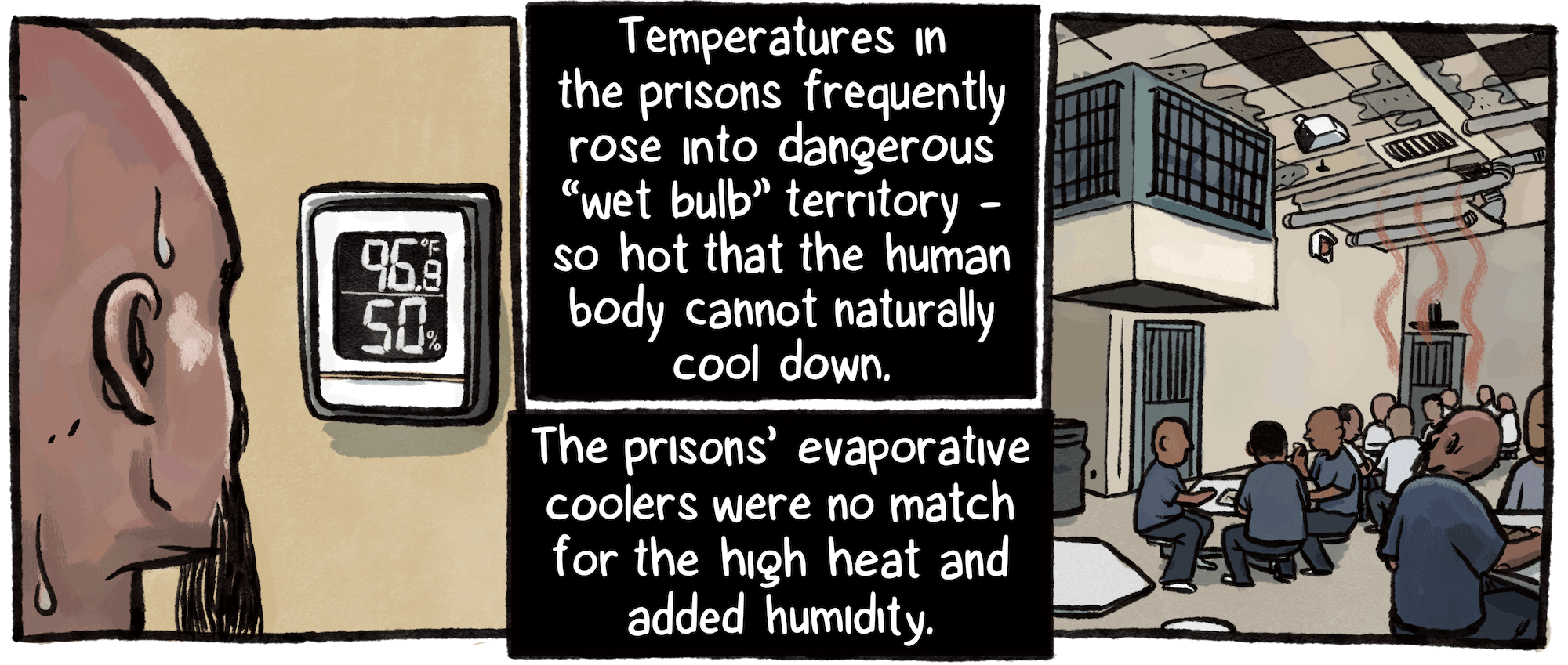
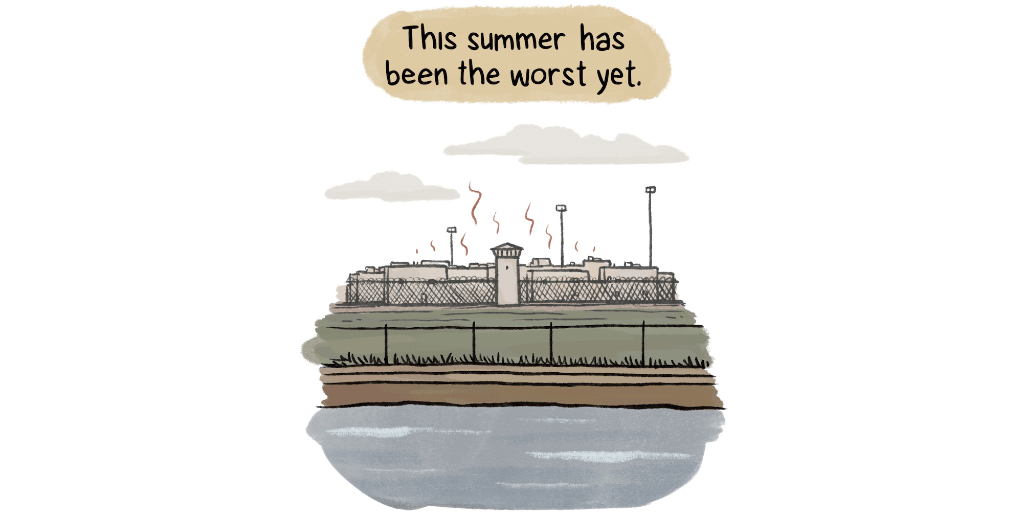
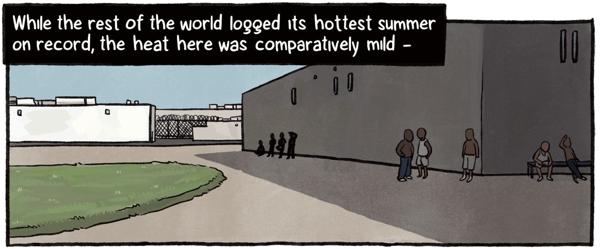
Daily temperatures, National Weather Service station in Hanford, California.

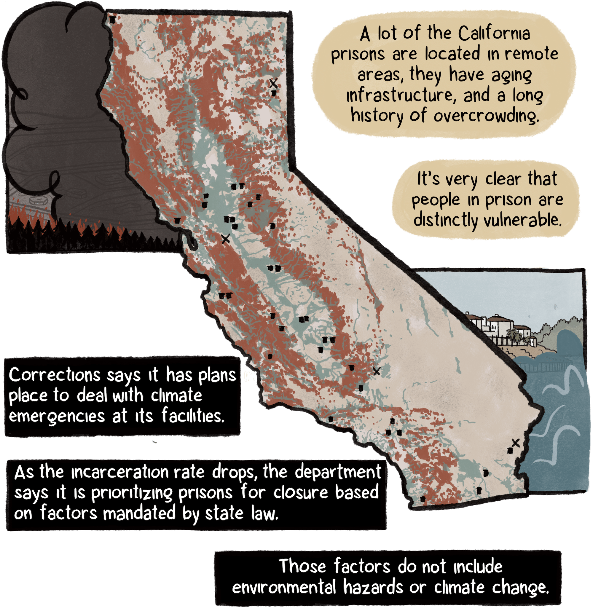
Fire risk depicted is sourced from CalFire 2023 maps; floodplains sourced from FEMA; prison locations, with “X” marking facilities being closed or in process of being closed, California Department of Corrections and Rehabilitation.

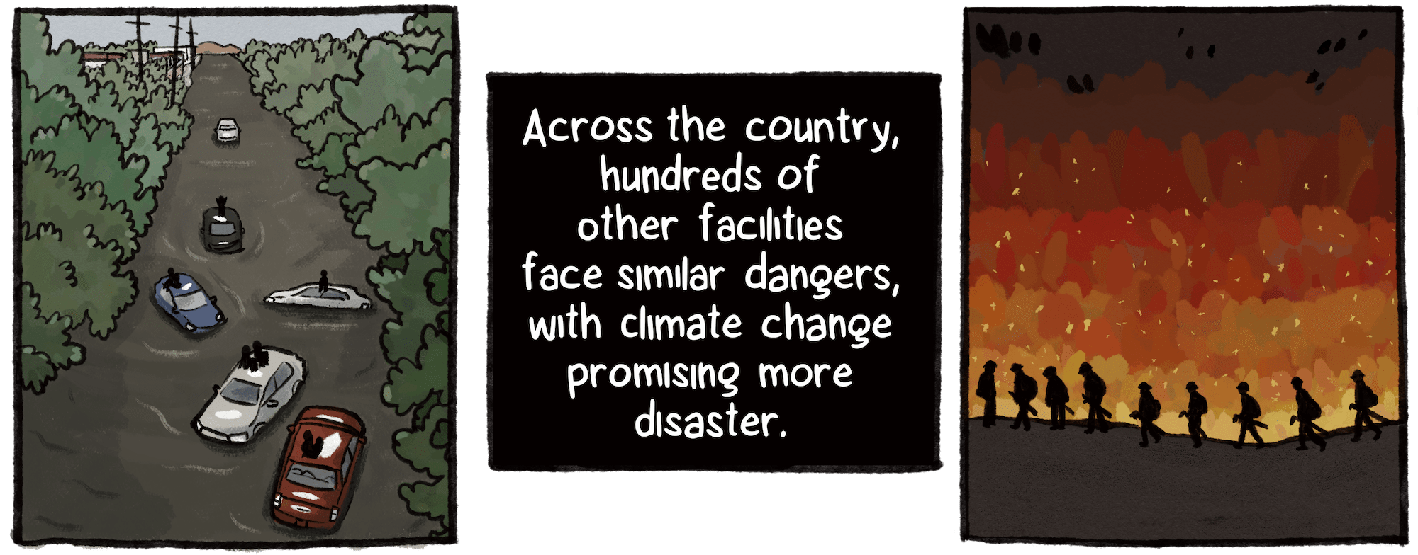
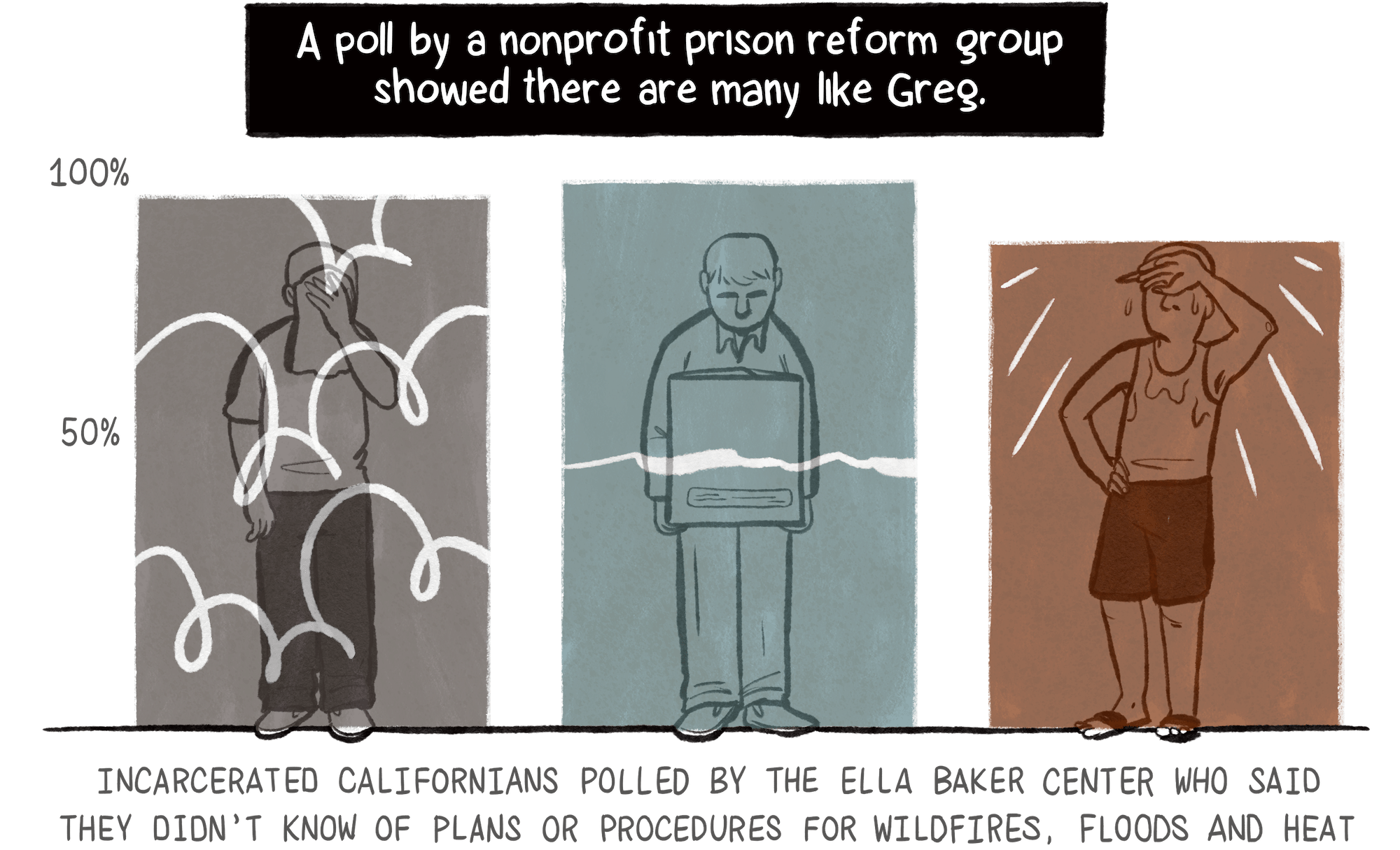
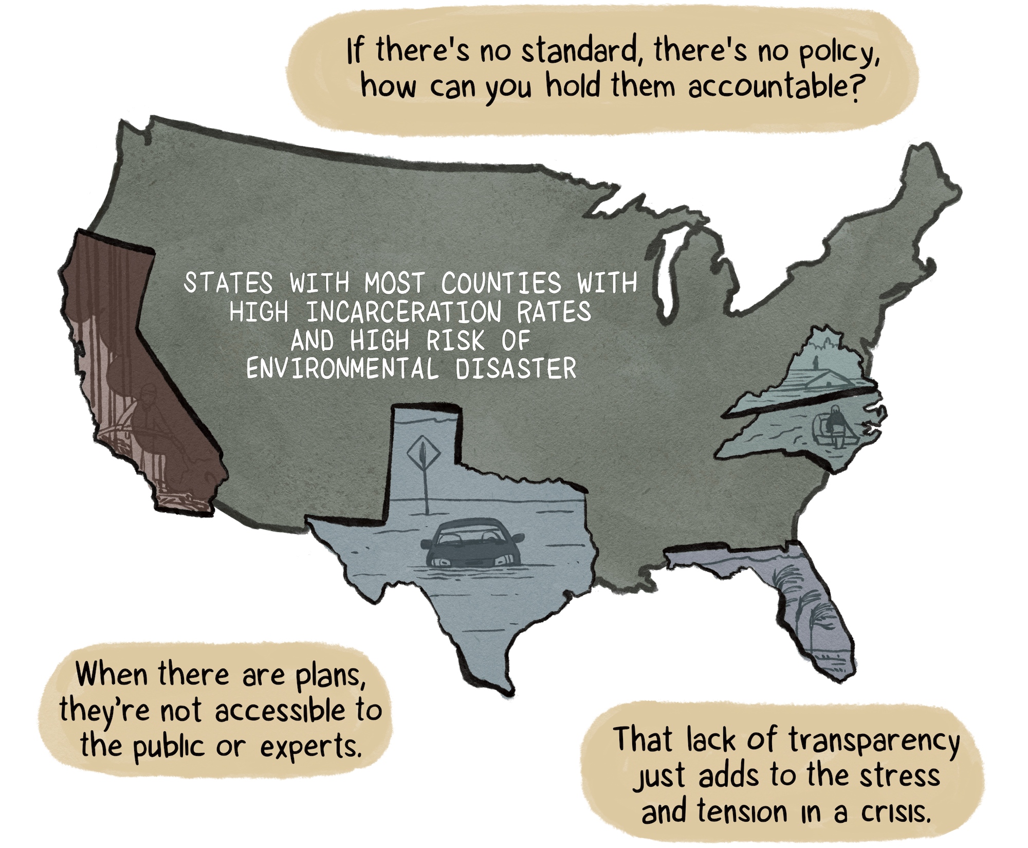
“Overlapping Crises: Climate Disaster Susceptibility and Incarceration” study published in 2022, based on data from FEMA and The Marshall Project.

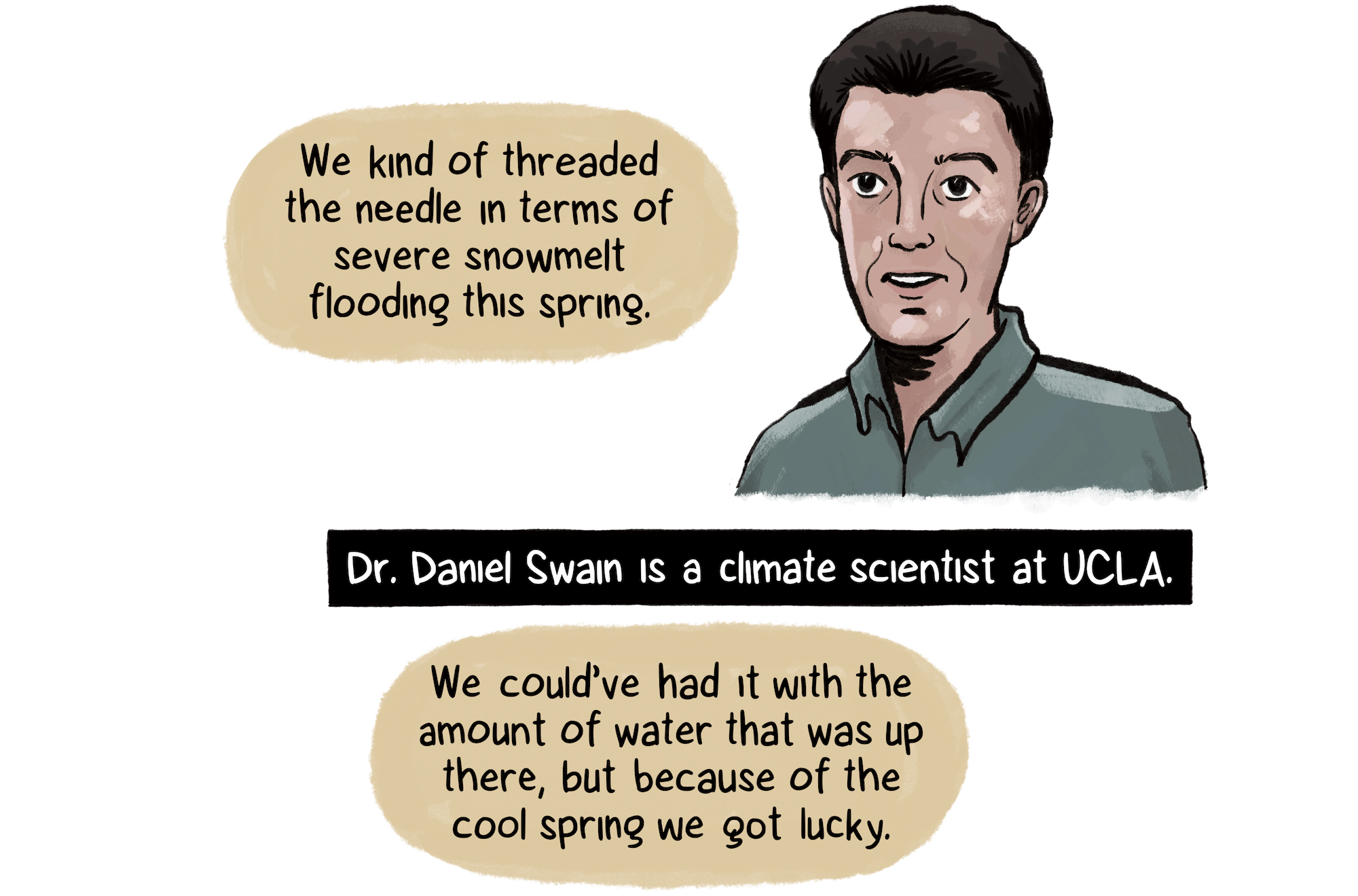
Climate scientist Daniel Swain “office hours” on YouTube, July 10, 2023.