Even in good years, farmers in the Midwest supplement rainfall with irrigation from the Ogallala Aquifer. The map below shows irrigated areas in blue; the darker the color, the heavier the irrigation. That big, dark patch in the middle, to the left of the little icon, is irrigated by both surface water and water from the Ogallala and other aquifers in the High Plains system.
The Ogallala spreads across 174,000 square miles, providing drinking water and irrigation to a huge swath of the United States, replenished slowly by rainfall in the region. It’s a critically important resource, which is why it’s been a big part of the Keystone XL fight — if it’s polluted by tar-sands oil, the damage could be catastrophic.
The Ogallala and other aquifers around the globe are also threatened by overuse. According to research published this week in Nature, “about 1.7 billion people live in areas where groundwater resources and/or groundwater-dependent ecosystems are under threat.” Researchers estimate that the amount of water being used is 3.5 times the size of the aquifers.
The map above shows aquifers around the world. Any splash of color is an aquifer, the color denoting the body of water’s health. Blue aquifers are healthy — taking in about as much water from precipitation as is extracted. The more red the aquifer, the worse the condition it’s in. The Ogallala, which is part of the High Plains aquifer system, is not in good condition. Along the bottom of the map, you can see several aquifers (including High Plains) displayed within large gray shapes. That gray shape represents how big the surface footprint of the aquifer would need to be in order to collect enough rainfall to replenish what is withdrawn. We’re pulling much more water out of the High Plains aquifer than we’re putting in.
Scientific American explains what that could mean:
The problem with drawing too much water from an aquifer, which has been stored in these geologic formations for thousands of years, is that it can’t easily be restored once pumped dry. … Once pumped dry, the Ogallala would take at least 6,000 years to refill.
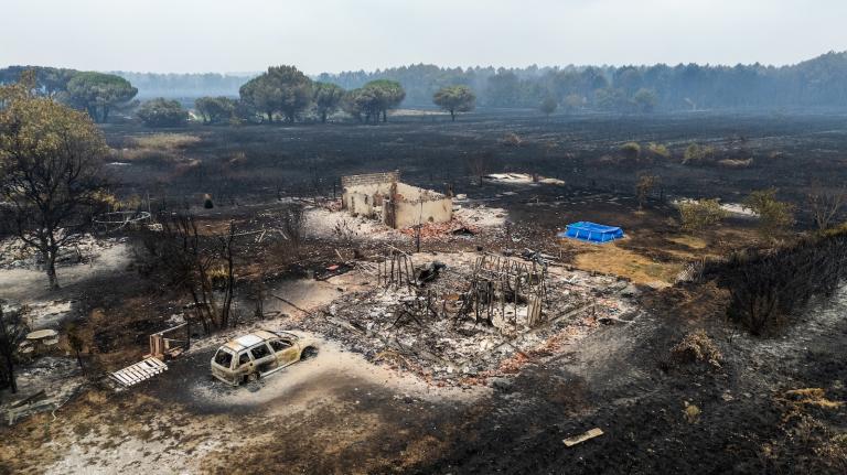
Another complication of pumping too much water from an aquifer is that creeks will run dry and surface waters can literally be sucked back underneath the surface. That’s not good for wildlife.
And from NPR:
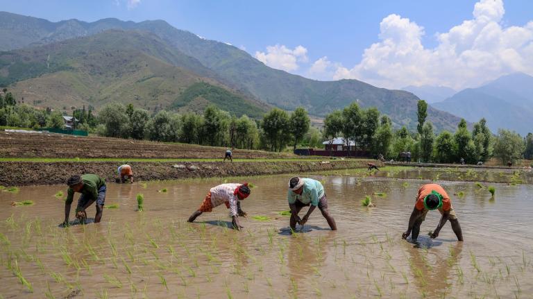
Some of these aquifers are being exploited at a stunning rate, but what’s truly alarming is how many people depend on that over-exploitation for their food. These aquifers include the Upper Ganges, covering densely populated areas of northern India and Pakistan, and the North China plain, which is the heart of corn-growing in that country. The aquifer of Western Mexico has become a large source of fruit and vegetable production for the U.S.
The High Plains aquifer in the United States, meanwhile, is having a particularly bad year. Farmers are pumping even more than usual, because of the drought afflicting this part of the country, and it is getting less replenishment from rainfall. So water levels in the aquifer are falling even faster, leaving less water for the region’s rivers, birds, and fish.
Aquifers in India and Saudi Arabia and Iran are in much worse shape than the Ogallala/High Plains. And on the southern border of the U.S., we’re also pulling water out much more rapidly than it is being replaced. And once it’s gone, the impact on crop production in all of these locations will be immediate.
Without changes in irrigation and water use, the aquifers can’t be sustained. And reaching peak water in agricultural regions would be much worse than reaching peak oil. Not only for those regions, their people and animals — but for the rest of the world.