Yesterday, four places in the Northeast saw record high temperatures, two in New York and two in Massachusetts. Over the past week, the number of record temperatures was much higher, spread throughout western New York and into Rhode Island. That’s because, in the Northeast, late fall is the new late summer. And winter is the new fall.
According to scientists from the University of Massachusetts, that pessimistic assessment will probably be accurate for the region by 2070. From the press release:
A new high-resolution climate study by University of Massachusetts Amherst climate scientists, the first to apply regional climate models to examine likely near-term changes in temperature and precipitation across the Northeast United States, suggests temperatures are going to be significantly warmer in all seasons in the next 30 years, especially in winter. Also, they project that winters will be wetter, with more rain likely than snow. …
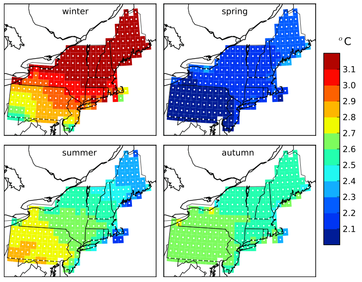
Overall, the researchers say the region is projected to warm by some 2 to 3 degrees C by mid century, with local changes approaching 3.5 degrees C in winter. Precipitation will go up as well, particularly in winter, but again not uniformly across the Northeast. …
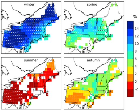
“The only clear signal of change for precipitation is noted in winter, which appears to be heading toward wetter conditions, consistent with current trends,” [Michael Rawlins of the Climate System Research Center] says. Winter precipitation is projected to rise significantly above natural weather variability, around 12 to 15 percent greater from southwest Pennsylvania to northern Maine, with the exception of coastal areas, where projected increases are lower.
“But we shouldn’t expect more total seasonal snowfall,” he adds. “Combined with the model-projected temperature trends, much of the increase will occur as rain. We’re losing the snow season. It is contracting, with more rain in early and late winter.”
Having grown up in the Snow Belt — a region that traditionally gets massive lake-effect snowfall during the winter — I just want to say: That sucks.
Here is how the researchers think temperatures and precipitation will change. Both diagrams break down change by season, comparing a 1971-2000 baseline to 2041-2070.
Winter in much of New York state could be as much as 3 degrees C warmer. Meaning a 50-degree F day is now 55.5 degrees.
And across the entire Northeast: 14 percent more precipitation.
When I was a little kid, the city where I grew up was blanketed in a massive blizzard. That was 1977. One hundred years later, such a thing may be unheard of, in a region that might as well be renamed “the Rain Belt.”
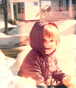
The author, a while ago.
