We’re spoiled: Most time-lapse videos give an awe-inspiring look at the aurora borealis, or a tour of Iceland, or a nighttime view of America’s great spaces. Not this one, which fits more in the category of “eye-opening yet depresses the hell out of you.” Ringing endorsement, right? Who’s ready to see Earth’s forests disappear?!
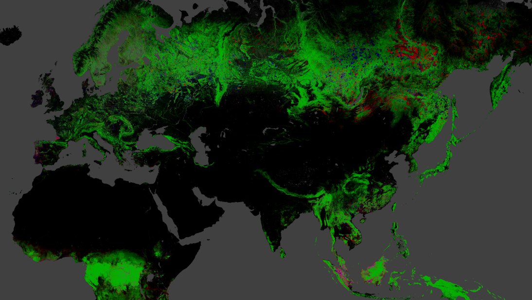
The time-lapse maps are from new research published in Science last week, illustrating forest growth and demise from 2000 to 2012. According to the New Republic, 888,000 square miles of trees vanished over those 12 years.
“You see, obviously, your big deforestation clearings, your big forestry land uses, you see the big fires,” says the video’s oddly chipper narrator, lead researcher Matthew Hansen. “It’s REALLY cool.” Cool isn’t exactly a word we’d use to describe deforestation, but yeah, the video’s use of 650,000 NASA satellite images is pretty illuminating. Now excuse us as we sob into an upcycled vintage hanky and then make like Johnny Appleseed.
A message from
Your support keeps our climate news free.
Grist is the only award-winning newsroom focused on exploring equitable solutions to climate change. It’s vital reporting made entirely possible by loyal readers like you.
At Grist, we don’t believe in paywalls. Instead, we rely on our readers to pitch in what they can so that we can continue bringing you our solution-based climate news. Donate today to keep our site free.