In a remote and heavily forested region of northern Maine, a critical resource in the fight against climate change has been hiding beneath the trees. In November, scientists with the U.S. Geological Survey, or USGS, announced the discovery of rocks that are rich in rare earth elements near Pennington Mountain. A category of metals that play an essential role in technologies ranging from smartphones to wind turbines to electric vehicle motors, rare earths are currently mined only at a single site in the United States. Now, researchers say a place that’s been geologically overlooked for decades could be sitting on the next big deposit of them — although a more thorough survey would be needed to confirm that.
While the U.S. government frets over shortages of the metals and minerals needed to transition off fossil fuels, it also lacks the basic geological knowledge needed to say where many of those resources are. Less than 40 percent of the nation has been mapped in enough detail to support the discovery of new mineral deposits, hampering the Biden administration’s plan to boost domestic mining of energy transition metals like rare earths and lithium, an essential ingredient in electric vehicle batteries. But the administration and Congress are now attempting to fill the maps in, by ramping up funding for the USGS’s Earth Mapping Resources Initiative, or Earth MRI.
A partnership between the federal government and state geological surveys, Earth MRI was established in 2019 with the goal of improving America’s knowledge of its “critical mineral” resources, a list of dozens of minerals considered vital for energy, defense, and other sectors. The initiative was quietly humming along to the tune of about $11 million per year in funding until 2022, when Earth MRI received an additional influx of $320 million, spread out over five years, through the 2021 Bipartisan Infrastructure Law. Since then, Earth MRI has kicked into overdrive, with the USGS launching dozens of new critical mineral-mapping efforts from Alaska to the Great Plains.
The USGS will be hunting for minerals both in the ground and at abandoned mines, where there may be valuable metals sitting in piles of toxic waste. The deposits they identify could eventually be extracted by mining companies, though experts say lawmakers and regulators will need to carefully weigh the benefits of mining against its social and environmental costs.
For now, says Earth MRI science coordinator Warren Day, the goal is to accomplish something that’s never been done before. “Nobody’s ever mapped all the critical minerals for the nation,” Day told Grist. “This is a huge undertaking.”
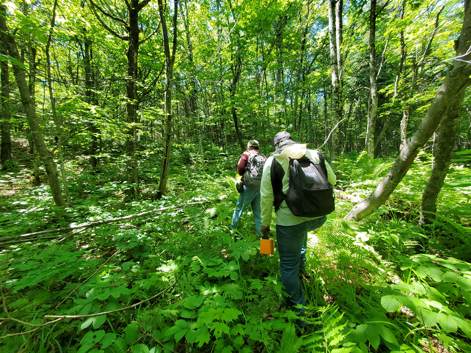
Indeed, the process of mapping the Earth is both labor intensive and time consuming: Geologists must be sent out into the field to record observations and locations of geological features like faults, take measurements, and make detailed interpretations of a landscape. Those interpretations might be augmented with laboratory analyses of soil and rock samples, as well as data collected by aircraft and other remote sensing instruments. It can take several years for researchers to synthesize all of that information into a map with a resolution of an inch to 2,000 feet, the standard scale that state geological surveys work at. Those geological maps don’t fully characterize ore deposits to determine whether they are economical to mine. But they often form a starting point for private companies to conduct that more detailed exploratory work.
“Our part is the definition of the geological framework where deposits could occur,” Day said. “Private industry takes that and tries to define the resources.”
That industry-led exploration can take an additional several years, after which it might take up to a decade to permit and build a mine, says Allan Restauro, a metals and mining analyst at the energy consultancy BloombergNEF. The mismatch between the time from exploration to mining, and the anticipated near-term ramp-up in demand for energy transition metals, has led many experts to predict we’ll see shortfalls of resources like lithium within the decade.
“Even if something were to be discovered right at this very instant, it may not be an actual producing mine until beyond 2030, when demand has shot up,” Restauro told Grist.
To help close the gap between mineral discovery and future demand, Earth MRI scientists are racing to collect as much baseline geological data as they can. The federal government is contracting private companies to do airborne geophysical surveys — flying specialized instruments over a region to measure specific properties of the rocks underfoot. The primary approach the USGS is using, called aeromagnetic surveying, measures slight variations in the Earth’s magnetic field that relate to the magnetic properties of local rocks. In some cases, the agency is also conducting radiometric surveys, which detect natural radioactive emissions from rocks and soils containing elements like thorium and uranium. These elements can indicate the presence of specific mineral types of interest: Thorium, for example, is often found alongside rare earth elements.
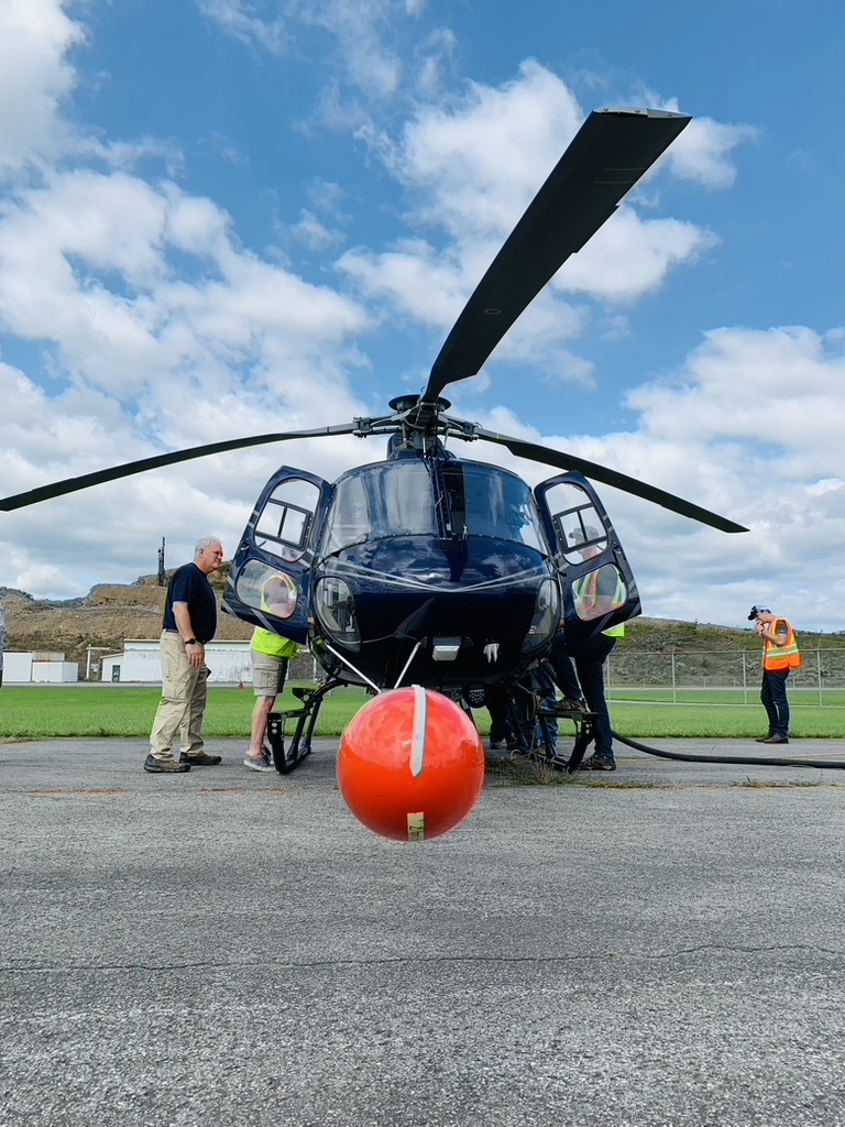
As the USGS is conducting reconnaissance from the air, state geologists are sent out to the field for detailed surface mapping and sampling.
Earth MRI scientists have identified more than 800 focus areas around the nation — regions with at least some potential to host critical minerals. With the Bipartisan Infrastructure Law boosting the initiative’s total budget to $74 million annually from 2022 to 2026, the effort to survey all of them has ramped up “significantly,” says Jim Faulds, the president of the American Association of State Geologists. About twice as many states are now engaged in mapping projects as before the law, and individual projects are receiving three times the funding they were before. That’s expected to be a major boon for Western states like Nevada and Arizona, which have only had a quarter to a third of the land mapped in detail and are among the most promising places in the country to find energy transition metals.
“Many Western states are mineral rich,” Faulds said. “But we don’t necessarily know where those minerals are.”
Even in places where large mineral deposits have been discovered already, we don’t necessarily have detailed maps of the region. That’s the case for the Thacker Pass area near the Oregon border, host to some of the largest lithium resources in North America, as well as an area of west-central Nevada that has large lithium deposits. New Earth MRI-funded survey work in these areas will help define the full extent of these resources, says Faulds, who directs Nevada’s state Bureau of Mines and Geology.
In the eastern U.S., where some states are relatively well mapped, there’s still a potential for new discoveries. Geologists had no idea, for example, that the Pennington Mountain area of northern Maine was host to rare earth-rich rocks: Earth MRI funded a project in the area because it had previously been mined for elements like copper and manganese, said Anji Shah, a USGS geophysicist who contributed to the study.
“When we chose the area, we were thinking about those particular mineral resources,” Shah said. “It was only when we got the [airborne survey] data and we noticed some anomalies that we said, ‘Hey, this might be high in rare earth elements.’” Follow-up work in the field and lab confirmed not just elevated levels of rare earths, but also niobium and zirconium, minerals used in jet engine components and nuclear control rods.
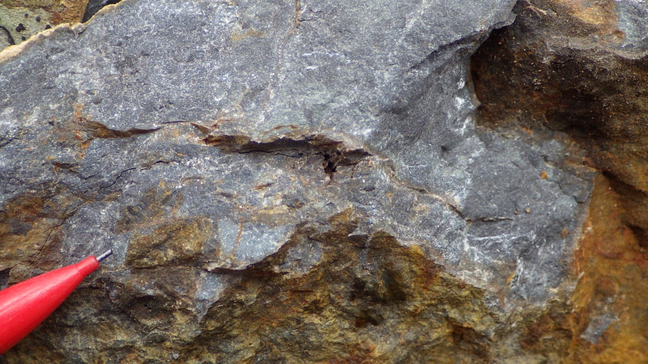
Discoveries like this could ultimately lead to the establishment of new mines and new domestic supply chains for critical minerals, a key policy goal of the Biden administration. But as companies start clamoring to dig these rocks out of the ground, the administration will have to think carefully about how to balance its climate and national security priorities with the potential harms of mining, which can degrade local ecosystems, cause air and water pollution, and transform rural communities. Projects that aren’t sited carefully are likely to meet local resistance, as illustrated by a proposed lithium mine at Thacker Pass that recently began construction despite fierce opposition from conservationists, a local rancher, and Native American tribes.
“We’re going to discover many more deposits” out of Earth MRI, said Thea Riofrancos, a political scientist at Providence College in Rhode Island who studies the intersection between resource extraction and green energy. But the benefits of extracting those minerals, Riofrancos said, “should not be presumed.”
Riofrancos would like to see the government thinking holistically about better and worse places for mining, perhaps combining maps of mineral deposits with maps showing biodiversity, water resources, historically marginalized communities, and Indigenous lands, where a large fraction of today’s energy transition metal mining occurs, according to a recent study. (Day says the USGS always obtains written consent from tribes before mapping reservation lands.) Taking all of these factors into account when deciding where to permit new mining will help ensure that harm is minimized, Riofrancos says.
One of the more attractive places to hunt for energy transition metals could be abandoned mine land, which has already been degraded. Coal mining waste, for instance, can be enriched in rare earth elements; scientists with the Department of Energy are currently working out the best ways to extract them. Several years ago, Shah and her colleagues discovered that mining waste at abandoned 19th- and 20th-century iron mines in the eastern Adirondack Mountains in New York is also enriched in rare earths — in particular, the so-called heavy rare earths that are more economically valuable.
Riofrancos sees the USGS’s inclusion of mine wastes in its mapping efforts as a positive sign. “The more industrially developed an area is, the less new harm is created by mining,” she said, adding that it might be possible to extract new metals from mine waste in tandem with environmental cleanup efforts.
But ultimately, it’s private companies that will decide, based on the trove of new information the government is collecting, which areas it wants to explore further for possible mining. And at this point, Faulds says, “there’s quite a bit of interest at all levels” in Earth MRI data.
“I would say companies are on the edge of their seats,” he said.
